


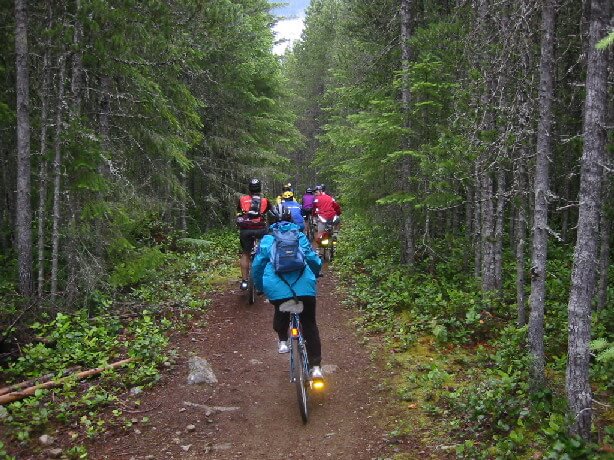
The Chilliwack River Valley teems with mystery. The wild Chilliwack River is a favourite for fishermen and kayakers and leads to approximately 25 km of fish channels, a fish hatchery, and a myriad of mountain streams. The towering mountains offer a multitude of sought after rugged trails to high lakes and ridges. There are complete rainforest ecosystems and Chilliwack Lake itself is a large body of water that intrigues and is so awe inspiring that it brings out the poet in us. Wildlife abounds including birds of prey, the Blue Heron, many other bird species, bears, deer, and wild mountain goat to name a few.
This section of coastal rainforest is magnificent. It is also a timber harvest area. Tree species: Douglas fir, western hemlock, western red cedar, red alder, paper birch, and black cottonwood. Plants: salal, sword fern, bracken fern, flat moss, false azalea, lanky moss, step moss, Alaskan blueberry, goose berry, dull Oregon grape, false Solomon’s seal, thimbleberry, wild ginger, prickly rose, and devil’s club.
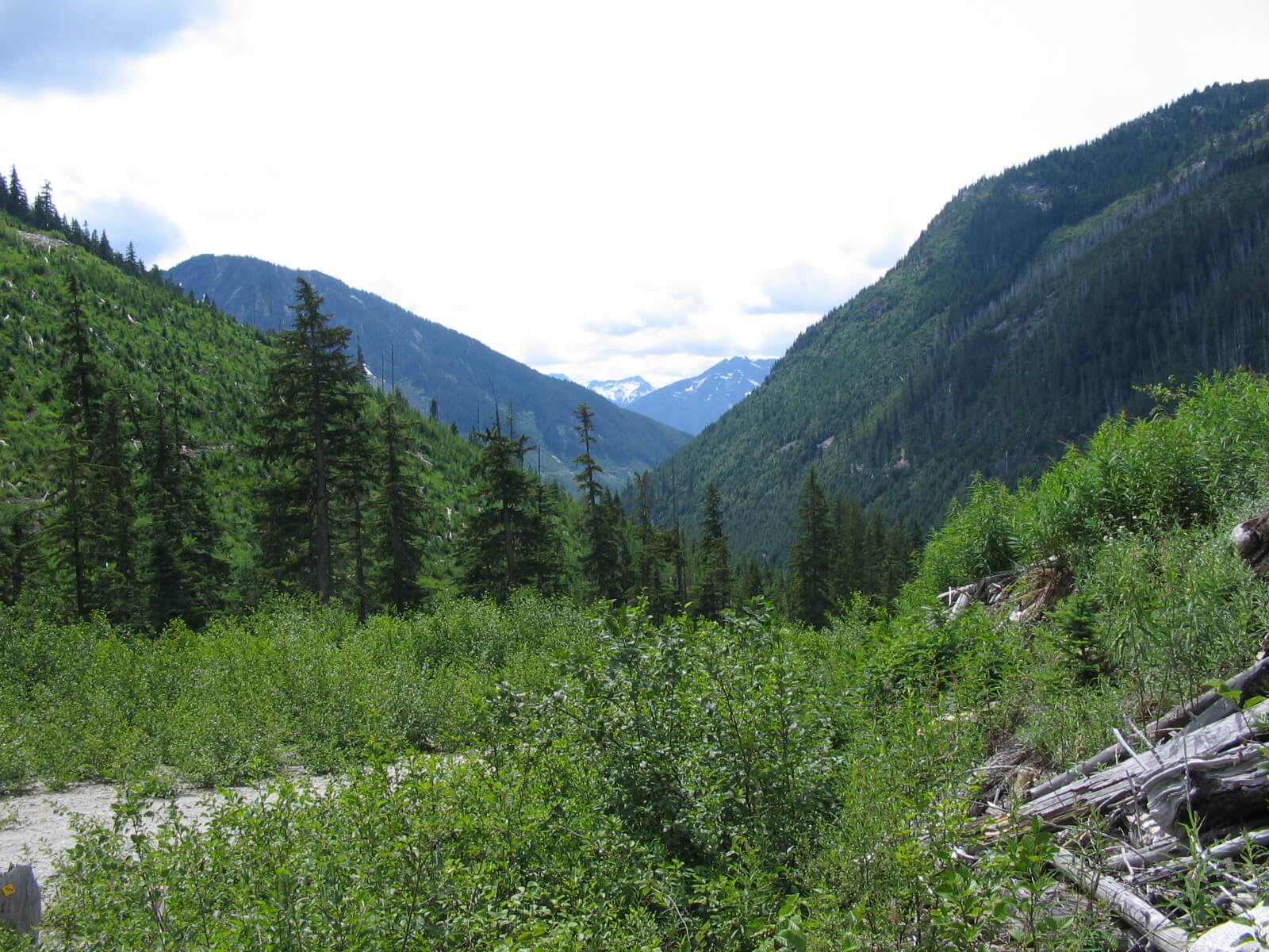
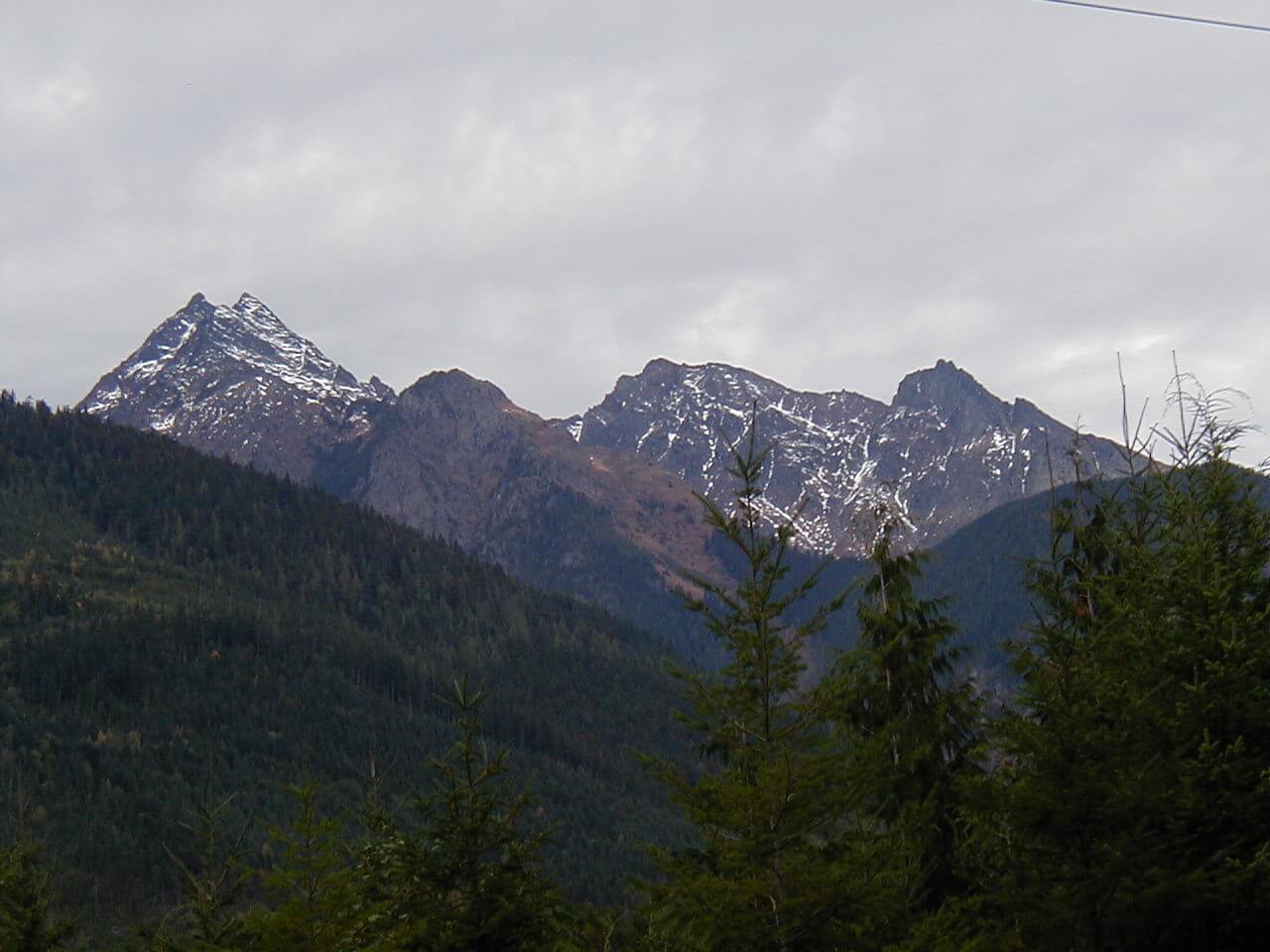
There are enough adventures available in the Chilliwack River Valley to fill several complete summers. These include: Liumchen Ridge, Mt. Slesse, Mt. Ford, Williams Peak, Pierce Lake on Mt McFarlane, Elk Mt., Cheam Peak, Mt. Foley, Mt. Laughington, Williamson Lake, Radium Lake, and Lindeman, Greendrop Lakes. The east end of Chilliwack Lake takes the adventurer to a prized first growth forest known as Sappers Park, and a trail that crosses the US border to North Cascades National Park and goes as far as Ross Lake. There are, of course, other uncharted treks that takes the traveler along valleys or mountain passes.
Staging Areas:
The main spots are: Cultus Lake, Tamihi Forest Recreation Service Campground and staging area, Thurston Forest Recreation Service Campground, a smaller Riverside Forest Recreation Service Campground, Chilliwack River Hatchery (at Slesse Creek) and Chilliwack Lake BC Parks Campground and picnic area.
GPS INFORMATION:
- KML/KMZ files can be opened in Google Earth, and many smartphone apps.
- GPX files can be opened by most GPS software apps when KMZ cannot. Note, GPX files do not contain custom colours and icons that we use on our maps; all tracks and icons will appear the same colour and styles. We recommend using KMZ instead of GPX if possible.
The files below include data for only this specific area. For all of our Trans Canada Trail data for the entire province (including features, campsites and alternate routes), download our BC.kmz master file (1.2 MB)
Visit our GPS & Navigation page for instructions of how to use your smartphone as a GPS device (even when outside of data coverage) or how to import data to your Garmin unit.
GPS DOWNLOAD (KMZ FILE)
GPS DOWNLOAD (GPX FILE)
DOWNLOAD INFORMATION SHEET
Staging Areas:
The main spots are: Cultus Lake, Tamihi Forest Recreation Service Campground and staging area, Thurston Forest Recreation Service Campground, a smaller Riverside Forest Recreation Service Campground, Chilliwack River Hatchery (at Slesse Creek) and Chilliwack Lake BC Parks Campground and picnic area.
Washrooms:
The main spots are: Cultus Lake, Tamihi Forest Recreation Service Campground, Thurston Forest Recreation Service Campground, Chilliwack River Hatchery (at Slesse Creek) and Chilliwack Lake BC Parks Campground and picnic area.
Route Highlights:
Please note! Paleface Pass is usually laden with snow until Mid June. If you plan on embarking over the Pass before this, you may encounter deep snow. Contact us for the latest conditions! Also, as of June, 25 2019 the thickest part of the brush has been cleared enough to make the trail passable on the Silverhope side. Also there a few rock falls that require walking your bike through. On the Paleface Creek side the Forest Service Road has been completely reestablished due to a recent timber harvest and can be easily cycled right up to the Pass. Watch for a trail to the left just before entering the actual pass. On a bicycle, you are likely going to be pushing your bike up some of the fairly steep inclines.. The pass itself while having a somewhat challenging single track trail it is enjoyed for its mystical qualities. Cyclists with panniers and trailers should consider going back to Chilliwack and use our alternate route to Hope.
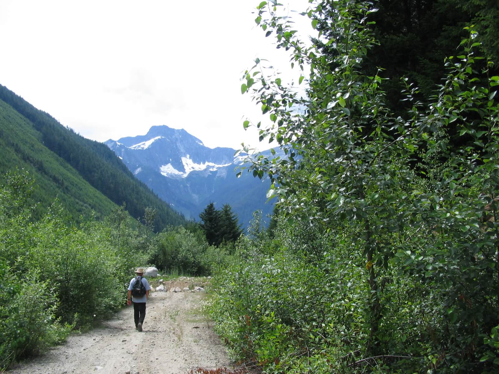
While very rewarding, going from Chilliwack to Hope via Chilliwack Lake and Paleface Pass, the Chilliwack River Valley offers challenging rugged natural trails and forest roads. It is also a summer-fall route because of its high elevation gain over Paleface Pass (up to 4200 ft). The Tolmie Trail from Tamihi to Anderson Creek is still being upgraded as of the Summer of 2019, a 6-km section of trail that has been severely damaged by motorized recreation. It has been cleared of severe windfalls and debris as of June 2019.
Elevations
Change of elevation is approximately 1370 m (4200 ft) over 60 km. Expect the trail to go up and down 20 to 90 metres several times during the first 45 km from Cultus Lake.
- At Cultus Lake – 60 m/200 ft
- At Liumchen Bridge 300 m/1000 ft
- At Tamihi 120 m/400 ft
- Tolmie Trail (West high point 240 m/800 ft — East high point 300 m/1000 ft) – Change of elevation 600-700 ft twice
- At Borden creek 180 m/600 ft
- Larsons Bench 330 m/1200 ft
- Post Creek Bluff 660 m/2150ft (change of elevation 90 m/300 ft)
- Chilliwack Lake – 625 m/2050 ft
- Paleface Pass – 1270 m/4150 ft
- From Paleface Pass to Hope there is a 1170 m (4000 ft) elevation change. More than half of the change is in the first 12 km.
DOWNLOAD INFORMATION SHEET
Shopping:
Stock up in Chilliwack or Hope; there are absolutely no provisions along the way, other than those found at Cultus Lake.
Accomodations:
Good BC Forest Service Campgrounds are located at Tamihi Camp,Thurston Camp, and Riverside Camp
BC Parks have Campgrounds at Chilliwack Lake, Silver Lake and Eaton Lake (See Provincial Parks)
Those taking the Post Creek Route can find camping at Greendrop Lake (both ends)
There is a private campground at Slesse Park, a short ways west from Tamihi.
Bed & Breakfasts can be found in the City of Chilliwack except for Riverbend Guest House at Slesse Park near Tamihi
Transportation:
Directions:
DOWNLOAD INFORMATION SHEET (PDF)Liumchen Trail (Cultus Lake to Little Tamihi Creek — part of the Centennial Trail) — 9.5 km
Above Cultus Lake, follow Vance Road going southward to a system of active forest roads. Be aware of possible back road vehicles and logging equipment.
Continue on the forest road eastward through Department of Defense lands.
At the first opportunity continue on the road as it turns sharply to the left or northward and go over a bridge that crosses Liumchen Creek – total so far 4.4 km.
Just before crossing the creek you may want to visit this former forestry recreation site to enjoy a canyon and Liumchen Falls. This is an unmanaged area. Be careful.
Stay on this forest road without taking any roads that lead to the right. It will eventually reach the Valley floor along the south side of the Chilliwack River (add 4.8 km). Take care not to take any of the misleading branches going left. Stick to the main road. Enjoy the great views over the Chilliwack River Valley to Elk, Thurston Mountains, other mountain peaks and the valley below towards Chilliwack.
Tamihi Trail (Little Tamihi Creek to Anderson Creek — 2.5 km)
Go eastward across a bridge crossing Little Tamihi Creek and watch for the Centennial Trail (now the TCT) on your left. Take this 2.5-km fishers trail over an un-named creek (1.5 km) passing the Tamihi Forest Service Campground area. This is a fishers paradise on the Chilliwack River. The prize catch is Steelhead.
Tolmie Trail (Tamihi Creek – to Anderson Creek — 6 km)
Note: This section of trail is quite challenging because it has changes of elevation ranging from 300 to 700 ft. Cyclists who don’t enjoy this type of challenge should take Chilliwack Road to Anderson Creek.
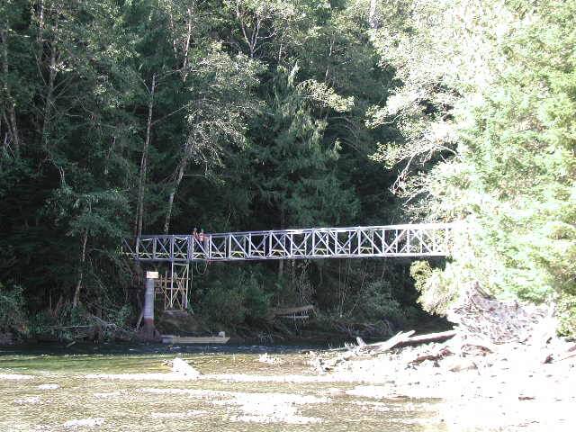
At the bridge over Tamihi Creek immediately start uphill on the Tamihi Forest Road (0.4 km). Watch on the left for an entrance to the trail. This is a grassy area that tends to get overgrown and hide the sign. Don’t be discouraged by the tall grass. After about 0.5 km through a fairly immature grand fir forest the trail will cross a creek and start going downward. At the bottom of the hill turn right to go up again. After about 1 km turn right at a clearing. Be aware that there is a false right turn as you go up. Follow this mainly grand fir forest trail to the edge of a private property. Turn right into an immature cottonwood forest. After crossing a creek (dry most of the time) you will be treated to mature black cottonwood and maple trees with a great variety of other plants such as devil’s club that grow in wet ground, a truly unique area. Because of the clay surface it can be slippery when wet . This is a descent of 0.6 km. The next two km will reveal an old corduroy road and superb rainforest vegetation. At the next junction of forest roads turn right again and watch for a trail on the left. It will end at Anderson Creek on Chilliwack Lake Road. Follow Chilliwack Lake Road east over the bridge crossing Anderson Creek.
Thurston Trail (Anderson Creek to Borden Creek — 5 km)
Just after the bridge over Anderson Creek on Chilliwack Lake Road take a trail on the right fronting Anderson pond. Then follow Chilliwack Lake Road for about 400 metres and watch for a trail sign on the right. If you see a gravel pit you went too far. Follow it to the Thurston Meadows Campground across the Chilliwack Lake Road after having passed fish channels and a former logging railroad grade. Follow the River around the campground and continue on the trail along fish channels to Borden Creek along the Chilliwack River.
SlesseTrail (Borden Creek to the base of Larsons Hill — 2 km)
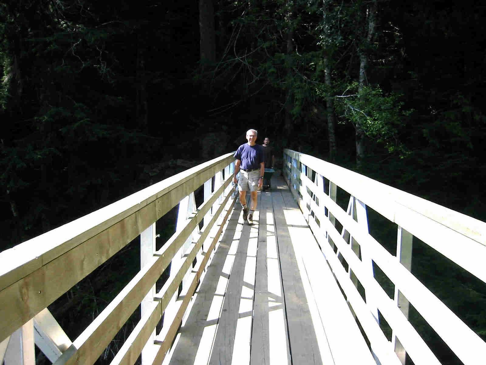
Cross Borden Creek on Chilliwack Lake Road and pick up the trail again. Follow the trail for 1.5 km to a parking area along Chilliwack Lake Road. Cyclists may prefer to proceed on Chilliwack Lake Road to the Chilliwack River Fish Hatchery; the dike is quite rough at this time. Walkers are directed to walk on a dike along the Chilliwack River. When the dike runs out follow the trail in a forested area, followed by a wilderness camp to Chilliwack Lake Road. Go through the wilderness camp parking area and continue over Slesse Creek Bridge. On the other side of the bridge it is strongly suggested to visit the the Chilliwack River Hatchery if the gate is open. Otherwise, just continue past the Hatchery to concrete barriers, the beginning of the next segment of trail. If you chose to go through the hatchery, after the visit, look for a small bridge and a set of stairs on the way out. This leads to a parking lot and the the beginning of the next segment of trail at the concrete barrier. Go out of the parking lot immediately rather than walking through it to a locked gate.
Larsons Bench Trail (Bottom of Larsons Hill at Chilliwack River Fish Hatchery Sign to the next Chilliwack River crossing — 7.3 km)
Follow the trail to the top of the hill then turn left. It is 2.5 km before returning to Chilliwack Lake Road at the entrance of the Pierce Creek Trail and FSR. Continue east on the TCTand follow it through a DND site all the way to Pierce Creek. Cross Pierce Creek and follow this forested trail on a former logging road, then onto a forest harvested trail to a gravel pit. The trail continues behind the pit and heads back towards Chilliwack Lake Road. Just before reaching Chilliwack Lake Road take the former logging railroad to the right and follow it until it connects with Chilliwack Lake Road. Follow Chilliwack Lake Road for a short distance passing Ford Mountain Corrections Camp to the Chilliwack River crossing.
Nesakwatch Trail (Chilliwack River Crossing via Angel Wing Fish Channels to the end of Centennial Fish Channels — 7.1 km)
Note of interest: The Centennial Fish Channels are named after the Centennial Trail that we are using for this part of the Trans Canada Trail.
Equestrians and road bike cyclists
use Chilliwack Lake Road for about 400 m to a second road on your right by-passing the Angel Wing Fish Channels and watch for a trail going east on your left that will take you to the Riverside Forest Service Campground.
Walkers (and adventurous cyclists)
find a trail on the south side of Chilliwack Lake Road right after crossing the bridge over the Chilliwack River. Follow this trail along the Angel Wing fish channels to a 2nd road leading out of the this area. On the road leading out of the fish channels watch for a trail heading east on the right in a forest of large trees followed by an immature forest of grand firs and pine. Follow this single track trail for about 2.5 km where it eventually comes out on Chilliwack Lake Road.
Follow Chilliwack Lake Road a short distance (100 metres) to the Riverside Forest Recreation Service Campground along the Chilliwack River.
Go through the campground and turn south over two forestry bridges crossing the Chilliwack River. (It is 3 km from here to the end of the Fish Channels). Immediately after the bridges, walkers take the trail on the left of the road and follow it until it comes out onto the forest road again. Follow the road over a small bridge and at the first opportunity get on the Centennial Fish Channels on your left and follow them to the end. Then continue on the forest road over Centre Creek. Equestrians must follow the forest roads from the Riverside Forest Recreation Camp to Centre Creek because of narrow bridge crossings. Adventurous cyclists who like challenging forest trails can follow the hiking trail or like the equestrians follow the forest road to the start of the second section of the Centennial Channels just past the small bridge mentioned above.
Centre Creek Trail (East end of Centennial Fish Channels to Radium Lake Trail — 6.6 km)
From the Centennial Fish Channels proceed east to Centre Creek bridge and turn north (left) Centre Creek Forest Road.
Turn right at the next opportunity. continuing on a forest service road. This is the old Centennial Trail with vestiges of old signage still on the Trail. It is also a former logging rail grade. Follow it to the Post Creek bluff.
Follow the Trail over a bluff to Radium Lake Trail. The bluff section of the trail will prove to be quite challenging for cyclists (expect to push your bikes and grunt for about 0.5 km going east and 1.0 km going west- not as steep going west – The whole trip over the bluff is 1.5 km).
Radium Lake Trail (Radium Lake Trail fork on bluff on the way to Chilliwack Lake Provincial Campground Kiosk via new Chilliwack River Bridge – 3.2 km)
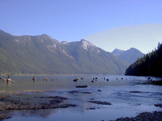
This soon becomes an very pleasant forest trail along the Chilliwack River. Radium Creek Bridge is soon reached. Once at the Chilliwack Lake Bridge a pleasant reward awaits with views of mountains over the lake from a vista at the headwaters of the Chilliwack River.
Chilliwack Lake Trail (From the south edge of the Chilliwack Lake Campground to Paleface Creek – 8 km.)
After following the trail in a lodgepole pine forest (quite unique in our west coast forest) on the east side of the Chilliwack Lake Provincial Campground, follow the north side of the Lake to Paleface Creek. The views over the lake are sensational.
Centennial Trail Alternative for hikers (Radium Creek to Silver/Skagit Road via Greendrop Lake- 17 km)
From the Chilliwack Lake Provincial Park gate turn (left) westward on the Chilliwack Lake Road for about 400 metres and watch for a road going north. This is the trailhead to Lindeman, Greendrop, and Flora Lakes.
Make your way past Lindeman Lake to Greendrop Lake.
At the south end of Greendrop Lake there is a steep trail that heads over its west flank — its somewhat difficult to find . This makes its way to a campground above the north end of the lake.
Coming out of the north side of this campground is a trail that will take you to the Hicks Creek Forest Road. Follow this overgrown partly decommissioned road down to the Silver Skagit road.
Paleface Pass Trail (Mouth of Paleface Creek and across to the top of the pass – 7 km: 5 km to the trailhead going over the pass – 2.5 km to the turn-off on the way up – turn left. )
This will be a real grunt for cyclists but doable if you are in great condition and are prepared to push your bike. Expect working forests, first growth forests, rough terrain, and great views.
The 2.2 km trail across the pass from what we have named as monument rock on the last leg of forest road to the Upper Silverhope Forest Service Road is a typical mountain trail.
Upper Silverhope Trail – 16.8 km
The first 11.8 km is a forest road that starts at Paleface Pass, the start of Silverhope Creek.
The Upper Silverhop FSR has many water bars across the road and can be rough and fairly steep in places. Also watch for slides and fallen rock on the roadway. Use a great deal of caution while riding down this forest road. 0.5 km before reaching the Silver Skagit Road turn north on the former Centennial Trail to Hicks Forest Road for 5 km. Turn east on the Silver Skagit Road towards Hope.
Silver Skagit Trail – 12.5 km
In the interim, this is the Silver-Skagit Road from Hicks Creek (km 22.5 off Silver-Skagit Road) to a future bridge over Silverhope Creek to Silver Lake Trail. Watch for the Eaton Lake Forestry Recreation Campsite (#25 on the forestry map link below) at about the 10 km mark on the Silver-Skagit Road on your right if you are looking for a campsite on the way.
Silver Lake to Silver Creek – 10.2 km
Silver Creek is part of Hope.
Until a bridge is constructed at the south end of the park over Silverhope Creek, the only access is at the north end. Hence, after camping here one must, in the interim go out the same way. The rest of the Trail follows the Silver-Skagit Road to the District of Hope boundary.