Capilano-Mosquito Creek HIKING/CYCLING TRAIL LOOP t63

Capilano-Mosquito Creek HIKING/CYCLING TRAIL LOOP t63

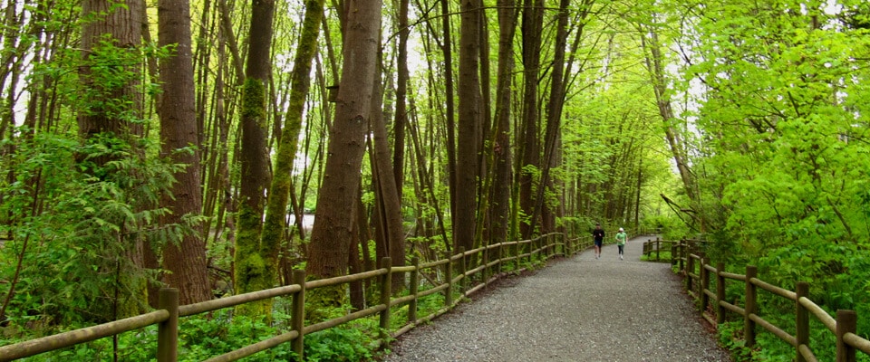
This is a Loop set in the traditional ancestral territories of the Squamish, Musqueam, and Tsleil-Waututh Nations with many interesting features. The loop spans the Spirit Trail, Capilano Regional Park, and the Mosquito Creek Trail.  It is a sensational walk from the Seashore up into a deeply forested mountainside along with canyon views.  Some particularly interesting destinations on this route are the Squamish Welcome Figure and Sna7m Smanit public art piece in Ambleside, as well the fish ladders in the Capilano Fish hatchery facility.  Be prepared for a whole day excursion of about 5-6 hours or more.  Best to start it either at the Fish Hatchery or in Ambleside Park.

There are actually 3 options on this section of the Trans Canada Trail.  The complete Spirit Trail version is a paved greenway path all the way through and can be done quite easily in 1.5 hours.  The Capilano Regional Park routing while being on parts of the Spirit Trail climbs up to the Cleveland Dam in Capilano Regional Park and continues through Edgemont Village to Mosquito Creek.  This latter route involves some roadway when cycling and can be done in less than 3 hours.  For those walking use the great Capilano Pacific Trail to the Capilano Regional Park.  Note: Loop routing is possible when going along the Capilano River.

Landmarks

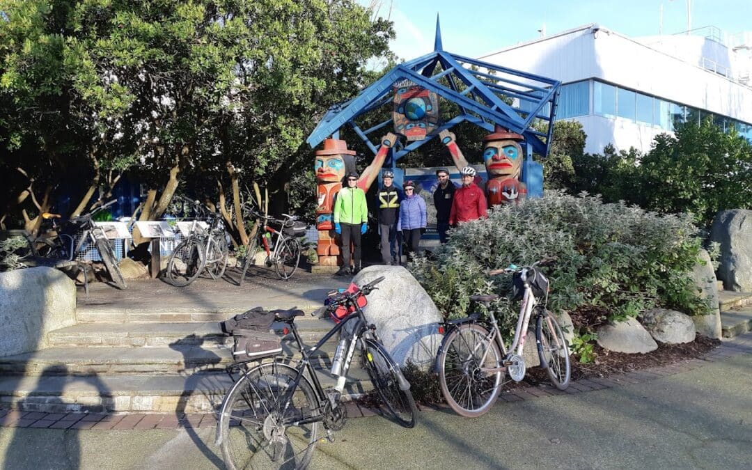
Squamish Nation Welcome Figure

Artwork by Sequilieum Stan Joseph located at Ch’tl’am (Ambleside Park). Made from old growth Red Cedar it is a gift from the Squamish Nation. Welcome figures were traditionally positioned on shore lines to welcome visitors who made a canoe journey to come for potlatch. When one raises their hands in this motion it can signify thanks or welcoming.

North Vancouver WALKING/HIKING/CYClING TRAIL LOOP w7

North Vancouver WALKING/HIKING/CYClING TRAIL LOOP w7

As well as the Trans Canada Trail, this Loop combines a portion of the City of North Vancouver Green Necklace Trail  and Spirit Trail with their greenways and parks. A stretch of the Green Necklace along Keith Road connects the historically significant Victoria Park with Queen Mary Elementary and its community gardens.  The Grand Boulevard affords views towards the City of Vancouver. From here in a clockwise direction one enters the forested sections of the route.  Allow 3 to 4 hours. Add 2.5 kms for a total of 15.5k when adding the optional routing.  Best done clockwise starting at Brigman Park.

Tsawwassen to Vancouver: Alternate Route to the Trans Canada Trail

Tsawwassen to Vancouver: Alternate Route to the Trans Canada Trail

This section of trail offers an alternate between the City of Vancouver and the ferry terminal in Tsawwassen – effectively the most scenic and most enjoyable way to travel between Victoria and Vancouver, when combined with the Lochside Trail once on Vancouver Island. Along the way it features among several parks Trout Lake, Burnaby Central Park, Metrotown and the Queensborough and Alex Fraser Bridges.

Science World to Richmond on the south side of the Alex Fraser Bridge is 14.3 km.  It is another 35 km to the Tsawwassen Ferry Terminal from Science World for a total of 50 km.

Tsawwassen to Langley: Alternate Route to the Trans Canada Trail

Tsawwassen to Langley: Alternate Route to the Trans Canada Trail

While not an official Trans Canada Trail alternate route at this time, this route is meant to connect the TCT in Langley with the Lochside Trail to Victoria.  It offers a shorter route on the TCT in and out of Victoria to the Lower Mainland and vice versa. 

The 61-km Alternate Route described here connects back to the main route of the Trans Canada Trail at the Golden Ears Bridge in Langley via Delta and Surrey.  Mainly off-road routes are also possible to connect back to the City of Vancouver to rejoin the main route of the TCT.

This corridor connects regional greenways, municipal and regional parks, and forests taking advantage of dikes and utility rights of ways.

From the Tsawwassen Ferry terminal one is pleasantly greeted by a causeway with the Salish Sea washing up on both sides.  Next is the Tsawwassen FN with its breakwater, half km boardwalk over marshland, the reserve itself, and finally the huge Tsawwassen Mills commercial centre.  East of downtown Tsawwassen, the 16-km dike Boundary Bay Greenway overlooks a large bay all the way to White Rock and Bellingham in the United States.  Bird watchers abound on these dikes.  The dikes run into Mud Bay Regional Park, again a great bird watching area with wetlands.  From there heading north the route takes in the Delta-South Surrey Greenway with its Watershed Park and the edge of the famous Burns Bog.

Through Surrey the trail mainly follows a hydro right-of-way and passes through Green Timbers Urban Forest to later experience Tynehead Regional Park.