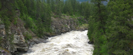
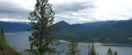
The Trans Canada Trail in the West Kootenay region includes a wide variety of trail experiences – from historic rail trail in the west, to dramatic hiking routes along the Kootenay River, to urban trail in Nelson, paved highways – and even an 8 kilometre ferry crossing across Kootenay Lake! The Trans Canada Trail in the area also splinters out in all cardinal points of the compass, with junctions in Castelgar, South Slocan and Nelson.
To the west, the trail enters the West Kootenay region from the Boundary region at the height of land near Farron Station along the Columbia & Western railway.
The Columbia & Western (C&W) rail trail corridor is owned by the Province of BC’s Ministry of Forests, Lands and Natural Resource Operations (MFLNRO), administered by the Recreation Sites and Trails BC department, which oversees trails, recreational sites and campsites on crown lands and other provincial land assets (excluding Provincial Parks). The trail was first acquired by Trans Canada Trail and then passed on to the Province with the vision of creating a non-motorized cross-country rail trail experience, particularly for bicyclists.
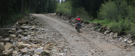
Trail conditions along the C&W are constantly changing and hard to predict – uncontrolled access to the trail by motorized vehicles in recent years has led to a major deterioration of the trail surface, and until a plan is implemented to solve this issue, trail users are encouraged to plan ahead for a challenging – but overall rewarding – journey.
We highly recommend bicyclists to use sturdy equipment on the trail. Mountain bikes are best, but a sturdy hybrid will be much lighter – an important factor when traveling long distances. Front suspension isn’t necessary, but it can increase comfort on bumpy washboard sections. Tire width should be a minimum of 35-38mm, and wider tires (though slower) will be helpful when encountering deep sand. As a former railway, steep inclines are virtually non-existant. Snow can stick to the trail near Farron (north of Christina Lake and the Paulson bridge) into mid May on north-facing slopes. We recommend wearing gloves (in addition to a helmet of course), as cyclists can lose their balance on soft sand and take the odd tumble – cuts on your palm can be painful during a multiple-day ride!
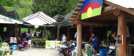
To the south, the Columbia Trail follows the river towards the city of Trail. However, this section has not yet been given Trans Canada Trail designation, though the trail within Trail is part of the TCT – and even features a pavilion!
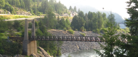
To the north, the Slocan Valley Rail Trail begins in South Slocan and winds its way to Slocan Lake. Bicyclists can approach South Slocan from Castlegar using the shoulder of Highway 3 – or for a quieter ride, Pass Creek Road. These portions can easily be travelled on foot, or better, using a hybrid or road touring bicycle.
To the east, the Trans Canada Trail continues it way to Nelson. Here, the trail splits once again, heading south on the Salmo Great Northern Rail Trail, as well as continuing east to Grey Creek, where the Trans Canada Trail enters the East Kootenay / Rockies.