
The main features of this loop along with its many viewpoints:
- River Rock Casino River Front
- Burkville Institutions & Airport on Sea Island
- Fraser River Dike Trail
- West Dike Trail along Sturgeon Banks and the Salish Sea
- Garry Point with its fishing fleet in Scotch Pond fleet and the Fisherman Monument
- Steveston Quay Village
- Imperial Landing and Britannia Heritage Site with its charming Chinese heritage houses and fishing boats
- South Dike Greenway Trail
- Finn Slough with its heritage houses on stilts
- Horseshoe Slough joining up with the Shell rail trail greenway
- Bridgeport rail trail greenway
Options
One can work in shorter walking loops within this map
This is a very scenic 7.3 km walking loop (no bicycles and not wheelchair accessible) that tours the West Vancouver / Horseshoe Bay area on wilderness trails and abandoned rail line as well as paved urban pathways and sidewalks. Give yourself up to 3 hours for this loop as there are many places to stop along the way. The trail climbing uphill to Whyte Lake is tranquil and features large trees and lush forest floor but can be moderately strenuous. The loop can be travelled in both directions. The best starting point is at Gleneagles Community Centre.

This loop is a great day ride, accessible from multiple staging areas experiencing Regional and District Parks, dikes, and other land features connected by regional greenways. Visit bird sanctuaries, marshlands and tidal flats, with a number of key historical features along the way. The village of Ladner makes a great rest stop, especially on Market Days. Completing the loop of 68 km counts for two sub-loops, 33a and 33b. This cut-off is the division between c33a to the west and c33b to the east. All these loops are best done counterclockwise, especially the c33b loop that takes in River Road and puts the cyclists nearer to the river bank.
Here is a Youtube rendering of the route: https://www.youtube.com/watch?v=80AeY_dMr10
Note that the orange track is the complete cycle route described here.
Alert regarding getting over the tracks at Delta Port
Recently, BC Rail is becoming more vigilant at enforcing the signage indicating ‘end of trail’ and to not to enter this area to get across the railroad tracks. The detour requires going down and up two very steep embankments over water in a ditch to get to a road on the other side.. The 4.5 km detour adds roughly 3.3 kms to the whole route. We are working to overcome this obstacle with the Port authorities. In the meantime, we are hopeful that bridging will be allowed over the ditch for the detour by the Spring of 2019. Please remember that all Trails BC routing is suggested only as routes that we have successfully used in the past but we take no responsibility for the choices you make. Do let us know about any changes and difficulties you encounter while using our suggested routings.
37 km from Pitt River Bridge to Abbotsford (and 46 km of optional spurs in Maple Ridge)
In this more rural part of the Trans Canada Trail there is a main and an alternate or spur route.
At the Pitt River Bridge, take the time to notice the activity of the Pitt River and be reminded that this river is tidal and it flows out the largest tidal lake in the world, Pitt Lake.
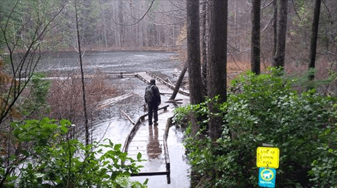
The main route from the Pitt River Bridgehead for the Golden Ears Bridge is via the Pitt River Regional Greenway. The Greenway follows the Pitt and Fraser River to Harris Landing. On the way, there are great vistas of the mountains to the north, in particular, the Golden Ears in the Alouette Provincial Park, of cranberry and blueberry fields, of log booms in the two rivers, and a local airport. Harris Landing at the end of the Greenway provides a terrific refuge from the open dikes to a typical coastal forest along with its huge black cottonwoods and wonderful glimpses of the Fraser River.
Past Harris Landing the pathway continues past a settlement that used to be a mill site called Sawyer’s Mill where views of the Golden Ears Bridge come into prominence and on a clear day the Mount Baker snow cap towers over it.
The Golden Ears Bridge offers great pathways on both sides and allows for a leisurely ride or stroll across the bridge getting yet another perspective of the mighty Fraser splitting around Barnston Island on the west side of the bridge.
After crossing the Bridge into Langley down a spiral ramp the route soon goes past a very large cranberry farm that used to be a peat farm. Further along is Derby Reach Regional Park and the Historic Fort-to-Fort Trail, a very pleasant journey mostly on a single-track trail. A stop at the Old Fort site to take in the interpretive panels is a must. As well, it is highly recommended to take the 1 km heritage tour of Fort Langley with its shops, restaurants, and museums.
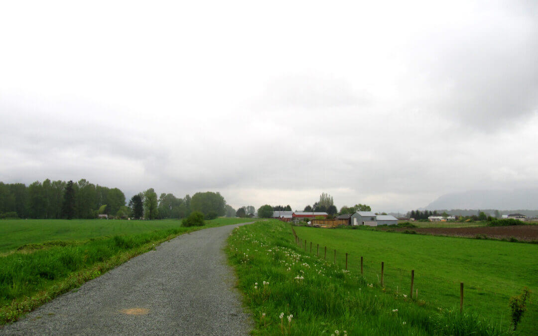
From here the present route is on River Road overlooking the Fraser River to the Nathan Creek dike and, a short distance later, again on roadway off the dike to the Abbotsford Boundary in a very rural setting.
Alternate or Spur and Equestrian route to Kanaka Creek (23-km)-(route will continue to Mission in the future)
All the way along this trail there are interpretive panels detailing the activities and heritage of this area. They are well worth the time to read and contemplate. Do not be alarmed by the cannon blasts during blueberry season. These are to keep the birds from devouring the blueberries. The trail along the dikes is rural and is on the south side of the Pitt Polder. From this point, it is very much quite urban as it passes through Old Haney and past heritage buildings all the way to Kanaka Creek Regional Park. The equestrian trail splits with the cycling and walking trail at Harris Road — see map.
Burrard Inlet is more often called Moody Inlet starting at the Port Moody Boundary. The Trail through the TriCities covers a 26 km stretch from this boundary to the Pitt River Bridge. Expect a varied, fun, and interesting trail experience with a few sidewalks for walkers and roads for cyclists in Port Moody Centre and Guildford Way in Coquitlam.
The Inlet Trail is a greenway with an undulating gravel trail. The first part of the Trail to Reed Point Marina was once the location of Aliceville. The ivy seen along the Trail was the backyard of residents. The country store was on the road down to Petro-Canada Port and the last house was sold to Gulf Oil Company in 1958. The views take in the BC Hydro Thermal Plant and Mountain Views over Moody Inlet, an arm of Burrard Inlet. The second part of Inlet Trail from Reed Point Marina to Port Moody Centre additionally features industrial activity such as the yellow sulphur piles of the SimcprTerminal and the Reichhold Chemical Plant. There are interpretive signs all along this route. Of note, this was the location of the first western most CPR rail station established in 1886. A visit to the Port Moody Museum at the entrance of Rocky Point Park will divulge many of these historical moments in the area.
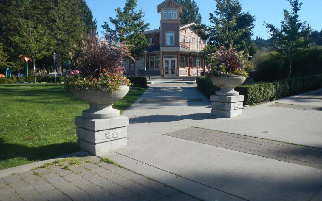
The Trail takes in the Old town of Port Moody with interesting heritage buildings, shops, and restaurants. Past this, the Shoreline Trail starting at Rocky Point Park features extraordinary tidal activity in the mud flats and is a greenway past a large recreation centre complex and a modern City Hall. Given extra time, it is worth taking a look at the architecture foyer of the City Hall. Past this complex through Pioneer Park the Trail heads through Newport Village a prime example of a dense livable residential village that reduces the need for a car.
Guildford Way, a boulevard with sidewalk and bike lanes, accesses a number of schools, the Coquitlam Grind and a park before reaching the entrance of the Hoy Creek Trail, a connector greenway between Douglas College Campus and Coquitlam Center Park. Hoy Creek is one of four major salmon producing creeks in the TriCities.
Entering Coquitlam Town Centre Park and following LaFarge Lake to the TCT Pavilion, the Trail continues on a series of greenways, that includes the Coquitlam River Park, Hyde Creek Trail and the Pitt River dikes and features magnificent coastal trees, a major fish hatchery on Hyde Creek and tidal Pitt River. It is also part of the Port Coquitlam Traboulay PoCo Trail that encircles Port Coquitlam.
Of note, the Hyde Creek Recreation Center is the site of the Terry Fox Hometown Run. It is difficult to imagine that LaFarge Lake was the site of a former quarry. Also, treat yourself to an extraordinary sight on Hyde Creek when the salmon are spawning in November. The dry creek reverts back to a flowing creek teeming with spawning salmon.
Along the Pitt dikes herons are plentiful along with other wild birds such as ospreys and ducks. Be treated with extraordinary views of the Golden Ears Mountain and farmlands all along these dikes. The river is also very active with boats and log booms. It is a tidal river in conjunction with Pitt Lake, one of the world’s largest tidal lakes.

Recent Comments