
This loop which gets very hilly at times offers a variety of superb greenways and parks. Through Coquitlam we will enjoy older parts that include Como Lake Park, Blue Mt. Park, Mundy Park and Riverview, as well as, Coquitlam Centre Park, the Coquitlam River and the David Ave Parkway. In Port Moody and Poco, it takes in Sasamat Lake, Bedwell Bay, Belcarra Regional Park, as well as the Shoreline Trail along Moody Inlet to Rocky Point Park the old parts of town. It involves greenways, bike paths, and some roadway. Along the Coquitlam River we experience part of the PoCo Trail.
This extraordinary routing which is close to 60 kms in length for the complete loop will feel more like 65 kms because of its hill climbs and relatively slow trails. This routing has been changed to reduce repetition from another TriCity Cycle Tour and now includes the upper west side of Coquitlam.
Here is a Youtube video of a large part of this ride:
https://www.youtube.com/watch?v=tRgaDvxSssY

98% of this section of the Trans Canada Trail is enjoyed on greenway along the Coquitlam River, Hyde Creek, the Pitt River, and Fraser River. Allow 4 hours of quite easy riding.
To get detailed descriptions select the Trans Canada Trail routing options on this website.

Here are the main features: (all sensational!)
- Coquitlam Centre Park with Lafarge Lake
- Coquitlam River Loop
- Loops to Crystal Falls
- Smiling Creek Greenways all the way to Hyde Creek
- Hyde Creek Greenway
- Coquitlam Lake lookouts
- Burke Mountain Village
- Burke Mountain Summit makes up Pinecone Burke Provincial Park
- Deboville Slough
- Minnekhada Regional Park
- Widgeon Slough Regional Park
- ETC.
The main trail loop is just over 10 kms but could end up being a good 12 kms when taking in all its features. It is an additional km one-way to or from the Sperling Skytrain using a sensational bridge over Winston Ave, a rail track, and Still Creek while being part of the Central Valley Greenway.
The park can be accessed by Skytrain from 3 stations. The recommended one is at the Sperling/Burnaby Lake Station which is the shortest access and stays on greenways.
The main features involve wetlands around a fairly shallow Lake which ensures its lake formation because of the Cariboo Dam at the east end. It is fed by Still Creek from the west and drains out in Brunette Creek at the east end which, in turn, outflows into the Fraser River.
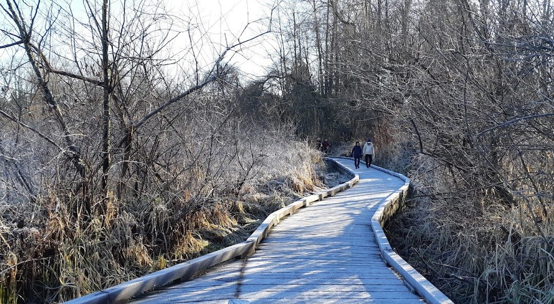
It is a first-class walking trail with a number of boardwalks, bridges and ways to view the lake. On a clear day, it affords views of the North Shore Mountains, as well as, Eagle Mt. and the Golden Ears Mountain to the east. It features a viewing platform and the prominent Piper spit into the Lake. The Spruce and Conifer trails are worthwhile detours. Do take in the interpretive signage along the way. On occasion, there are km indicators along the10 kms starting at the east end of the lake going clockwise from the south shore where there is also a parking lot with toilet facilities. The main parking lots are at the east and west end of the lake. At the east end, there is an equestrian center with trails, while on the west end are the playing fields. There is another access point, with parking, halfway along the north side of the lake. Unfortunately, you will become very conscious of the freeway traffic noise on the south side of the Lake which is less noticeable when the leaves are back in the spring and summer months.
For the main ground cover vegetation look for cattail grass, salmonberry, blackberry, ferns and mosses.
There are prominent groves of large cedar trees. Other trees frequently encountered are hemlock, Sitka spruce, alder, and large cottonwoods.
Ducks and geese are the prominent birds of interest. Near the south side of the Cariboo Dam, turtles can be seen sunning themselves on a floating log.
This is yet another one of our great regional parks that must be experienced.

Be prepared for a fairly hilly and challenging 70 km cycle.
This Cycle Loop features greenways and parks in Langley and the Township of Langley. The greenways are linked with fairly lengthy but mainly quiet country roads along farmland, forests, industry, and communities.
The main parks consist of the Campbell Valley Regional Park and the Aldergrove Regional Park, part of which is actually across the Abbotsford boundary (walk your bike on designated non-cycling sections). Sections of the route are shared with equestrians following the 4th and 8th Ave alignment paralleling the U.S. border. The other main greenways follow the Nicomekl River system as it heads towards Crescent Beach and Hydro corridors.
Of interest, the route takes in significant sections of the Old Yale Road part of what is now the Fraser Highway. One section still has the original cement center sections from 1923. Here is a Wikipedia link explaining its historical significance due to the Gold Rush as part of a route from New Westminster to Hope and then to the existing route to Yale: https://en.wikipedia.org/wiki/Old_Yale_Road Here is a quote,
“Construction began in 1874 for a wagon road between New Westminster and Hope roughly paralleling the route of the Telegraph Trail of 1865. On maps it was called the New Westminster and Yale (Wagon) Road, but known locally as Yale Road.
The route of Yale Road ran from New Westminster in a southeasterly direction through Langley Prairie and Aldergrove to Abbotsford. The road proceeded to curve south to follow a path along the south shore of Sumas Lake and along the north base of the Vedder Mountains through Yarrow, Vedder Crossing, north to Sardis and Chilliwack. From Chilliwack, the road followed Reece’s old trail through Rosedale and Bridal Falls, then northeasterly along the south shore of the Fraser River through Cheam View and Laidlaw to Hope and Yale.”

Recent Comments