
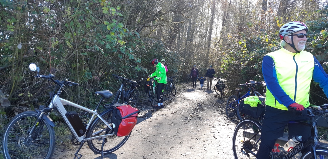
Equestrian Bypass Route. Alternate to the Kettle Valley Railway / Trans Canada Trail in the Myra Canyon
This route makes a great bypass of the Myra Canyon for equestrian trail users – or for everyone when the Myra Canyon becomes temporarily closed.

This route makes a great bypass of the Myra Canyon for equestrian trail users – or for everyone when the Myra Canyon becomes temporarily closed.

The Okanagan Rail Trail between Vernon and Kelowna follows, at this time, the shores of Kalamalka Lake and Wood Lake. The link along Ellison Lake is a future link presently breaking up the rail trail between Wood Lake and the Kelowna Airport.
Rail trail from Vernon to end of finished trail – 29.5k (about 60k there and back)
Rail trail along Kalamalka Lake – 17.5k
Rail trail along Wood Lake – 8.6k
Alternate along Wood Lake – 8.8k
Once the 5.8k connection along Ellison Lake is completed the full length of the Okanagan Rail Trail from Vernon to Kelowna will be about 46k in length.
In Kelowna it is really worthwhile doing the loop that takes in the Mission Creek Greenway and Okanagan Lake. The latter offers interesting greenway features along with other amenities of interest.
This greenway trail loop – 23k add 6.4k if you include the alternate further up Mission Creek.
Rail trail in Kelowna – 10.8k (add 7.3k when including the University Loop).
Okanagan Lake is a fantastic place to paddle, with calm, warm waters and view of desert-like valleys and pine-covered mountaintops. The lake can be paddled virtually its whole length, with many campsites and launches in the southern portion between Penticton and Kelowna.
This route is a concept and the information provided has not been provided by a local paddler. We welcome and appreciate any advice or verification you can provide – please help us improve and enhance this trail information!
We have developed a concept map displaying possible campsites, launch sites and rest stops.
The Kettle Valley Railway continues from Beaverdell to Midway along a combination of paved roads, gravel roads, gravel trail and dirt tracks – plus multiple cattle guards and gates – that will keep you on your toes! Like the KVR between McCulloch and Beaverdell, the use of motorized vehicles along the trail – and conversion of trail into actual road – in this area means that some sections of the trail have become challenging – with some serious washboard conditions. The ride can be tiring, but the quiet pastureland provides beautiful views and possible close encounters with farm animals.
Be sure not to miss one of the highlights on the KVR; in the small community of Rhone is Cyclist’s Rest (and WWII epitaph). Local – and lifelong – resident Paul Letard has built a replica caboose which for years served as “the cyclist rest stop”. Now Paul lives in Midway and the new owners are keeping the cyclists rest stop open, but without the amenities. Please do not disturb them and it is only day-use. Water is no longer available here, the Big Dipper Campground a couple kms towards Beaverdell, has potable water available.
Rounding a bend in the river, the trail arrives to the warm grasslands of Midway. The museum is a popular place to explore. Midway is often the stopping point for many travelers since the KVR technically ends here – but beyond lies another rail trail – the Columbia & Western. The Columbia and Western Rail Trail extends from Castlegar to Midway for about 164kms and Midway was its terminus.

The trail between Hydaulic Lake and the community of Beaverdell is fairly quiet, though the use of motorized vehicles along the trail – and conversion of trail into actual road – means that some sections of the trail have become challenging – with some serious washboard conditions. Bicycle riders without front suspension will get their bones rattled! However, the rail trail is better than riding the busy hwy 33 corridor and has sections that are far removed from the speeding traffic. Also cycling this section gives views of the West Boundary and the West Kettle River which are outstanding.
Our map includes a short detour into the village of Beaverdell, which features a small general store, b&b’s and restaurants. To find more detailed info and updates on the rail trail, please contact the local stewardship society called Trails to the Boundary Society.
Recent Comments