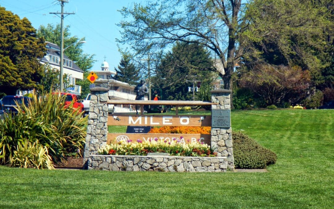
This 10 km shoreline tour starts and begins at Clover Point, the Pacific Terminus of the Trans Canada Trail and takes advantage of Victoria’s beautiful shoreline, exciting harbourfront, historic buildings and following the Trans Canada Trail to return south, passing directly through the city’s crown jewel, Beacon Hill Park. Take advantage of an amazing spur – the Ogden Point Breakwater, now featuring handrails to accommodate visitors of all ages and mobility. The entire loop can be walked in 2 hours, but with so many attractions along the way, it can often take over 3!
- Walking time roughly 2 hours, with stops up to 3.
- Jogging is not recommended at peak hours; route can be congested with slow walkers and dogs! Early mornings are fine. Roughly 45 minutes.
- Cycling is not permitted along many sections. Roads are generally cycle-friendly. Time roughly 45 minutes.
- Horses not permitted.
- Skateboarders and rollerbladers are not permitted along many sections.
- No accessibility issues. There are stairways at Ogden Point and the Inner Harbour, but these can be easily by-passed.
Do the purple tracks for a 16 km walk and added attractions.
The western portion of the Trans Canada Trail begins in Victoria, the capital of British Columbia, on Vancouver Island. From there, it travels north to Nanaimo, where it connects to the mainland by ferry at Departure Bay. The trail passes through scenic forest, mountain, coastal and rural areas, and visits several communities along its 200 kilometre route.
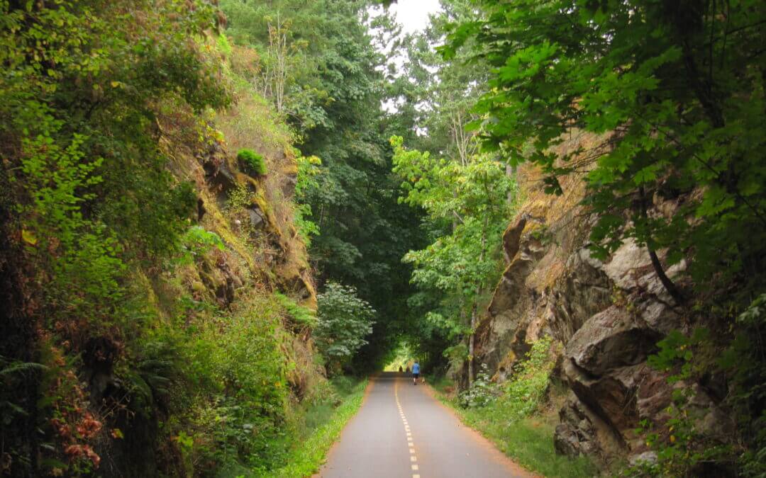
Many portions of the Trans Canada Trail on Vancouver Island are built on abandoned railway lines where the grades are gentle and many of the famous wooden trestle bridges have been upgraded for trail use. The trail surface is normally packed or paved. The trail is used by pedestrians, cyclists, and horseback riders. Motorized vehicles are not permitted on trails that are designated as Trans Canada Trail, though road connections are shared with vehicles.
This section of the Trans Canada Trail passes through the communities of Cassidy, Extension and city of Nanaimo. Nanaimo is the second largest city on Vancouver Island and the hub through which much of Vancouver Island’s commerce connects to the mainland. On the Island, Nanaimo is a crossroad providing access to travel and adventure north, south and west. Nanaimo was known as a coal-mining town in the mid-1800 and developed strong logging and fishing industries.
The trail between Cassidy (Haslam Creek) and the outskirts of Nanaimo (Highway 19 and Harewood Mines Rd) is considered primarily to be a hiking-oriented route, though many sections are well suited to those on sturdy hybrid or mountain bikes. Those on touring bikes should consider a bypass to this whole area as outlined on our map, such as the Parkway Trail.
The trail through the city is a pleasant combination of forested walking paths, urban commuting routes, nature parks and waterfront trails. A Trans Canada Trail pavilion is located near the Vancouver Island University in the southwest corner of the city. The trail connects directly to the Departure Bay ferry terminal, where travelers can travel to Horseshoe Bay, on the mainland in West Vancouver. Travelers having to wait overnight for a ferry might want to check out Newcastle Island Marine Provincial Park This 336 hectares reserve located right in Nanaimo Harbor is accessible by a 10 min ferry ride leaving from Maffeo-Sutton Park, just north of downtown Nanaimo (south of the ferry terminal), and offers fine camping and facilities.
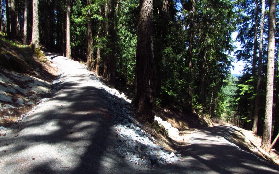
The Cowichan Valley boasts the highest mean temperatures in Canada and its rainforests are home to some of the world’s tallest trees. The Trans Canada Trail travels through these forests, primarily following rail trails. The route is easy to follow and accessible to virtually all levels of physical fitness. The trail surface is mostly well packed finely crushed gravel and is easy to ride, walk or jog along. Equestrian use is permitted in many areas, but not everywhere. The trail also passes through quaint seaside villages such as Saltair, Chemainus and Ladysmith. The region’s hub of activity centres around the city of Duncan.
An important note about the route between Shawnigan Lake south to Victoria; the route over the Malahat involves some very challenging climbs. For cyclists hauling trailers or panniers, it may well be in your best interests to use our Bypass Route, particularly for those travelling south (the grades between Sooke Lake Road and the CRD watershed are especially tough in this direction. The bypass route will lop off a great deal of Trans Canada Trail, including about 13 km of perfectly pleasant rail trail along Shawnigan Lake, but it uses a combination of fairly quiet roadways, urban trails and a nice ferry ride. At the north end, it connects to the Cowichan Valley Trail at the NW corner of Shawnigan Lake on Renfrew Road. At the south end, it connects to the Galloping Goose just north of downtown at Interurban Road.
Note: Work by the Cowichan Tribes owned Khowutzun Development Corporation will start on Monday, Aug. 26, 2024, and finish by mid-September 2024.
The trail will be fully closed starting Sept. 3, 2024, between Glenora Trailheads Park and the east side of Holt Creek Bridge during this time, with no detour available. The area will be closed for as much as two weeks. While pre-works are underway, trail users are encouraged to use other parts of the Cowichan Valley Trail.
One option is to check on our maps for those who want to include the Kinsol Trestle on the way to Cowichan Lake via Deerholme through Duncan avoiding to take the Highway.
Victoria is the largest city on Vancouver Island and is the capital of British Columbia. The region includes many municipalities that have grown together into an area known as Greater Victoria. Victoria is a popular tourist spot, famous for its “British” character, gardens, and moderate climate. A must see for new visitors to the city is the Royal BC Museum. Much of the Trans Canada Trail in the Victoria area follows established regional trails, mostly on the famous Galloping Goose rail trail.

Recent Comments