This will be a rewarding experience for those of you who are experienced with the backcountry. At this time, the trail takes in quite a bit of roadway. Even if there are efforts being made to take this whole trail off Ministry of Highways roads (about 13 km at this time), the route will likely always include a substantial amount of former Forest Service Roads and a few active ones.
These alternatives to the main route of the TCT give options to equestrians and hikers only. Because of high elevations, the season for these trails starts at about the second week in July to about the second week in October. The trip from Chilliwack Lake is between 5 to 7 days of wilderness and alpine trekking. Chilliwack Lake Provincial Campground to Coalmont is about 126 km via Paleface Pass and about 120 km via Greendrop Lake. Subtract 10 km if you don’t take the Granite Mountain route. Support with vehicles can be provided along the Silver Skagit Rd (Upper Silverhope and Skagit River trailheads) and Highway 3 (Sumalo and Cascade trailheads). 4W drives can make it to Lodestone Lake from Coalmont but beyond that, it may not be possible. While there are campgrounds along the way, be prepared for wilderness camping.
Generally, hikers have three options from Chilliwack to Coalmont on the KVR:
- Go over Paleface Pass and follow the main TCT route described in Chilliwack-Silverhope to Hope (note that cyclists are recommended to take a different option via Hwy 7 to Hope from Chilliwack)
- Go over Paleface Pass and head for Coalmont via the Skagit and Cascade Trails
- Take the Centennial Trail via Greendrop and Hicks Creek and head for Coalmont via the Skagit and Cascade Trails.
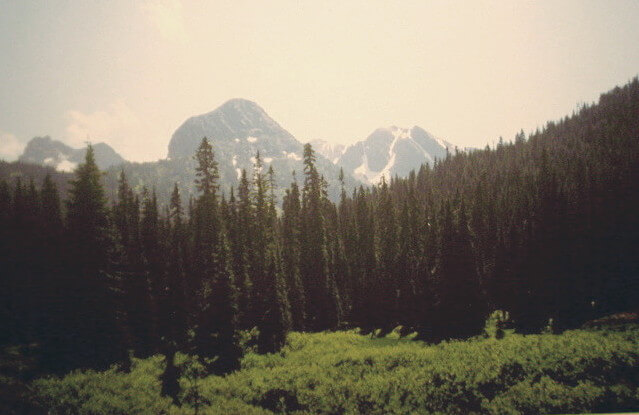
- This route offers camping at Lindeman and Greendrop Lakes in the Pass. Both these Lakes are in the Chilliwack Lake Provincial Park. The lakes themselves are quite beautiful, especially Greendrop Lake viewed from the trail above the lake.
- At the east end of Greendrop Lake is the start of the Hicks Creek FSR trail. Unfortunately, the top part of this FSR has been decommissioned for 7 km and as of 2014 it has become impassable. Hence it would be quite a slog for 7 kilometers. Watch for a TCT sign going south about 1 km before reaching the Silver Skagit Road.
Equestrians really only have one option and that is to go over Paleface Pass and head for Coalmont via the Skagit and Cascade Trails.

This route bypasses the more adventurous Paleface Pass route which travels through the Chilliwack River and Silver/Skagit River Valleys – and climbs over the Cascade mountain range. We recommend this bypass route for all Trans Canada Trail users from mid-October to July. Throughout the rest of the year, Paleface Pass is normally laden with snow and should only be attempted by well-prepared cross-country travelers equipped for backcountry trail riding.
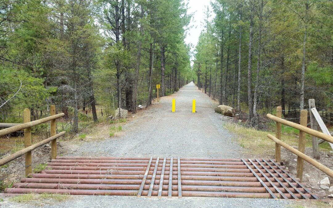
The Chief Isadore Trail from Cranbrook to Wardner has a packed gravel surface, which is half on old Rail Grade and half new trail. A 17-km “Mayook Trail” section is a new trail with enhanced single track, 1.3 metre width, with a sustained 5% grades with some short sections up to a 10% grade.
Do a loop adventure! Rampart Rest Area Loop, 6.5 km: The Rampart Loop is a family cycling or hiking loop. It begins (and ends) at the Rampart Rest Area on Highway #3. On a bike, ride the trail in a clockwise direction starting from the restroom because it is an even climb. After 2.1 km – turn right (west) onto the rail grade trail (this is an intersection with a new road). Hike or bike the rail grade west for 2.7 km. Turn right at a kiosk sign and head back to the rest area by the pond.
Mountain Bikers – try the Mayook Trail! With 17 km of trail, Mountain bikers (intermediate level) will love the fun ride along lower flanks of Mount Baker on a 1.3-metre-wide gravel trail. Elevation gain is 200 metres on well-made switchbacks and gradual grades. Begin from either the Ha-Ha Creek Road or the Pritchard Road Trailheads
Looking for a scenic 21 km loop that includes rural paved roads? Try the Ha-Ha Creek Road Loop Ride, with a stop in Wardner! Start from the trailhead at Ha-Ha Creek Road (the junction between the Mayook Trail and the Wardner Trail sections) and ride the rural paved Ha-Ha Creek Road around to Wardner, then complete the loop by riding back along the old rail grade of the Chief Isadore Trail.
The Chief Isadore Trail is a public recreation trail within active forest, range, and grassland. You may encounter livestock (May to October) and /or wildlife year round. Please do not approach livestock or wildlife. Logging may also take place near the trail. Deer and elk hunting season begins in September and throughout autumn

This route is a suitable alternative to traveling the Trans Canada Trail north on Vancouver Island to reach the lower mainland (Vancouver area) via the Swartz Bay-Tsawwassen ferry. Our Southwest region maps provide information on routes connecting from the Tsawwassen ferry terminal.
Entering from Alberta near the small community of Clayhurst, the trail follows rural roads south for 67 kms, crossing the Peace River, passing through Rolla, and arriving to Dawson Creek. At this point, the TCT joins Dawson Creek’s Rotary Trail through the city, bypassing all the city traffic. The trail route joins the Alaska Highway for most of its 968 km – through Fort St John, Fort Nelson, and various other communities before arriving to the Yukon border between Lower Post and Watson Lake – the only exception is a short detour at Kaskatinaw Provincial Park between Dawson Creek and Fort St. John; the highway bridge is narrow and the route uses the original highway bridge which lies further north.
The Alaska Highway was constructed during World War II for the purpose of connecting the contiguous U.S. to Alaska through Canada. Though the highway was completed in 1942, it was only opened to the public in 1948. The surface is now paved along its entire length.
Canada’s great open wilderness lines the road and travelers are sure to encounter some interesting wildlife. Be sure to rest up along the beautiful shore of Muncho Lake and even take advantage of the opportunity to explore some of the abandoned stretches of the “old Alaska Highway” which have been bypassed as the current highway continues to be improved and straightened over the years.
When you finally reach the border after about 1000 kilometres, there’s no doubt you’ll realize why Yukon’ers refer to the rest of the country as “the Outside”!

Recent Comments