
Travelling north from Elkford, the Trans Canada Trail is now designated, travelling west to the Wapiti ski hill, then north to Round Prairie. From the northern limit of town (at “Crossing Creek” or “Round Prairie” depending on who you ask) the route is designated and ready to take you north to Alberta; it simply follows the Elk Valley Highway.
The road continues to Elk Lakes Provincial Park, and once in the park, travellers can follow the powerline trail as it continues north through the park, reaching the Alberta border and continental divide. From here, the trail is being developed by our Albertan friends and will continue to Banff through “Kananaskis country” in Peter Lougheed Provincial Park.
Many of the road connections used in this area are Forest Service Roads, maintained by the Ministry of Forests, Lands, and Natural Resource Operations. Visit their Roads and Bridge Works page if unsure about the current status of a road along your route.

The Trans Canada Trail from Fernie to Elkford is mostly suited to mountain bikers and hikers, with winding narrow trails making up a great deal of the distance. However, bypass routes for touring cyclists do exist.
Within Fernie, an older “legacy” portion of the trail runs counter-clockwise around the west and north circumference of the city, along the Elk River. This section of the trail is splendid and easy for cyclists and walkers alike. Northbound (Sparwood) bound touring cyclists may wish to leave the trail at the NW corner, using the highway bridge to cross the river and begin travelling north; this will bypass the more difficult section of the Elk Valley Trail between Fernie and Hosmer.
For those continuing on the official trail route, the “legacy” route rejoins the Elk Valley Trail at the Eastern side of the town’s circumference. Alternatively, the Elk Valley Trail can simply be travelled directly north from the Aquatic Centre. Leaving the city headed north, the “Elk Valley Trail” (formerly known as the Coal Discovery Trail) travels north to Hosmer – a fantastic novice mountain bike and hiking trail. From Hosmer north to Ingham (a reference to the nearby highway rest area, as the area doesn’t seem to have an actual official name), the official route leaves the Elk Valley Trail and follows the highway for a short time in order to bypass a section that is not designated as part of the Trans Canada Trail due to wildlife concerns. The trail is indeed open to the public however, so users may continue north on the trail if they wish.
The highway bypass does reconnect with the Elk Valley Trail and leads to the Mountain Shadow campground, through the golf course, crossing the highway and entering Sparwood by the Titan truck, before continuing north towards Elkford.
New sections of trail reduce the number of kilometres one must travel along Highway 43 (Elk Valley Highway) and Lower Elk Valley Road between Sparwood and Elkford.
The route from Wardner towards Elko roughly follows the west shore of the the Kootenay River (Lake Koocanusa) on former forestry roads, heading south and eventually running parallel to Caven Creek Road and crossing Lake Koocanusa (Kikomun Newgate Road bridge) and entering Kikomun Creek Provincial Park and utilizing bits and pieces of a former rail grade. From Bayne’s Lake, the trail is mainly forestry roads – some of which can be muddy – which begin to travel north, eventually reaching Highway 3 and the town of Elko.
From Elko to Morrissey Creek, trails users will find themselves on a gravel logging road which runs along the south-and-east bank of the Elk River. This logging road is certainly quieter than the highway but sees considerable logging-truck traffic and can be dusty as well. Take great caution with approaching logging trucks from all directions – and it is probably best to pull over to the side of the road to let them pass, which they will do at high speeds. An alternative route is simply staying on Highway 3 (preferably only from Elko to Morrissey)
From Morrissey Creek north to Fernie, mountain biking trails known as the “Elk Valley Trail” take in views of the looming mountain ridge lying on the west side of the Elk River. Portions of the route are challenging, so River Road and Cokato Road can be used as bypasses for touring cyclists.

The mountain views get bolder as TCT travelers move form the eastern edge of the Purcell mountain range at Kimberley, down through the Rocky Mountain Trench beyond Cranbrook, and up toward the western fringes of the Rockies at the community of Wardner.
Kimberley is BC’s highest city at 1113 meters and is known as the Baverian City of the Rockies. Close to the downtown center of KImberley at the Platz, the TCT emerges onto the new NorthStar Rails to Trails.
The route from the southern end of the NorthStar to Rotary Way in Cranbrook is in development, but Rotary Way itself is fully designated as Trans Canada Trail and includes a pavilion.
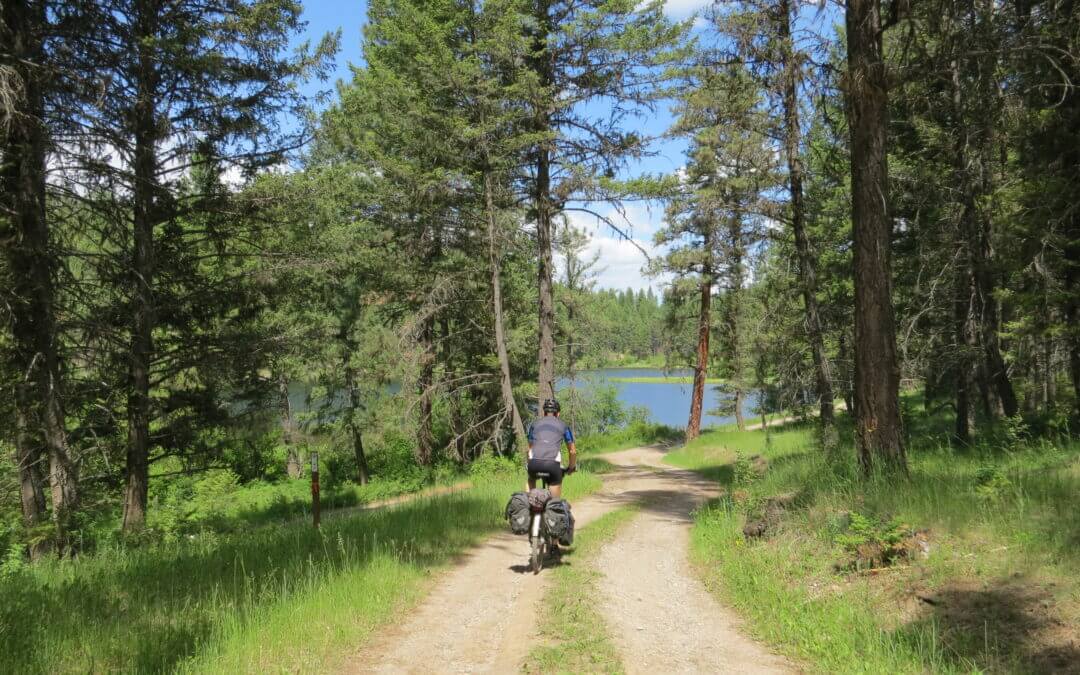
Travelling the Trans Canada Trail from Gray Creek to Kimberley is an extremely arduous journey in the wilderness for 80 km on a forestry road, plus an extra 10 km through Kimberley Nature Park with minimal amenities, no supplies and limited-to-no cell service until approaching Kimberley. Cyclists should carry spare brakes, chain links, tubes, tires and a comprehensive set of bike tools. If you are up to the challenge, you certainly will be glad you tried it!
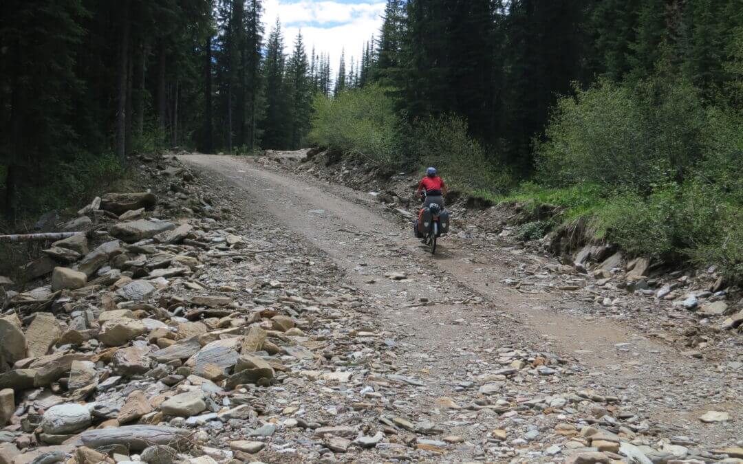
The route follows active forestry roads and cyclists are asked to USE CAUTION along the way; the road’s poor visibility and heavily laden logging truck traffic can make this route a potentially hazardous journey if users do not remain vigilant and aware of their surroundings. Give all traffic – particularly logging trucks – extra room to pass.
Note: The Gray Creek Pass road is normally closed to vehicles through the winter, opening as late as early-mid July. Late snow and the occasional washout can delay the annual opening. Hikers and cyclists can often pass through these obstacles but do so at their own risk. Visit the Gray Creek Store’s website for the latest road conditions!
Here are some historical dates for the seasonal openings/closings:
| OPENING DATE (approx) |
CLOSING DATE (approx) |
|
|
| June 13, 2019 |
|
| June 25, 2018 |
October 12, 2018 (reopened a week later, then closed again Oct 28) |
| June 23, 2017 |
October 18, 2017 |
| June 21, 2016 |
November 11, 2016 |
| June 10, 2015 |
October 31, 2015 |
| June 26, 2014 |
October 31, 2014 (3″ snow) |
| July 4, 2013 |
October 3, 2013 (6″ snow) |
| 2012: Closed most of the year due to washouts, etc |
|
The history of the route over Gray Creek Pass goes back to the 1950s, when Cominco (now Teck Metals) built a power line over the Pass. Cominco employees who had relocated from Kimberley to Riondel were keen to have a shorter route back to the East Kootenay, and at the time two roads were considered – one over Gray Creek Pass, and one over Rose Pass to the north. It wasn’t until the late ’80s when the push for the backcountry route finally gathered momentum. Rose Pass would have required a three-mile tunnel so that idea was abandoned. Gray Creek Pass was finally completed in the 1990s, and officially opened in July 1990. Since, the powerline has been abandoned – but the road remains a popular route for visitors to the area, particularly amongst RV enthusiasts. Curiously, publicity about the route draws many German tourists to the Pass each year.
The route described begins at the Gray Creek Store (not to be confused with the General Store further south). Its eastern endpoint is the “Platzl” pedestrian mall in Kimberley.
For hikers Trails BC has proposed a hiking alternative as shown on our map page for the part of the route from Gray Creek to over the pass and connecting to the main Forestry Road. To read about a hiker who has done this section refer to this posted article.

Recent Comments