
A recognized paddling route (kayaking and brigade canoe only) to connect the Trans Canada Trail in West Vancouver to the Sea to Sky Trail in Squamish is now open and operational! This route provides launching and camping sites along the Howe Sound, which visit tranquil islands and takes in the majesty of Howe Sound from a very unique perspective.
As this an ocean paddling route, please note that while this site does provide GPS data, we highly recommend carrying paper charts for the Howe Sound. Contact your local chart dealer. Ideal charts from the Canadian Hydrographic Service (CHS) are Chart #3311 and/or Chart #3526. Both charts cover the region with 1:40,000 scale. However, Chart #3526 covers the southern shore of Bowen Island (south of Snug Cove) if you will be paddling in that area.
Trail Closure:
Please be advised that the road being part of the routing is closed to public access from Oct 27-31,2025 due to bridge work at Hole in the wall (road kilometer 10.5). The bridge is being re-decked and to accommodate this there will not be public access even by foot during this period of time. No temporary access, including walking, will be provided during this time making it impossible to get from the Coquihalla Summit to Portia thus requiring using Highway 5 for this section of trail.
Due to natural disasters along the trail early in 2022 it is not possible to continually follow the TCT trail along this route. Only sections are useable at this time. In fact, it is not, at this time, advisable to attempt using the TCT from Hope to Princeton. Some parts of the trail are also interrupted because of the Trans Mountain Pipeline construction. Please Note: The supervised gate at Carolin Mines Road does not restrict Trans Canada Trail users to access the rail grade through Jessica.
Description: From Silver Creek in Hope to Brookmere, it is quite an adventure that takes about two days to complete on a bike. Those continuing on the Trans Canada Trail should stock up in Hope for three to four days of travel involving at least three nights of camping to get them to Princeton. If you have a shuttle vehicle, it is possible to meet with the vehicle at many intervals.
Hope is the true western terminus of the Kettle Valley Railway, which is responsible for the outstanding Othello Tunnels on the edge of town. The route from here to Brookmere does use pieces of the old railway, but much of it has been abandoned or built over by the highway.
A Special Note about the Stó:lö (‘people of the river’ in the Salish language) and the Fraser River:
The Stó:lö people can trace their heritage back between 9,000 and 11,000 years relating to their life on the Fraser River. The river, as well as a source of food and transportation, was and still is integral to their ceremonies and rituals. In the summer they lived in plank-built houses and pit houses in winter. Good places to see examples of their tradition of excellent basket-weaving and other traditional information can be found at the Telte-Yet Campground Gift Shop, the Muskwa Gallery & Indian Crafts and at the Hope Museum at the Information Centre.
From BC Parks’ description of the Coquihalla:
In the early 1900s, the Canadian Pacific Railway decided a route was necessary to link the Kootenay region with the British Columbia coast by rail. Andrew McCulloch was hired as the chief engineer in May 1910. He had been involved in many CPR projects, including the Spiral Tunnels near Revelstoke.
McCulloch took on the challenging task of building the railway over three major mountain ranges. The Coquihalla subdivision included 38 miles from the Coquihalla Summit to the junction with the CPR mainline across the Fraser River from Hope. This section boasts the most expensive mile of railway track in the world: $300,000 in 1914. The construction was done almost exclusively by hand with the assistance of a few horse-drawn scrapers and some black powder. His assistant engineers nick-named the railway “McCulloch’s Wonder”.
The greatest challenge of this route was the Coquihalla gorge, just east of Hope, where the river had cut a 300-foot-deep channel in solid granite. Other engineers had suggested a mile-long tunnel by-passing the gorge, but McCulloch chose to build directly through it. Hanging in the gorge in a wicker basket, McCulloch surveyed the canyon for a straight line of tunnels that could be dug simultaneously. Cliff ladders, suspension bridges and ropes allowed workers to complete what is, to this day, regarded as a spectacular engineering feat. The tunnels are known as the Othello Tunnels.
McCulloch was an avid reader of Shakespearean literature and he used characters such as Lear, Jessica, Portia, Iago, Romeo, and Juliet are the named stations of the Coquihalla subdivision. The tunnels in the Coquihalla Canyon were near the Othello station – thus, Othello Tunnels. Many of the passengers on the Coquihalla line came expressly to see and photograph the station boards and to send postcards from the stations’ post offices as a souvenir. This added an ironic touch of gentility to this adventurous journey.
The Kettle Valley Railway was officially opened on July 31, 1916. The line operated both freight and passenger service between Vancouver and Nelson, but the operation was plagued with snow and rock slides. In a two-year period in the 1930s, the line operated for only a few weeks.
On November 23, 1959, a washout was reported just north of the tunnels. The 400-foot washout was too large to be filled in one day, and numerous other washouts added to the troubles of the maintenance crews. The line was closed and never reopened. It was officially abandoned in July of 1961. The tunnels and surrounding area became a provincial park in 1998.
Much of the modern four-lane Coquihalla Highway is built upon the original rail bed of the Kettle Valley Railway. Traveling at modern highway speeds it is difficult to imagine the formidable task of constructing a rail route through this rugged section of British Columbia. As you drive along the highway (or indeed hike or bike along the Trans Canada Trail), you may notice some small signs in the shape of an old steam locomotive, with Shakespearean names. These signs commemorate the approximate locations of the KVR stations along today’s Hwy 5.
The Chilliwack River Valley teems with mystery. The wild Chilliwack River is a favourite for fishermen and kayakers and leads to approximately 25 km of fish channels, a fish hatchery, and a myriad of mountain streams. The towering mountains offer a multitude of sought after rugged trails to high lakes and ridges. There are complete rainforest ecosystems and Chilliwack Lake itself is a large body of water that intrigues and is so awe inspiring that it brings out the poet in us. Wildlife abounds including birds of prey, the Blue Heron, many other bird species, bears, deer, and wild mountain goat to name a few.
This section of coastal rainforest is magnificent. It is also a timber harvest area. Tree species: Douglas fir, western hemlock, western red cedar, red alder, paper birch, and black cottonwood. Plants: salal, sword fern, bracken fern, flat moss, false azalea, lanky moss, step moss, Alaskan blueberry, goose berry, dull Oregon grape, false Solomon’s seal, thimbleberry, wild ginger, prickly rose, and devil’s club.
There are enough adventures available in the Chilliwack River Valley to fill several complete summers. These include: Liumchen Ridge, Mt. Slesse, Mt. Ford, Williams Peak, Pierce Lake on Mt McFarlane, Elk Mt., Cheam Peak, Mt. Foley, Mt. Laughington, Williamson Lake, Radium Lake, and Lindeman, Greendrop Lakes. The east end of Chilliwack Lake takes the adventurer to a prized first growth forest known as Sappers Park, and a trail that crosses the US border to North Cascades National Park and goes as far as Ross Lake. There are, of course, other uncharted treks that takes the traveler along valleys or mountain passes.
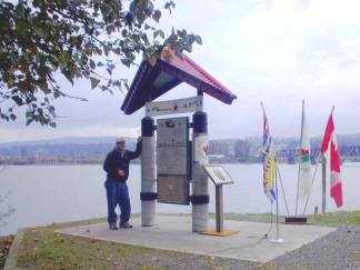
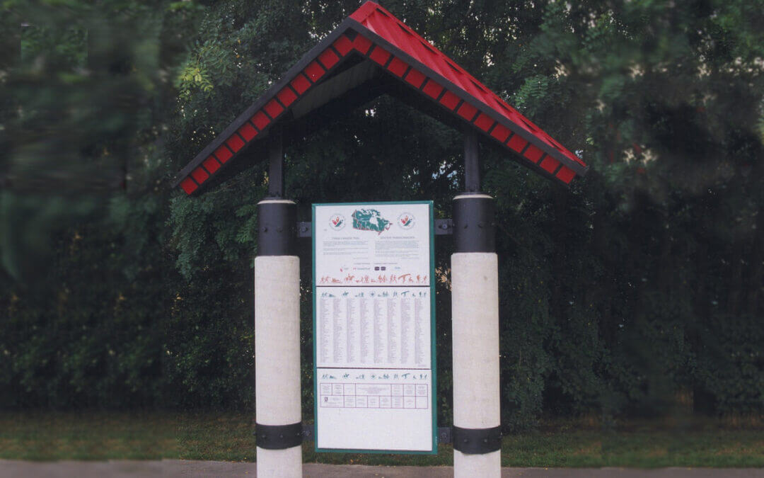
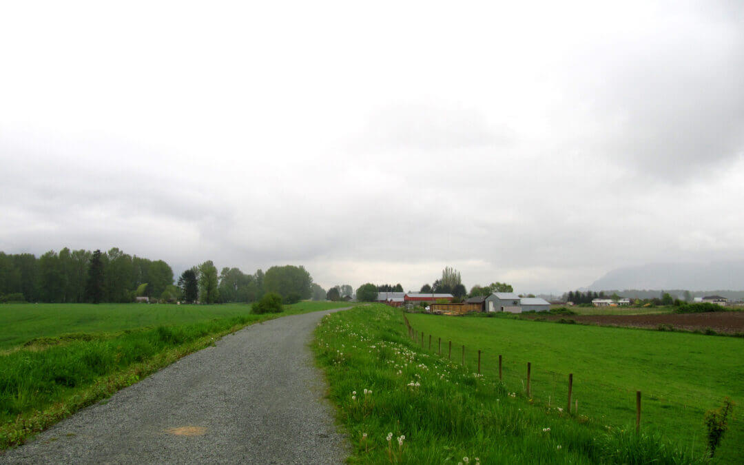
From the Abbotsford-Langley Boundary situated in Glen Valley in the middle of cranberry producing fields the trail will get away from the Fraser rising onto the Mount Lehman plateau following country roads passing farmlands and country estates to the Mount Lehman settlement with its heritage buildings dating as far back as 1864. Soon after, at Douglas Taylor Park, begins the 10 kilometre Matsqui Trail by descending back down to dikes along Fraser River protecting the Matsqui Prairie. At the Mission Bridge is the Matsqui Trail Regional Park where there is the location of a red-roof TCT Trail Marker overlooking the Fraser River. Note – there is no longer a campsite at this Regional Park. Supplies can be found a few blocks south on Riverside Street in historic Matsqui Village.
Over the Mission Bridge, is a large shopping centre and historic Mission City. A little further along is the Hatzic Rock Site where there is a Longhouse Interpretive Centre run by the Xá:ytem First Nations, Stó:lö member — 35087 Lougheed Highway. Mission is also the end of the line for the West Coast Express Commuter Train that can take one all the way back to Vancouver in the morning and back again in the evening.
The end of the Matsqui Trail abuts against the Sumas Mountain a challenging bump bounded by the Fraser River and the Sumas Prairie stretching all the way to the U.S. border.
For the Trans Canada Trail, it was decided to follow the base of the mountain on country roads to Clayburn Village, the site of a former clay factory of which remnant of its large kilns can be found in a park across a quaint coffee shop. Then, its over the toe of the mountain on the superb paved east section of the Abbotsford Discovery Trail. However, for the more adventurous hiker, there is a rugged trail (the Centennial Trail) that traverses the mountain past Chadsey Lake in the Sumas Mountain Regional Park and later rejoins the main Trans Canada Trail at a major pumphouse on the Sumas River on the edge of the Barrowtown. The pumphouse controls the water levels of the diked Sumas River protecting lands that was reclaimed from a huge shallow lake.
Off the toe off Sumas Mountain the trail finds itself on yet another series of dikes controlling the Sumas River and the Vedder Canal. The Vedder takes the outflow of the Chilliwack River and is a real magnet for fishermen. At a bridge over the Vedder (Keith-Wilson Bridge) is the Chilliwack boundary and the start of the Rotary Vedder Dike Trail.
Here trekkers are treated to vistas of farmland and mountains, a blue heron rookery known as The Great Blue Heron Reserve, the Rotary Interpretive Center, and many interpretive markers along the way. The trail is generally hard-packed gravel and flat, allowing many user groups, including wheelchairs, to take advantage of this section. This was the location of the former Canadian Forces Base Chilliwack. Washroom facilities are located at several locations along the trail.
The trail ends at Vedder crossing where a decision needs to be made either
- Head on the more adventures route via Cultus Lake, Chilliwack Lake Provincial Park, and over Paleface Pass to Hope, a mountainous route.
- Take the alternate cycling route through the City of Chilliwack back along the Fraser to Rosedale and then over the Agassiz Bridge to take Highway 7 to Hope, a relatiely flat route with good bike shoulder lanes..
Cultus Lake Park and Cultus Lake Provincial Park are located in a beautiful mountain setting that attract thousands of people every summer. It offers all the amenities associated with a summer destination. The Soowahlie First Nation, a member of the Stö:ló, also make this area their home. This is the last chance to buy supplies before heading up the valley.
37 km from Pitt River Bridge to Abbotsford (and 46 km of optional spurs in Maple Ridge)
In this more rural part of the Trans Canada Trail there is a main and an alternate or spur route.
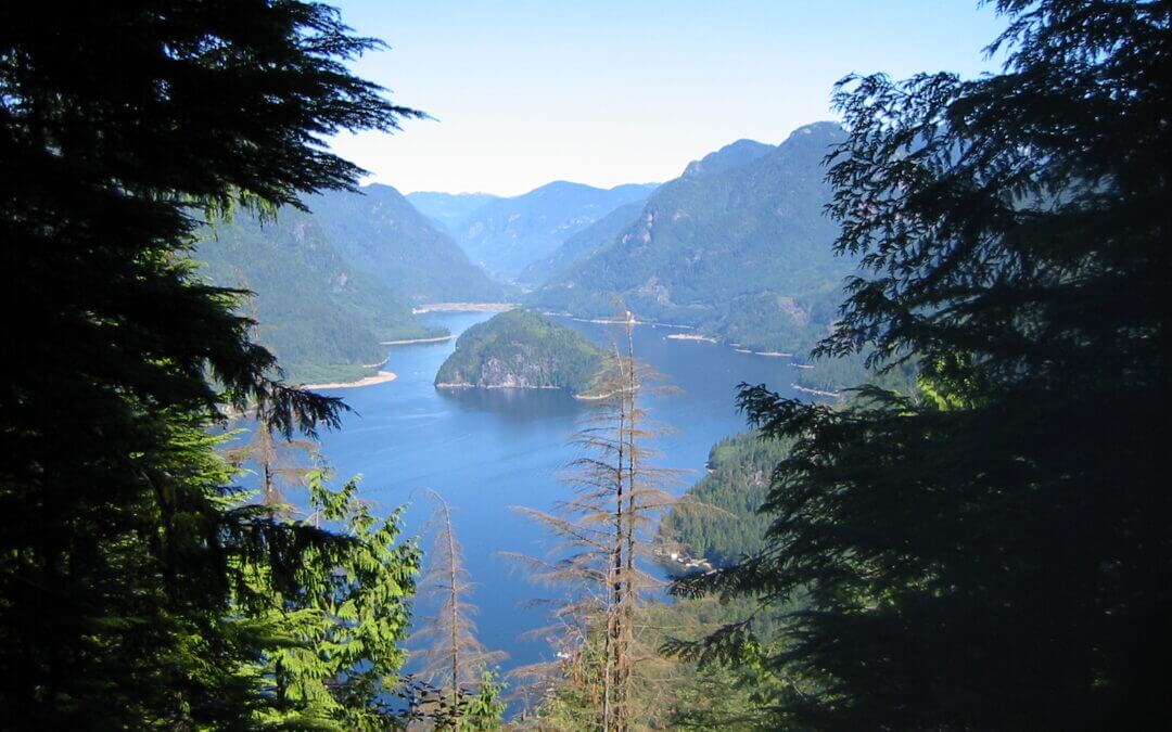
At the Pitt River Bridge, take the time to notice the activity of the Pitt River and be reminded that this river is tidal and it flows out the largest tidal lake in the world, Pitt Lake.
The main route from the Pitt River Bridgehead for the Golden Ears Bridge is via the Pitt River Regional Greenway. The Greenway follows the Pitt and Fraser River to Harris Landing. On the way, there are great vistas of the mountains to the north, in particular, the Golden Ears in the Alouette Provincial Park, of cranberry and blueberry fields, of log booms in the two rivers, and a local airport. Harris Landing at the end of the Greenway provides a terrific refuge from the open dikes to a typical coastal forest along with its huge black cottonwoods and wonderful glimpses of the Fraser River.
Past Harris Landing the pathway continues past a settlement that used to be a mill site called Sawyer’s Mill where views of the Golden Ears Bridge come into prominence and on a clear day the Mount Baker snow cap towers over it.
The Golden Ears Bridge offers great pathways on both sides and allows for a leisurely ride or stroll across the bridge getting yet another perspective of the mighty Fraser splitting around Barnston Island on the west side of the bridge.
After crossing the Bridge into Langley down a spiral ramp the route soon goes past a very large cranberry farm that used to be a peat farm. Further along is Derby Reach Regional Park and the Historic Fort-to-Fort Trail, a very pleasant journey mostly on a single-track trail. A stop at the Old Fort site to take in the interpretive panels is a must. As well, it is highly recommended to take the 1 km heritage tour of Fort Langley with its shops, restaurants, and museums.
From here the present route is on River Road overlooking the Fraser River to the Nathan Creek dike and, a short distance later, again on roadway off the dike to the Abbotsford Boundary in a very rural setting.
Alternate or Spur and Equestrian route to Kanaka Creek (23-km)-(route will continue to Mission in the future)
All the way along this trail there are interpretive panels detailing the activities and heritage of this area. They are well worth the time to read and contemplate. Do not be alarmed by the cannon blasts during blueberry season. These are to keep the birds from devouring the blueberries. The trail along the dikes is rural and is on the south side of the Pitt Polder. From this point, it is very much quite urban as it passes through Old Haney and past heritage buildings all the way to Kanaka Creek Regional Park. The equestrian trail splits with the cycling and walking trail at Harris Road — see map.

Recent Comments