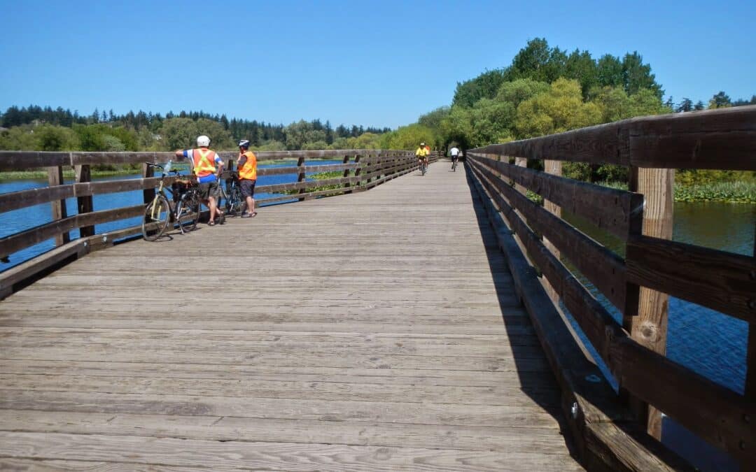
This superb urban trail loop takes advantage of a variety of greenways, city parks, and ecological settings. A good place to start is in the parking lot at Swan Lake. The highlights are Swan Lake, the Blenkinsop Bridge on the Lochside Trail, and the Centennial Trail. It connects with the Trans Canada Trail and takes in its alternative, the Lochside Trail. It is equally interesting going clockwise of counter-clockwise. Allow 5 to 6 hours. If you choose to cycle it, you will be asked to walk your bike where bicycles are not allowed to be ridden (allow 2.5 hrs).
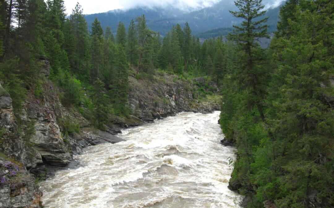
The extraordinary Cathedral Provincial Park owes its name to sensational mountain peaks that reach over 2600m/8,500 ft around a bowl in the Cascade Mountains just north of the U.S.A. border.
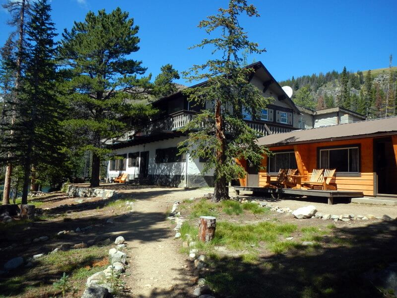
The majority of people visit the park by either camping or booking a room at the Cathedral Lakes Provincial Lodge. In either case, the best way to access the area is by booking a shuttle with the lodge.
Suggested time: 2 half days and 2 full days (3 nights) allowing to arrive on the 10:00 a.m. shuttle and leaving on the 3:00 p.m. shuttle.
The general location of the park is 22 km out of Keremeos on the south side of the Similkameen River. Here it is as described in Wikipedia:
Cathedral Provincial Park and Protected Area, usually known as Cathedral Provincial Park and also as Cathedral Park, is a provincial park in British Columbia, Canada. It is located east of E.C. Manning Provincial Park, south of BC Highway 3, and southeast of the town of Princeton and southwest of Keremeos. Its southern boundary is the border with the United States. Much of the park is the basin of the Ashnola River.
Suggested Hiking Itinerary
Diamond Loop (including Scout Lake) – half day (following the 10:00 a.m. shuttle – 8.8 km counter clockwise
Rim Trail Loop via Diamond Trail Loop junction, to Red Mt, Quiniscoe Mt, Pyramid Mt., Devils Wood Pile, Smokey the Bear/Giant Cleft, Lady Slipper Lake and back to Lodge- Full day about 7.5 to 8.5 hrs (counter clockwise) – 16 km
Goat Lake via Box Car Mt. and Lakeview Mtn. Loop – Full Day – approx. 14 km (optional – if staying for 2 nights only you may wish to forego this hike.
Lake of the Woods, Pyramid Lake, Glacier Lake and Quiniscoe Lake (including falls) Loops – half day, 8-km – clockwise – take the 3:00 p.m. shuttle out
The complete Centennial Trail through the Park is much longer as is the trail taking in Haystack Mt. These are multi-day back packing hikes.

This 16.2 km loop can be cycled or walked, taking in the well maintained and paved Rotary Trail, then following enjoyable dirt trails in the local Community Forest. In the Community Forest the Juniper Lane and Isadore Connector trails are used. Just over half of this loop route is already designated as part of the Trans Canada Trail.
- Walking time roughly 4 hours. Also suitable for jogging but be mindful at street crossings.
- Cycling time roughly 1 hour.
- Horses are not permitted on the paved Rotary Way but are welcome in the Community Forest.
- No stairs or accessibility issues, though some sections have rough surfaces.
- Rollerblading and skateboarding are not recommended.
Take note: At the northernmost point of the route, where the Isadore Rail Trail and the Community Forest intersect, the route is quite steep (average 10% grade), heading uphill (east) into the Community Forest. Therefore, cyclists travelling in a clockwise fashion on the loop may have to push their bikes for up to 1 km. We highly recommend using this route in a counter-clockwise direction.. unless you’re craving a good hill climb!
This 12.3 loop is one of the few “100% Trans Canada Trail” routes in existence! The loop takes in shaded forest trails along Mark Creek, and returns to downtown Kimberley on the Northstar Rail Trail. Suitable for hiking and cycling.
The Lions Way trail, which follows Mark Creek, runs downhill from north to south; travelling south is much easier. The Northstar, being a rail trail, is quite flat and easy to ride in either direction. Therefore, we suggest using this route in a counter-clockwise fashion. Cyclists should be aware of some blind corners and keep speed reasonable along Lions Way as this is a popular dog-walking route.
- Walking time roughly 2.5 – 3 hours. Dog-friendly.
- Jogging (~1 hour) is highly recommended as there are few street crossings. Some tripping hazards possible along the wooded segment.
- Cycling time roughly 45 minutes.
- Horses are not permitted.
- Skateboarding and rollerblading are not recommended on the Lions Way portion.
- No staircases or accessibility issues, though the trail surface may be challenging for wheelchairs. There are some steep declines along Mark Creek to consider.

The main features of this loop along with its many viewpoints:
- River Rock Casino River Front
- Burkville Institutions & Airport on Sea Island
- Fraser River Dike Trail
- West Dike Trail along Sturgeon Banks and the Salish Sea
- Garry Point with its fishing fleet in Scotch Pond fleet and the Fisherman Monument
- Steveston Quay Village
- Imperial Landing and Britannia Heritage Site with its charming Chinese heritage houses and fishing boats
- South Dike Greenway Trail
- Finn Slough with its heritage houses on stilts
- Horseshoe Slough joining up with the Shell rail trail greenway
- Bridgeport rail trail greenway
Options
One can work in shorter walking loops within this map

Recent Comments