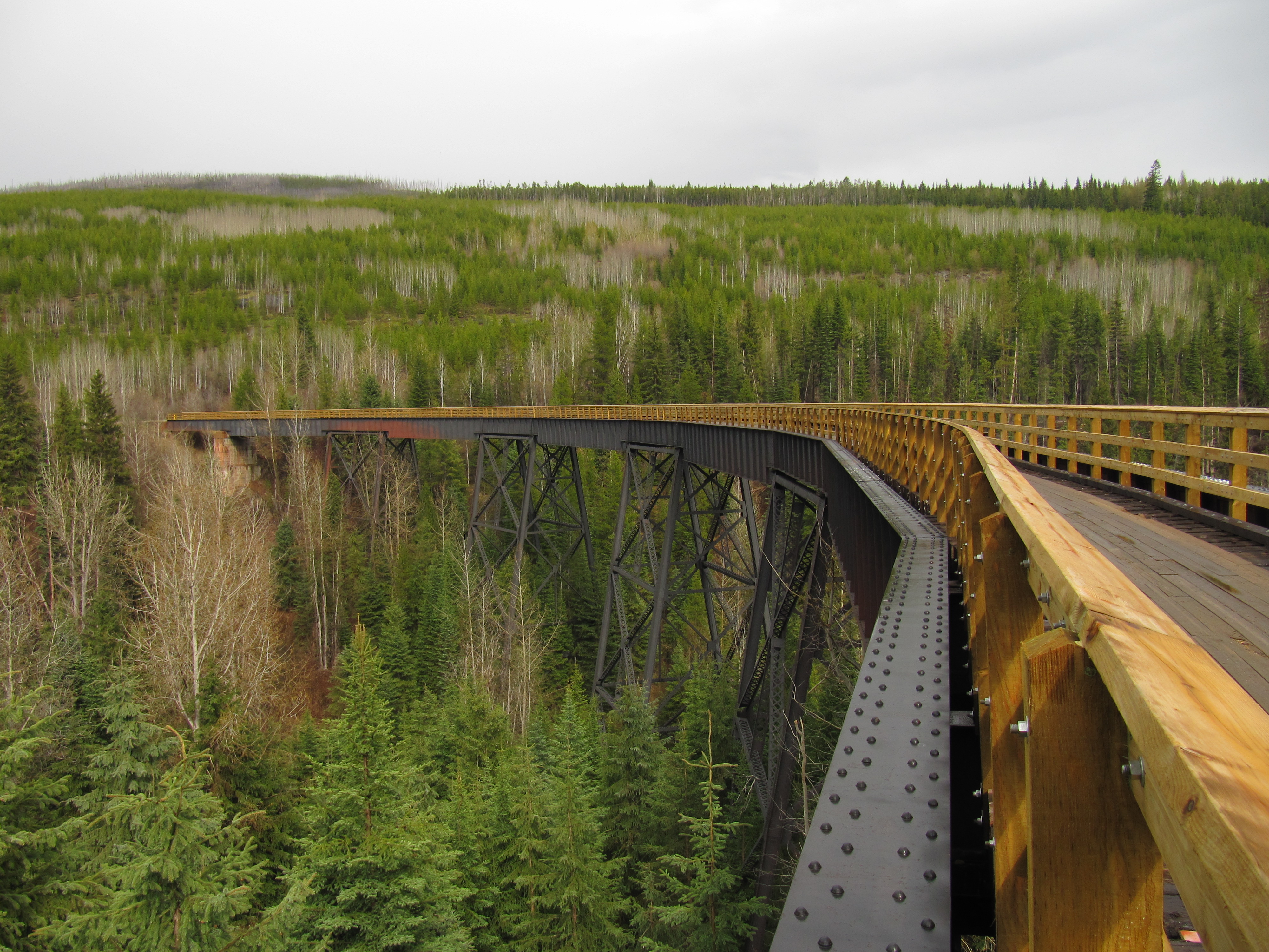
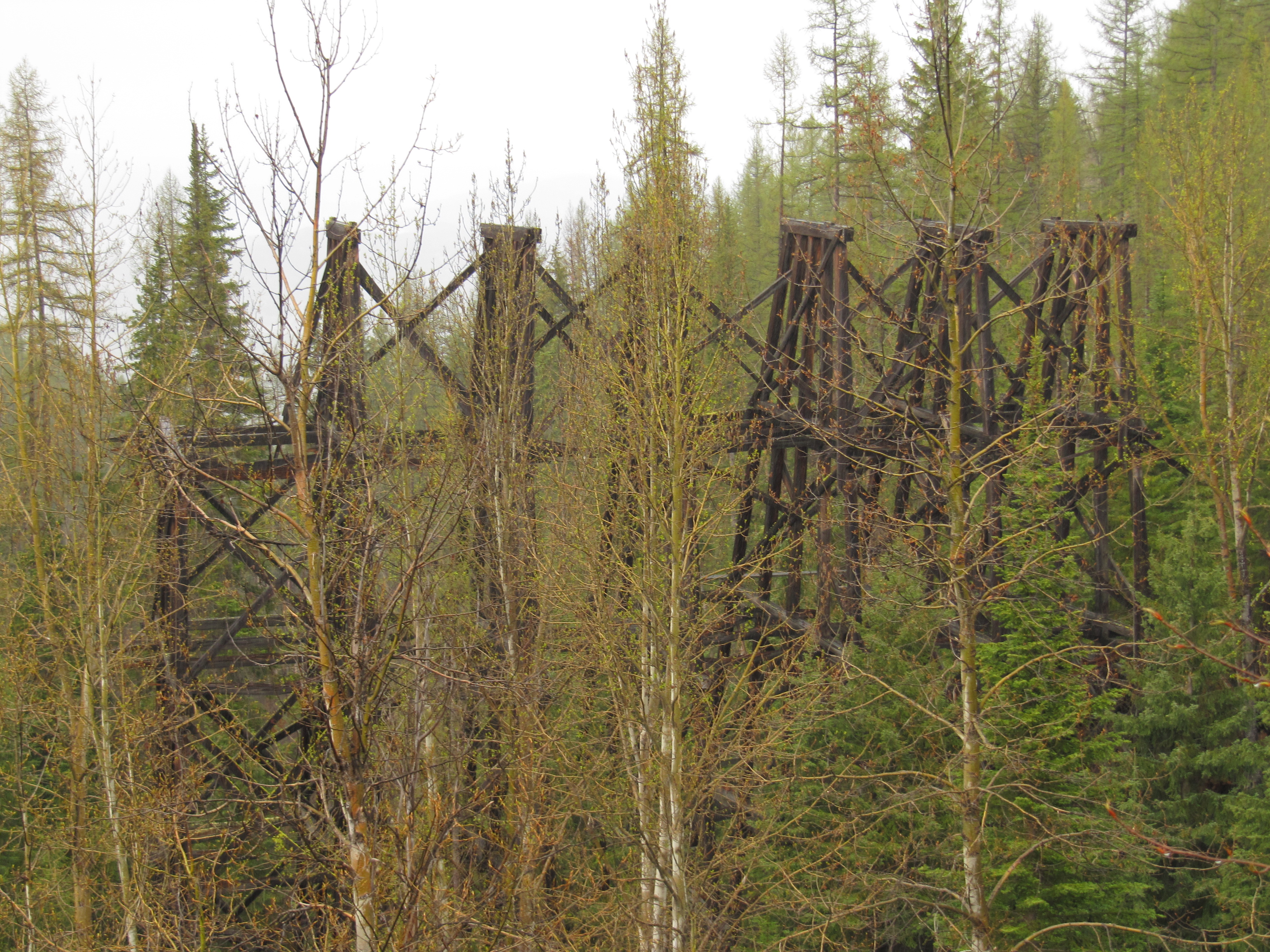
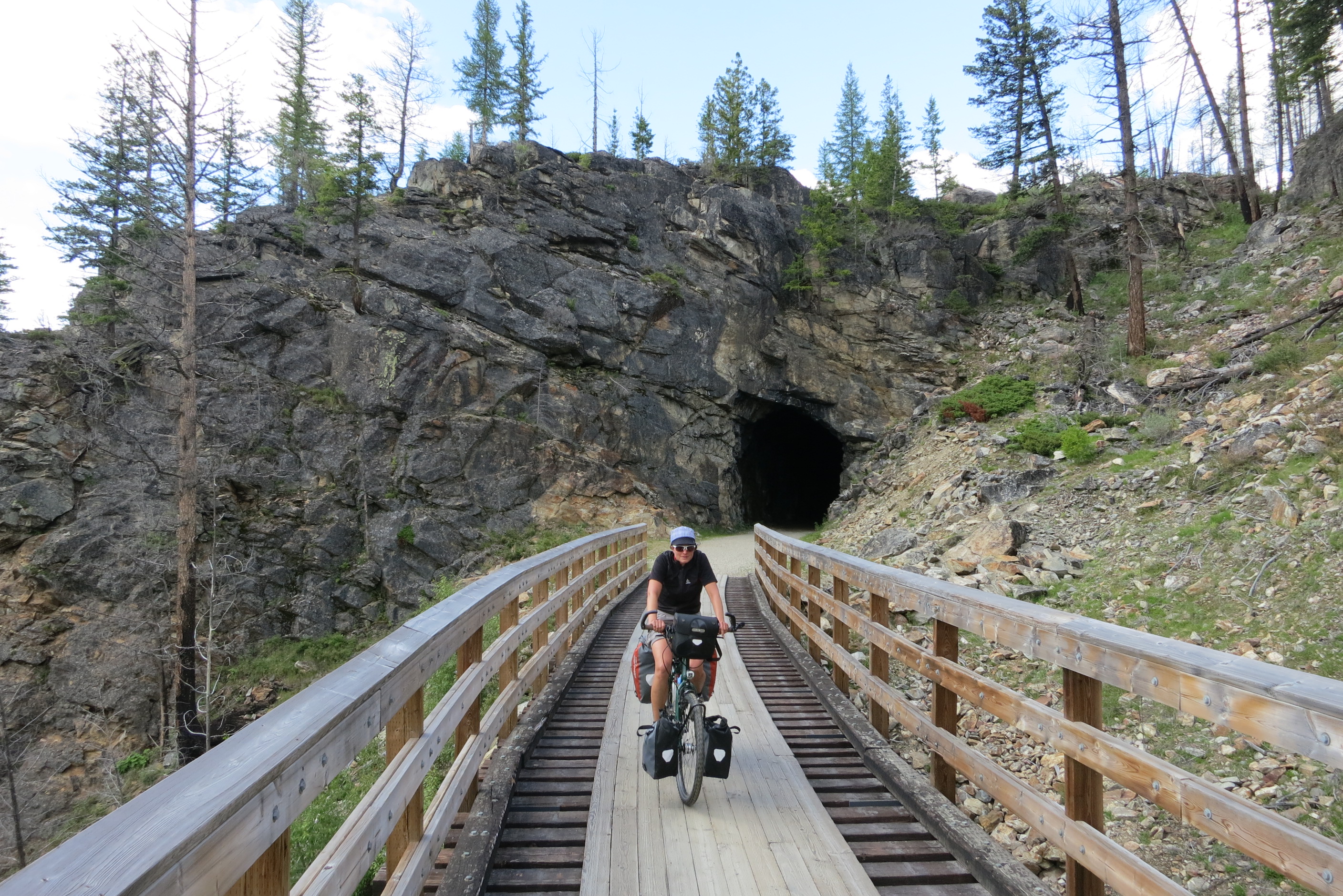
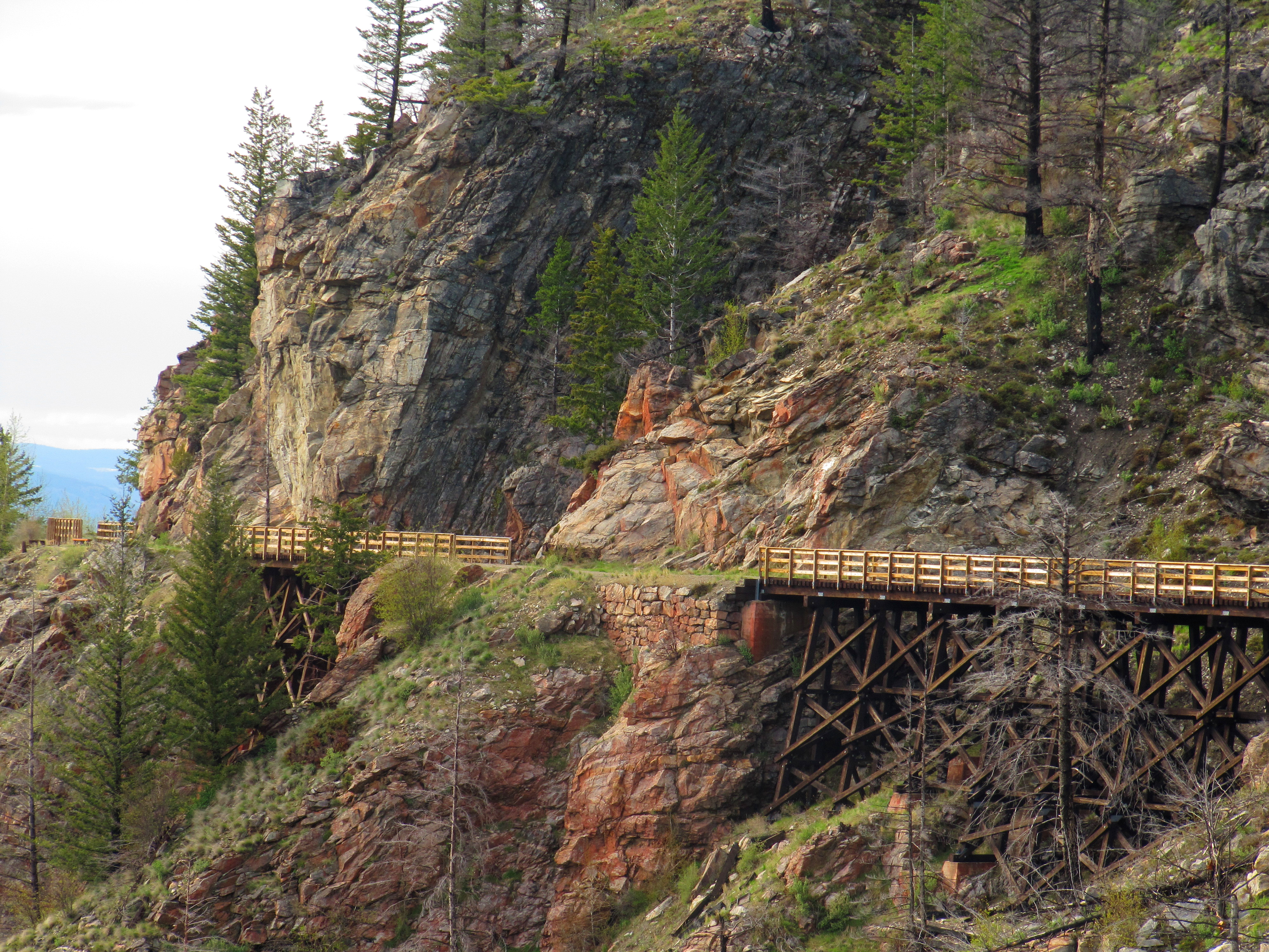
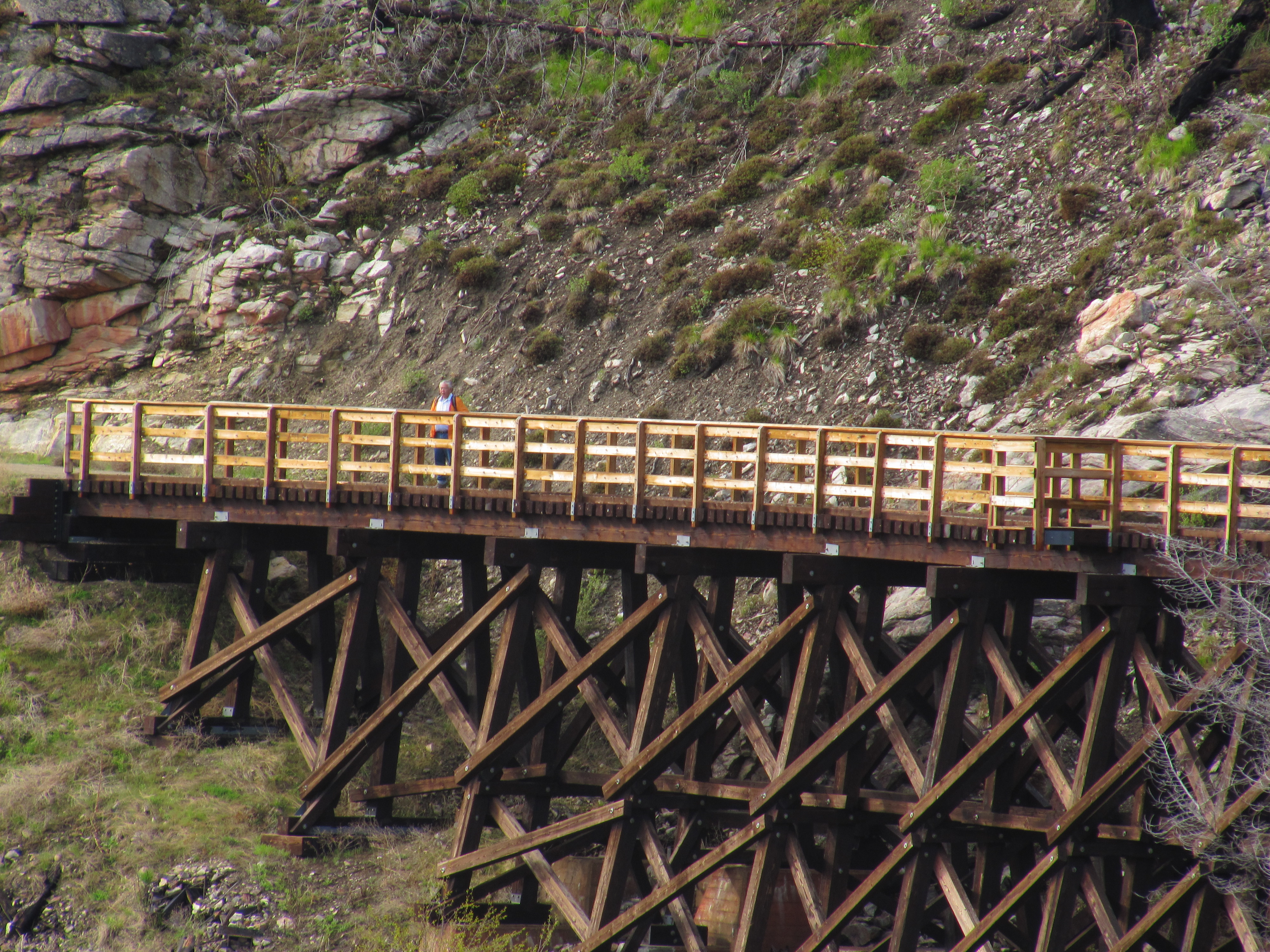
The Myra Canyon section of the Kettle Valley Railway was built between 1912 and 1914. It was part of a “Coast to Kootenay” railway line that linked Midway, in British Columbia’s Boundary District, with the Canadian Pacific Railway main line at Hope. The railway carried freight and passengers through the Myra Canyon until passenger service ended in 1964 and the last scheduled train went through in 1973.
In June 1973 the Kettle Valley Railway section in the Myra Canyon, with its wood-frame trestles, tunnels, rock cuts, and awe-inspiring mountainous terrain, was used by the Canadian Broadcasting Corporation (CBC) as a location for filming a segment of Pierre Berton’s “National Dream” television film on the construction of the CPR through the mountains of British Columbia.
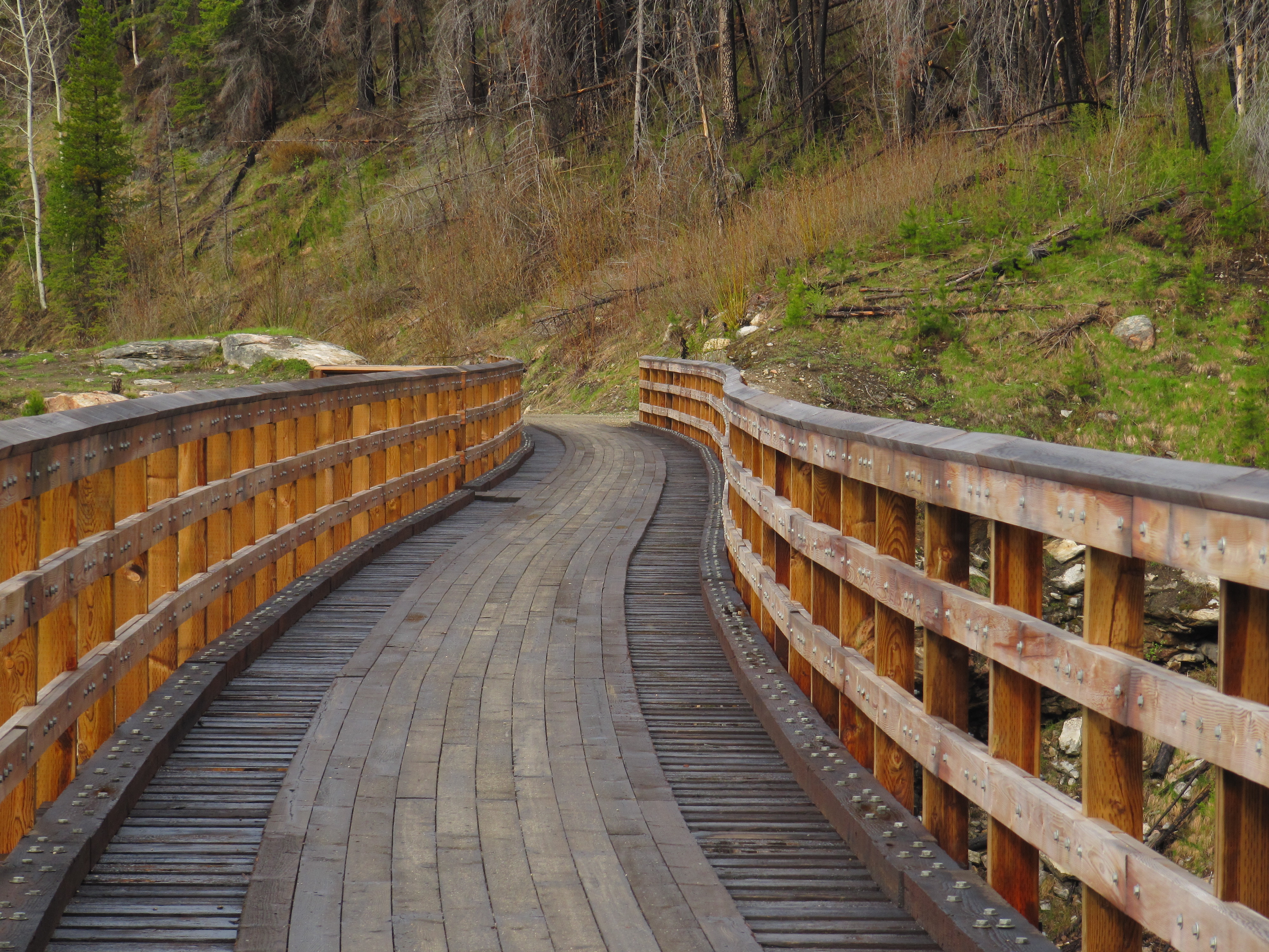
The province purchased the rail corridor from Canadian Pacific Railway in 1990. The Myra Canyon Trestle Restoration Society, established in 1992, has been instrumental in leading the restoration and maintenance of the corridor and trestles. Hundreds of volunteers have worked to cover the open trestle ties and timbers with boardwalks and to install railings to make the route safe and accessible for all ages and abilities. As a result, the trestles became a cornerstone of the Provincial Rails to Trails network, a vital link along the Trans Canada Trail, as well as a significant tourism asset attracting as many as 50,000 visitors a year.
In January 2003, the Myra Canyon section (from Mile 84.5 to Mile 90.5) of the Kettle Valley Railway was designated a National Historic Site.
The Kettle Valley Railway concludes its journey through the Okanagan as it winds its way from the Myra Canyon towards Hydraulic Lake at McCulloch Station. This portion of the trail is quite flat, dropping only about 20 metres in elevation at the halfway point, then regaining it at the lake.
Important: Much of this portion of the KVR runs through Myra-Bellevue Provincial Park, which has rules against motorized use on the trail. However, elsewhere on the KVR you will almost certainly encounter motorized vehicles along the route, particularly ATVs and dirt bikes, which could be travelling at high speeds. Over the years, unregulated motorized use has degraded the trail surface along the Kettle Valley Railway, making many areas quite challenging for hikers and cyclists. Users should come prepared for sandy conditions. Please see our equipment recommendations on the Okanagan main page or even more detail on our “Equipment Tips” page of our Travel Tips.
Staging Areas:
Good parking is available at Myra-Bellevue Provincial Park, particularly at the east end.
GPS INFORMATION:
KML/KMZ files can be opened in Google Earth, and many smartphone apps.
GPX files can be opened by most GPS software apps when KMZ cannot. Note, GPX files do not contain custom colours and icons that we use on our maps; all tracks and icons will appear the same colour and styles. We recommend using KMZ instead of GPX if possible.
The files below include data for only this specific area. For all of our Trans Canada Trail data for the entire province (including features, campsites and alternate routes), download our BC.kmz master file (1.2 MB)
Visit our GPS & Navigation page for instructions of how to use your smartphone as a GPS device (even when outside of data coverage) or how to import data to your Garmin unit.
Good parking is available at Myra-Bellevue Provincial Park, particularly at the east end.
Washrooms:
Outhouses are available at Chute Lake, Myra Canyon (parking lot) and the Recreation Site at Hydraulic Lake.
Route Highlights:
The trail from Chute Lake Resort to McCullough is complete and operational along the Kettle Valley Railway, although the portion of the KVR from Chute Lake to Myra-Bellevue Provincial Park has been converted to roadways.
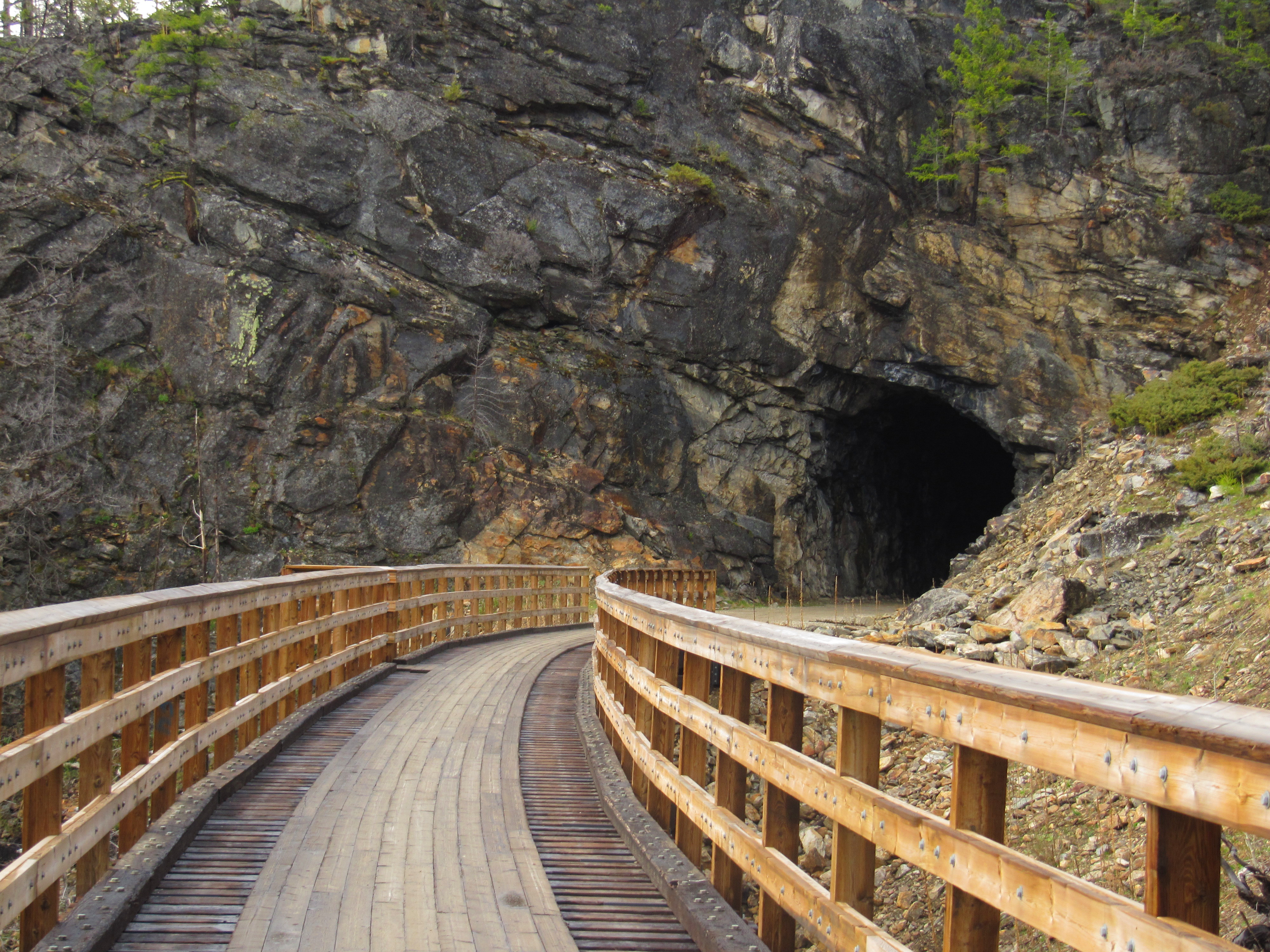
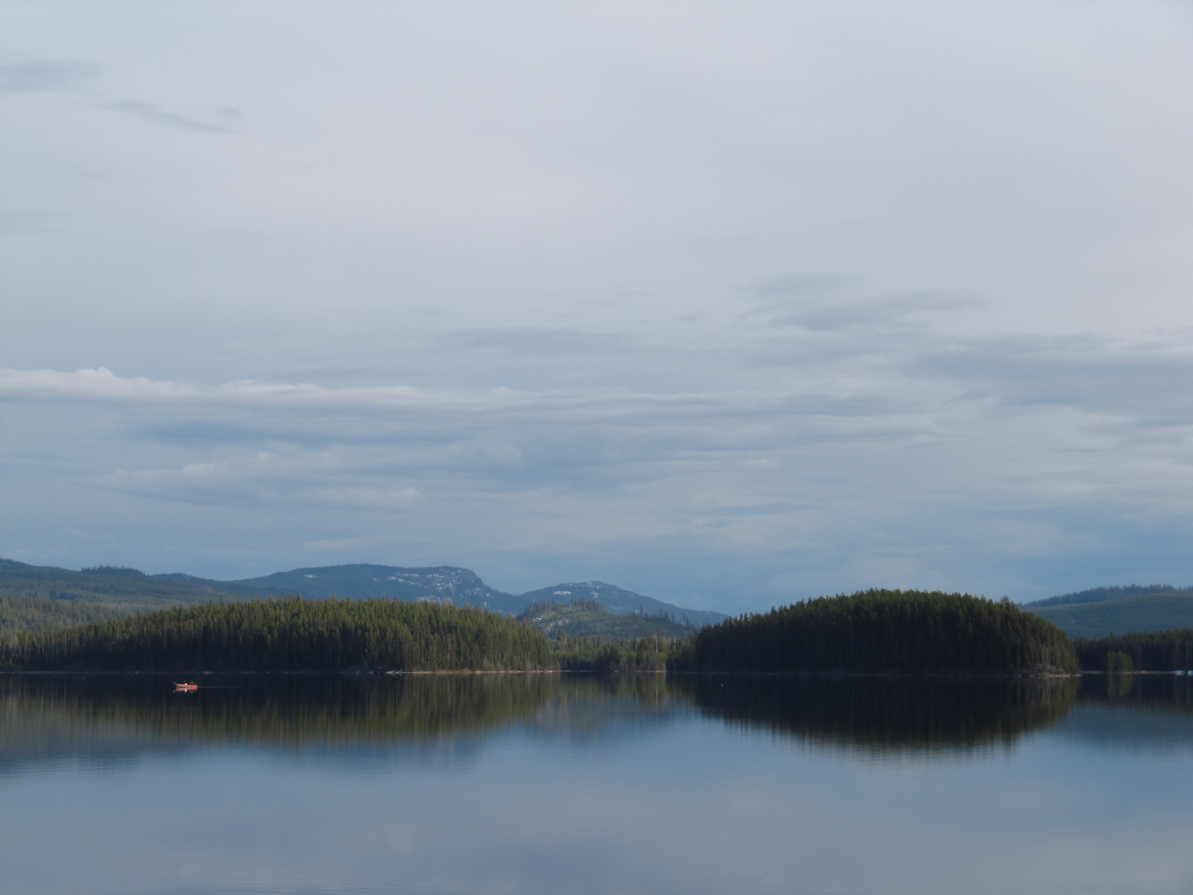
The biggest highlight of the area is of course Myra-Bellevue Provincial Park, with its extensive trestles and tunnels. The park is a National Historic Site.
Although the Kettle Valley Railway reaches its highest point within the Okanagan region during its travels through the Myra Canyon, the section adjacent to the east – the Okanagan Highlands – is nearly as high, peaking at 1265 metres above sea level. In fact, this area can often see snow clinging to the trail on north-facing slopes as late as late May, though it rarely hampers with travel plans. That said, those camping at Hydraulic Lake should be aware that nights can get cold outside the height of summer.
About 1.5 km east of Hydraulic Lake, the trail descends another 20 metres to Summit Lake, before entering the Boundary region – and continuing downhill to the communities of Carmi and Beaverdell.
In order to travel east along the Trans Canada Trail using the Kettle Valley Railway in the Myra Canyon area, trail users will begin at Chute Lake and travel to Hydraulic Lake (also known as McCulloch Station).
The rail corridor from Chute Lake to Myra Canyon is essentially a road for 17 km – note the destruction caused by the forest fire – to the Myra Bellevue Provincial Park gate, where the trail continues and you will be welcomed by the remarkable Bellevue Creek trestle.
The next 20 km will no doubt be a memorable point of your journey through endless trestles and tunnels of the Myra Canyon – all on perfectly graded, finely crushed gravel.
The trail leaves the park en route to Hydraulic Lake. The next 12 km are along a north-facing slope, and ankle-deep snow can remain on the trail sometimes into mid May after occaisonal harsh winters. A provincial recreation site provides camping at the eastern end of the lake (after the resort), but facilities are minimal.