VIDEO

MAP
The portion of trail that runs through Skagit valley is currently not accessible due to the number of erosion events that occurred during the fall 2021 rain events.
text
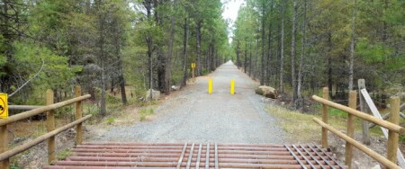
Othello Tunnels, are closed for the 2020 season. please visit BC Parks website for more information.
Updated 7-14-2020 As of June 28th, the KVR Rail Trail is now opoen through Myra Bellevue Provinical Park.
The Rail Trail is temporarily closed between Mrya Station and Ruth Station for trestle repairs. No through traffic.
Effective June 8, 2020. This closure includes the parking lot at Myra Station, no through traffic along trestle routes, and is in place to ensure the safety of all workers. This work is scheduled to continue until June 30, and we ask that you continue to check this webpage for updates prior to visiting the Myra-Bellevue Trestles.
Our workers thank you for your patience and understanding during these ongoing trestle repairs.
According to Recreaton Sites and Trails BC, "Two bridges, (KV-61 & KV-68) located 7 km & 12.5 km north of Tulameen are closed to traffic based on an engineered review of the structures." April 2020
Posted May 30, 2019 -- Last updated July 10, 2022. The closure affects the Vancouver/Burnaby area -- The Trans Canada Trail / The Great Trail has been closed at Montrose Park along the Bridgeway Trail just west of the underside of the Second Narrow’s Bridge. The closure is to ensure public safety due to stability concerns for the existing slope and an aging wooden structure that partially supports the trail. A detour is currently in place, in coordination with the City of Vancouver. The temporary closure is anticipated to be in place until the planned rehabilitation work is completed; the construction work is scheduled to begin in the fall of 2019 and is scheduled for completion by end of 2022, at which point we hope the trail will be reopened.
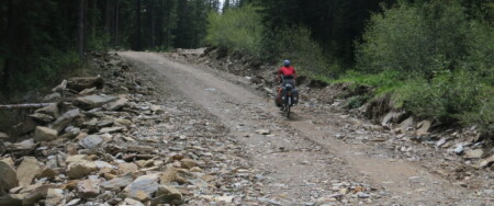
Posted Oct 30, 2020-- No update as of Sept 1 -- Closure affects Abbotsford area -- A major washout along Lower Sumas Mountain Road has completely shut the Trans Canada Trail for 4.2 km. The washout has worsened recently, and the area is completely closed due to safety concerns. The closure could be in effect for months - in fact, it may be in effect for the remainder of 2019! We have posted a detour route on our maps; the closed section is shown in red, and the detour is shown in yellow. The detour is 6 km long. We are monitoring the situation and will post updates when we hear of any. If you have news or updates about this closure, please let us know using the contact form at the bottom of this page.
Posted February 18. 2019 -- Update as of July 20, trails are stil closed and are expected to remain closed until Fall 2019! -- Closure affects Fernie area -- Area is still closed according to Fernie Trail Alliance blog post (scroll to map on page 4, see pink shaded area) on May 17. Notice still in effect: There has been extensive logging on the Elk Valley Trail in Fernie at Ridgemont Ave, heading N/NE towards Sparwood. The trail is unusable and closed. Currently we are recommending that Trail users follow roadways between Fernie and Hosmer. Please see the map on the Fernie/Sparwood route page; the closed section is shown in red, and the bypass route is shown in yellow. For further details, please contact the Fernie Trail Alliance. We will continue to monitor this closure bi-monthly.
Posted November 2, 2018 -- Updated Dec 1, 2019 -- Affects the Castlegar Area -- Teck has REOPENED the Ward's Ferry Trail which runs between Glade and South Slocan (between Castlegar and Nelson). For more information and updates, please visit the Castlegar Parks and Trails Society's page about the trail.
Ongoing notice -- Last updated Sept 1, 2019 -- Notice affects the Nanaimo area -- The Trail is currently OPEN in the Nanaimo area (as of our latest update, but check the Mosaic Forest Management site as well as the Regional District of Nanaimo (RDN) Trail Alerts page for updates). During times of high risk of forest fires, the Regional District of Nanaimo (RDN) closes the Trans Canada Trail (TCT) from the Timberlands Road trailhead by the Haslam Creek Suspension Bridge to the Harewood Mines Road trailhead at the Region's boundary with the City of Nanaimo. This 21 km section of the TCT is situated for the most part on private forest lands. Landowner (Island Timberlands) normally closes all company property in the mid-Island to recreational users due to fire hazard during the dry summer months (roughly July to early September). During a closure, users are advised to detour off the Trans Canada Trail from the Cowichan Valley Regional District boundary in the south all the way to the Nanaimo city limits to the north.
Ongoing Notice -- Last Updated Sept 1, 2019, no fires known to affect the Trail, but this can change daily -- Notice affects all of BC -- The 2019 wildfire season is upon us, but luckily so far it's been relatively mild; however, fires are burning out there in the backcountry. It's important for all Trans Canada Trail/The Great Trail users to check the BC Wildfire Service's map before heading into the backcountry. Check the map often if you are travelling across BC on the Trail. Here is a link to the interactive map. We will try to post closures as they happen, but we can't stress enough that Trail users are responsible for their own safety and should check the government's site often - and "when in doubt, stay out!".
Ongoing since 2011 -- Notice affecting the Greenwood Area -- Latest update February 9, 2019 -- Latest Status: GATE IS OPEN! Due to new ownership of the property, the gate making it difficult for some cyclists/horses on the Columbia & Western (2 km north of Greenwood) is now changed! Please stay ON THE TRAIL and between the fence lines, and enjoy your adventures! For the latest conditions on the ground, contact the "Trails to the Boundary Society" trail coordinator at 250-444-7547 or email trailstotheboundary@gmail.com. Trail users are encouraged to call 1-844-676-8477 (Ministry of Forests) if you want to report an infraction on any section of the trail.
Ongoing Notice -- Affects the Hope / Coquihalla Area -- Current Status (as of Dec 1 2019): The Othello Tunnels (at Coquihalla Canyon provincial park just east of Hope) are closed for the winter. The Tunnels are normally closed for the winter from November to late May. During this time, you may be able to use the alternate trail on our maps which bypass the tunnels. The tunnels normally reopen by May long weekend (current expected date May 15, 2020) but are often delayed due to rock slides that occur over the winter that block the trail and tunnel entrances. For the latest conditions, please visit http://www.env.gov.bc.ca/bcparks/explore/parkpgs/coquihalla_cyn/.
Ongoing, originally posted in 2013 -- Notice affecting the Salmo Area -- Annual closure in effect April 15 to June 15 (approx) -- Due to grizzly bear foraging each spring, the Salmo Great Northern rail trail is normally closed annually for 10 kilometres between Cottonwood Lake and Hall Siding (northern section, about 8 km south of Nelson) from mid April to mid June. The trail operator, the Regional District of Central Kootenay (RDCK), is responsible for this closure. Users are asked to use the highway as a bypass route when the closure is in effect. Read more on the Regional District's trail page. Note, the RDCK rarely (if ever) updates this webpage . Signs are posted along the trail when the closure is in effect, but the only other way to know if the closure is in effect is by contacting the RDCK directly; call their main switchboard at (250) 352-6665.
Updated June 14, 2020 Today we received an update about Gray Creek Pass, Tom Lymbery, owner of the Gray Creek Store shared; " there is a serious washout between the two crossings of Redding Creek where a large portion of road is missing when a large culvert plugged. Cranbrook Forestry plans a temporary wooden bridge which may not be possible for a couple of weeks at least."
Ongoing, updated Dec 1, 2019 -- Affecting the Gray Creek Pass Area -- Gray Creek Pass is now CLOSED for the winter (according to the Ministry of Forests). It is ideal to check in with the Gray Creek Store if you are planning to enter the area at all times of the year. We highly recommend visiting the Gray Creek Store blog or dropping in to the store. Also, check out the Road Works page for the Ministry of Forestry, Lands, and Natural Resource Operations. During the winter, be sure to check out the Ministry of Environment's reported snow depths near the summit (Click the link "Current Snow Survey and Water Supply Bulletin" and see Stations "2D05 Gray Creek Lower" and "2D10 Gray Creek Upper" - usually found around Page 10).