Cranbrook to Fort Steele
This route joins the Isadore Canyon trail to Fort Steele – a journey of 11 km – using tracks, trails and roadways.

This route joins the Isadore Canyon trail to Fort Steele – a journey of 11 km – using tracks, trails and roadways.

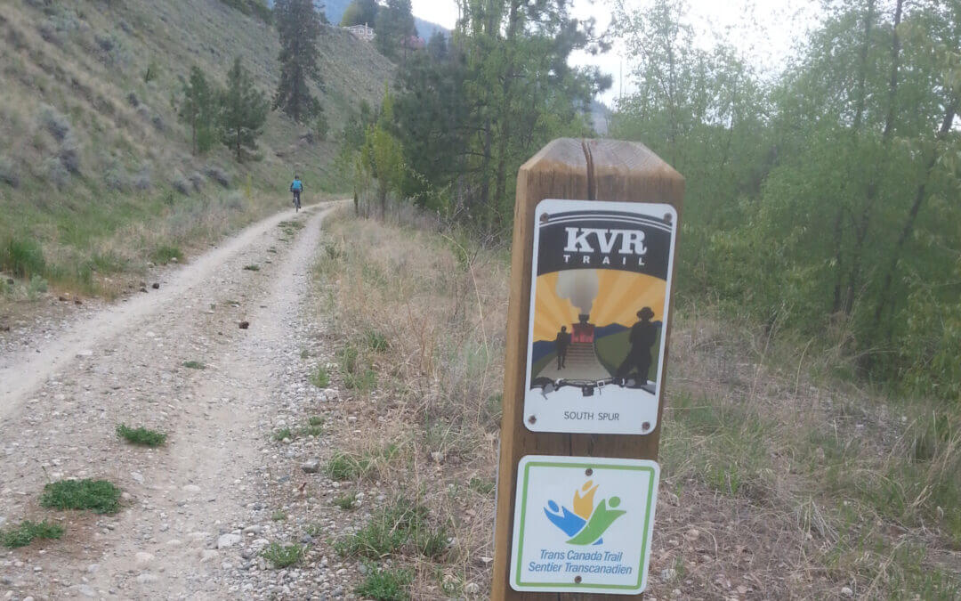
The Galloping Goose is named after the gasoline-powered freight railway cars that once chugged along this corridor, built during World War I to serve the communities west of Victoria.
This picturesque trail moves through urban, rural and wilderness scenery on its 55 kilometre journey from Victoria to the ghost town of Leechtown (north of Sooke) – you can even travel an additional 4 km past Leechtown to the termination point (a large fence blocking the trail) for a total of 59 km. While in operation, the railway continued north towards Shawnigan Lake and over the Kinsol Trestle in the Cowichan Valley. The entire trail was once designated as part of the Trans Canada Trail. However, the portion along Sooke Lake (north of Leechtown) has been closed to the public, as this is now the regional water supply – and the lake has been dammed and portion of the railway have been flooded. Although the portion of the trail between Victoria and Langford is still part of the Trans Canada Trail, the portion that continues from Langford to the terminus at Leechtown at Sooke Lake is no longer part of the “main route” as it cannot continue towards the Cowichan Valley.
The entire trail is surfaced with high quality, finely graded gravel. You can cycle, stroll, run, or even ride a horse through the rural sections. At the switch bridge in Victoria, “The Goose” intersects with the Lochside Regional Trail, a 29 kilometre former railway line from Saanich to Sidney.
While it is possible to cycle from Victoria to Leechtown and back in one long day, at about 118 km, it’s a challenge. Some options are finding accommodations in the Sooke area, camping at the Sooke Potholes (adjacent to the Goose before Leechtown) or riding out to Highway 14 and picking up a BC Transit bus (you can mount your bicycle on a rack on the front of all BC Transit buses). More information about these options is included below (under Accommodations and Transportation)
A 56 to 60 km one-way journey between Penticton and Osoyoos; definitely a challenging one-day round trip given the rough trail surface in some areas We recommend staying the night in Osoyoos. The portion from Penticton to Okanagan Falls and back is a lovely day trip (44 km return), and the section from Oliver to Osoyoos and back is also a great day trip (60 km return).

This Loop takes us over the Port Mann Bridge, the Alex Fraser Bridge, and Queensborough Bridge. The route follows as many greenways, regional parks and local parks as possible. The spectacular views from the bridge decks are among the main features of these rides. Two of these magnificent bridges are cable-stayed.
It takes place in Saperton, Coquitlam, Surrey, Delta, Queensborough, and New Westminster on both sides of the Fraser River. The main greenways are: United Boulevard approach to the Port Mann Bridge, Serpentine Headwaters Park, Tynehead Regional Park, Green Timbers, Surrey Greenway, Surrey Lake Park, Bear Creek, New Westminster Quay, Brunette-Fraser Regional Park and several other small parks. It offers a diversion of 16 km off the well known Surrey Green Timbers greenway trail in an attempt to connect less seen parks via urban streets.
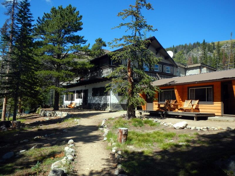
The extraordinary Cathedral Provincial Park owes its name to sensational mountain peaks that reach over 2600m/8,500 ft around a bowl in the Cascade Mountains just north of the U.S.A. border.
The majority of people visit the park by either camping or booking a room at the Cathedral Lakes Provincial Lodge. In either case, the best way to access the area is by booking a shuttle with the lodge.
Suggested time: 2 half days and 2 full days (3 nights) allowing to arrive on the 10:00 a.m. shuttle and leaving on the 3:00 p.m. shuttle.
The general location of the park is 22 km out of Keremeos on the south side of the Similkameen River. Here it is as described in Wikipedia:
Cathedral Provincial Park and Protected Area, usually known as Cathedral Provincial Park and also as Cathedral Park, is a provincial park in British Columbia, Canada. It is located east of E.C. Manning Provincial Park, south of BC Highway 3, and southeast of the town of Princeton and southwest of Keremeos. Its southern boundary is the border with the United States. Much of the park is the basin of the Ashnola River.
Suggested Hiking Itinerary
Diamond Loop (including Scout Lake) – half day (following the 10:00 a.m. shuttle – 8.8 km counter clockwise
Rim Trail Loop via Diamond Trail Loop junction, to Red Mt, Quiniscoe Mt, Pyramid Mt., Devils Wood Pile, Smokey the Bear/Giant Cleft, Lady Slipper Lake and back to Lodge- Full day about 7.5 to 8.5 hrs (counter clockwise) – 16 km
Goat Lake via Box Car Mt. and Lakeview Mtn. Loop – Full Day – approx. 14 km (optional – if staying for 2 nights only you may wish to forego this hike.
Lake of the Woods, Pyramid Lake, Glacier Lake and Quiniscoe Lake (including falls) Loops – half day, 8-km – clockwise – take the 3:00 p.m. shuttle out
The complete Centennial Trail through the Park is much longer as is the trail taking in Haystack Mt. These are multi-day back packing hikes.
Recent Comments