This 12.3 loop is one of the few “100% Trans Canada Trail” routes in existence! The loop takes in shaded forest trails along Mark Creek, and returns to downtown Kimberley on the Northstar Rail Trail. Suitable for hiking and cycling.
The Lions Way trail, which follows Mark Creek, runs downhill from north to south; travelling south is much easier. The Northstar, being a rail trail, is quite flat and easy to ride in either direction. Therefore, we suggest using this route in a counter-clockwise fashion. Cyclists should be aware of some blind corners and keep speed reasonable along Lions Way as this is a popular dog-walking route.
- Walking time roughly 2.5 – 3 hours. Dog-friendly.
- Jogging (~1 hour) is highly recommended as there are few street crossings. Some tripping hazards possible along the wooded segment.
- Cycling time roughly 45 minutes.
- Horses are not permitted.
- Skateboarding and rollerblading are not recommended on the Lions Way portion.
- No staircases or accessibility issues, though the trail surface may be challenging for wheelchairs. There are some steep declines along Mark Creek to consider.
This 2-day bicycle loop route travels from Nelson to the historic town of Kaslo, then to New Denver on a 114 km journey. The route uses an optional trail east of New Denver – featuring a cable car crossing. After spending the night in New Denver, return south to Nelson on the Slocan Valley Rail Trail – a 107 km journey.

Travelling north from Elkford, the Trans Canada Trail is now designated, travelling west to the Wapiti ski hill, then north to Round Prairie. From the northern limit of town (at “Crossing Creek” or “Round Prairie” depending on who you ask) the route is designated and ready to take you north to Alberta; it simply follows the Elk Valley Highway.
The road continues to Elk Lakes Provincial Park, and once in the park, travellers can follow the powerline trail as it continues north through the park, reaching the Alberta border and continental divide. From here, the trail is being developed by our Albertan friends and will continue to Banff through “Kananaskis country” in Peter Lougheed Provincial Park.
Many of the road connections used in this area are Forest Service Roads, maintained by the Ministry of Forests, Lands, and Natural Resource Operations. Visit their Roads and Bridge Works page if unsure about the current status of a road along your route.

The mountain views get bolder as TCT travelers move form the eastern edge of the Purcell mountain range at Kimberley, down through the Rocky Mountain Trench beyond Cranbrook, and up toward the western fringes of the Rockies at the community of Wardner.
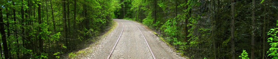
Kimberley is BC’s highest city at 1113 meters and is known as the Baverian City of the Rockies. Close to the downtown center of KImberley at the Platz, the TCT emerges onto the new NorthStar Rails to Trails.
The route from the southern end of the NorthStar to Rotary Way in Cranbrook is in development, but Rotary Way itself is fully designated as Trans Canada Trail and includes a pavilion.
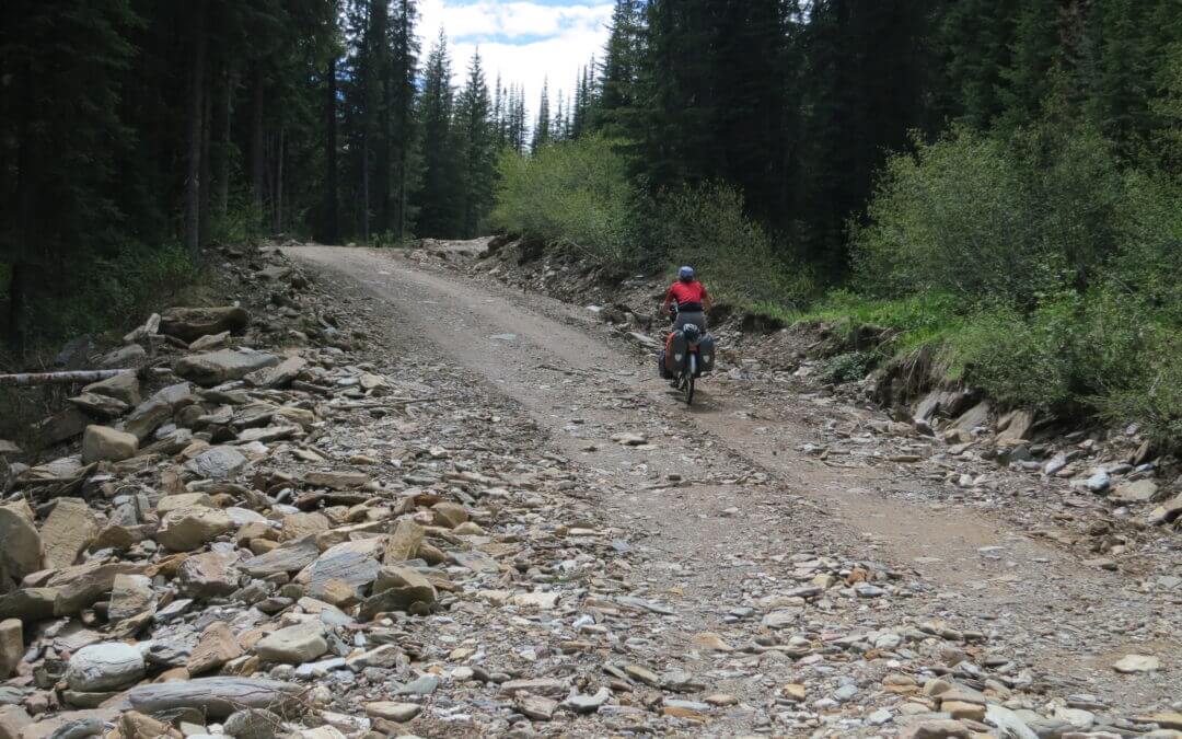
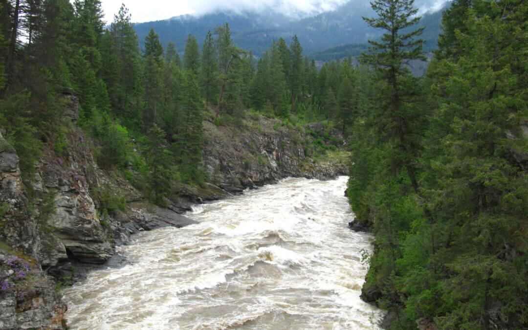
Travelling the Trans Canada Trail from Gray Creek to Kimberley is an extremely arduous journey in the wilderness for 80 km on a forestry road, plus an extra 10 km through Kimberley Nature Park with minimal amenities, no supplies and limited-to-no cell service until approaching Kimberley. Cyclists should carry spare brakes, chain links, tubes, tires and a comprehensive set of bike tools. If you are up to the challenge, you certainly will be glad you tried it!
The route follows active forestry roads and cyclists are asked to USE CAUTION along the way; the road’s poor visibility and heavily laden logging truck traffic can make this route a potentially hazardous journey if users do not remain vigilant and aware of their surroundings. Give all traffic – particularly logging trucks – extra room to pass.
Note: The Gray Creek Pass road is normally closed to vehicles through the winter, opening as late as early-mid July. Late snow and the occasional washout can delay the annual opening. Hikers and cyclists can often pass through these obstacles but do so at their own risk. Visit the Gray Creek Store’s website for the latest road conditions!
Here are some historical dates for the seasonal openings/closings:
| OPENING DATE (approx) |
CLOSING DATE (approx) |
|
|
| June 13, 2019 |
|
| June 25, 2018 |
October 12, 2018 (reopened a week later, then closed again Oct 28) |
| June 23, 2017 |
October 18, 2017 |
| June 21, 2016 |
November 11, 2016 |
| June 10, 2015 |
October 31, 2015 |
| June 26, 2014 |
October 31, 2014 (3″ snow) |
| July 4, 2013 |
October 3, 2013 (6″ snow) |
| 2012: Closed most of the year due to washouts, etc |
|
The history of the route over Gray Creek Pass goes back to the 1950s, when Cominco (now Teck Metals) built a power line over the Pass. Cominco employees who had relocated from Kimberley to Riondel were keen to have a shorter route back to the East Kootenay, and at the time two roads were considered – one over Gray Creek Pass, and one over Rose Pass to the north. It wasn’t until the late ’80s when the push for the backcountry route finally gathered momentum. Rose Pass would have required a three-mile tunnel so that idea was abandoned. Gray Creek Pass was finally completed in the 1990s, and officially opened in July 1990. Since, the powerline has been abandoned – but the road remains a popular route for visitors to the area, particularly amongst RV enthusiasts. Curiously, publicity about the route draws many German tourists to the Pass each year.
The route described begins at the Gray Creek Store (not to be confused with the General Store further south). Its eastern endpoint is the “Platzl” pedestrian mall in Kimberley.
For hikers Trails BC has proposed a hiking alternative as shown on our map page for the part of the route from Gray Creek to over the pass and connecting to the main Forestry Road. To read about a hiker who has done this section refer to this posted article.

Recent Comments