This cycle loop best done clockwise offers a lot of variety: urban greenways, extensive dike trail along the Fraser River, quiet urban streets and rural roads. The route goes through urban parks, and Island 22 Regional Park. The main areas are Sardis, Chilliwack Centre, Fairfield Island, Promontory, and Vedder Crossing. The chief watercourses are the Vedder River, Hope River, and the Fraser River. Expect to go past quite a bit of farmland.
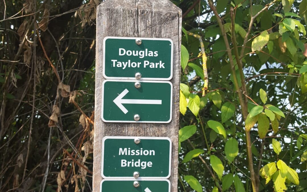
This 60 km route Follows dikes on both sides of the Fraser River taking in Hatzic Lake from Neilson Regional Park, Westminster Abbey Lookout, the Fraser River Heritage Park, the Mission Bridge to the Matsqui Trail on the south side. We follow the Matsqui Trail, part of the Trans Canada Trail, to Douglas Taylor Regional Park in the Mt. Lehman area. From there we make our way past farmlands to Glen Valley Regional Park. Expect great bottom valley views of surrounding mountain peaks.
The featured First Nations along this route is the Sumas Band of the greater Sto:lo First Nation on the south side of Sumas Mountain and the Matsqui Band of the Sto:lo Nation Council. We end in the Kwantlen FN of the greater Sto:lo First Nation territory as we approach Fort Langley.
• LEVEL OF DIFFICULTY
This is great for those looking for a challenge. Changes in elevation can be as much as 192m/630′. Cyclists should have experience cycling at least 40 km with some ease to attempt this trip.
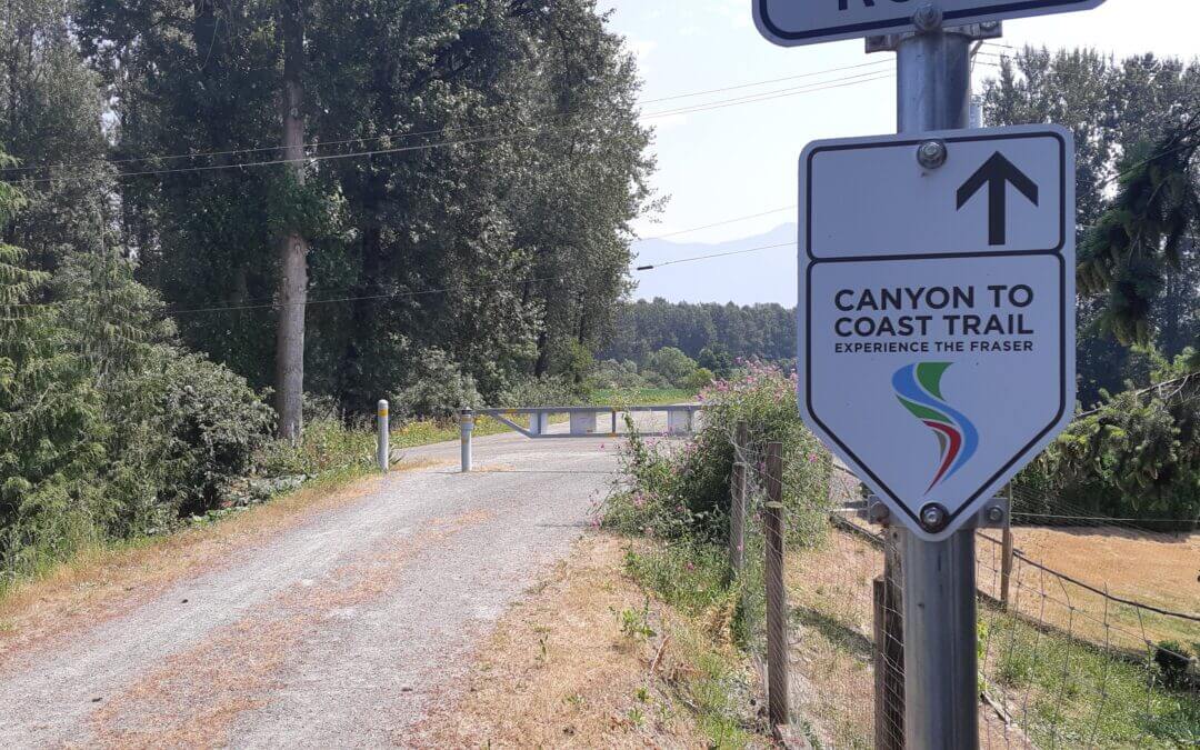
This 47 to 50 km cycle route features the famous Othello Canyon KVR rail trail with its tunnels, bridges, rapids, the Coquihalla River, Sucker Creek Fish Channels, Hope Center, the Fraser River, and Seabird Island with its picturesque Maria Slough. After Hope, much of it is on Highway 7, which has quite a good cycling shoulder and is the main cycling route between Agassiz and Hope on the Trans Canada Trail. It also features the former Kettle Vally Railway crossing of the Fraser in Hope (for viewing only at this time).
The featured First Nations along this route are Yale Band in Hope, the Skawahlook FN of the Sto:lo Council at Ruby Creek, and the Cheam FN (Wild Strawberry Place) of the greater Sto:lo Nation.
The trip offers exceptional views of mountain peaks such as Cheam, Foley, Four Brothers, Sowerby, Ludwig, etc on the opposite shore of the Fraser River. While always close to the shores and view of the Fraser River, access is not possible because of the active railway between the Highway and the river.
• LEVEL OF DIFFICULTY
This ride is either downhill or mostly flat (with the brief exception of getting on the highway bridge near Hope). It is a relatively easy ride for anyone used to cycling flat distances for several hours and have experienced cycling over 40 km at an average speed of about 12 to 20 km/hour with short stops along the way.


Recent Comments