The Trans Canada Trail takes in the northern fringes of these two very large urban centers and manages to follow pathways most of the time but in some sections, it finds itself on bikeways that are controlled quiet streets with sidewalks.
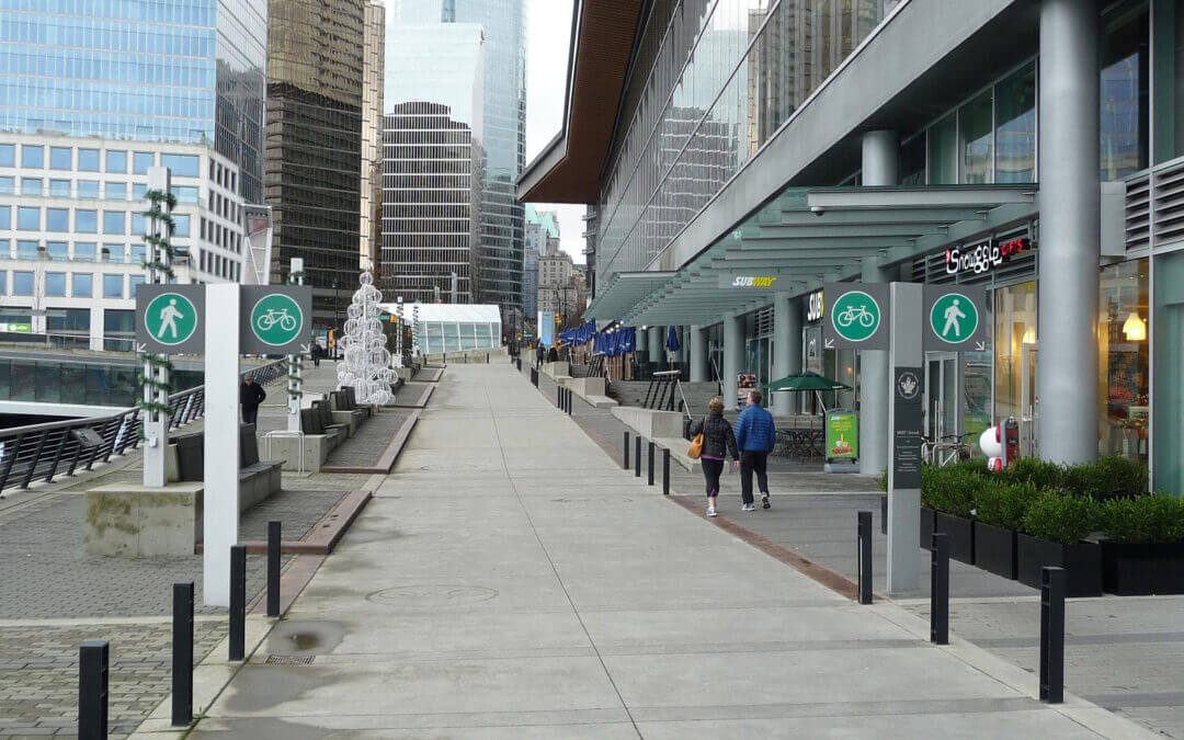
In the City of Vancouver, the trail up to the Second Narrows Memorial Bridge is paved. From here there are both paved and gravel paths through Burnaby. Through Vancouver, the pathway is mostly flat up to Clark Drive on the border of the Italian Quarter. From this point heading east, there are a number of moderate short hills up to Burnaby Mountain. Burnaby Mountain offers spectacular views and ecology, the reward for a very stiff climb of about 2 km and an equally steep 4 km downhill back to sea level. Our map shows an alternate route that is much easier with a few short steep climbs along Burrard Inlet that takes in Barnet Marine Park for those not up to heavy climbing and downhill.
On the North Shore there is a separate hiking and a cycling route from Horseshoe Bay to the exit of Capilano Regional Park on Capilano Road in North Vancouver.
HIKERS
Those hiking the upper main route should realize that there are no amenities along the Trail for about 26 km from Gleneagles Golf Course/Community Centre in Horseshoe Bay to the Capilano Regional Park. Anyone undertaking this trek must be in good physical condition and must carry water and food along with other hiking provisions. Be prepared for changes in weather and possible encounters with bears at all times.
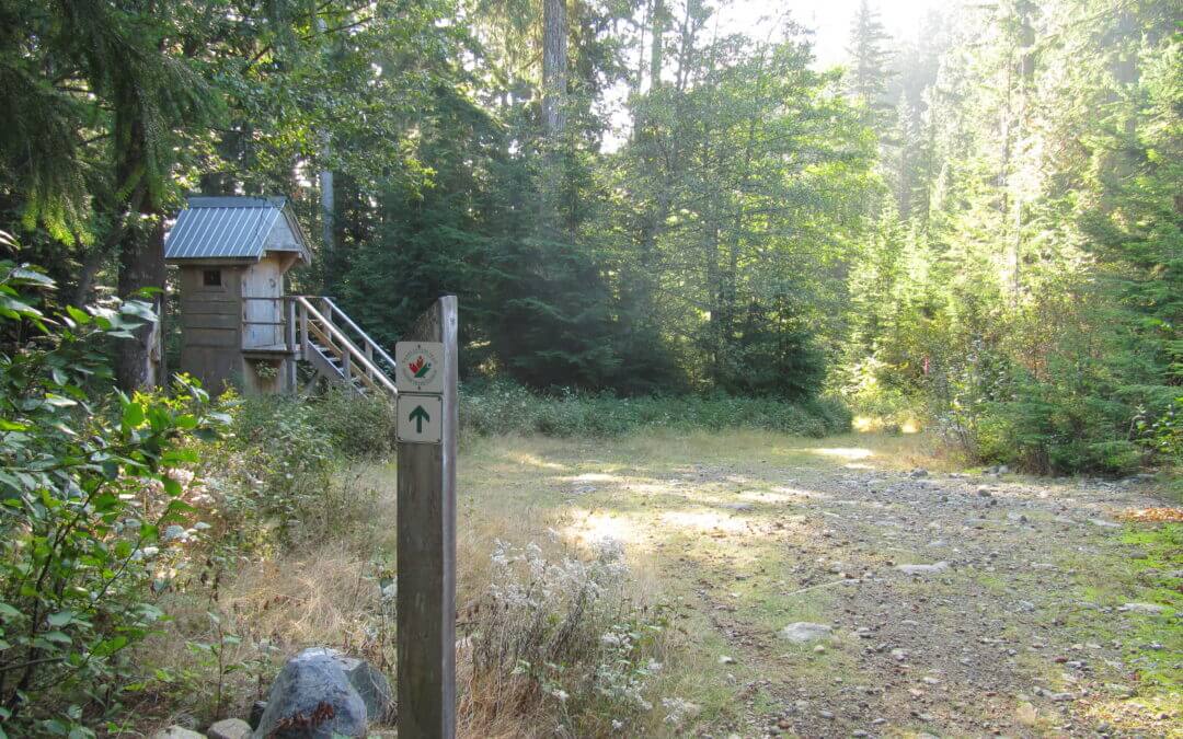
From Horseshoe Bay/Nelson Creek to Eagle Lake access road, the route heads to the Skyline Trail via the Cypress Creek Trail within easy access to the the ski areas on Cypress and Hollyburn Mountains in Cypress Provincial Park. Note that at the top of the Cypress Creek Trail, it is a short hike to the Cypress Mountain Ski facilities that can also be used as a staging area and where many other trails can be explored such as the Baden Powell Trail and the start of the Howe Sound Crest Trail.
From here, it can get quite overgrown in places. The Skyline Trail features vestiges of early century logging, picturesque ravines, waterfalls, and west coast forest. Access trails to Cypress Bowl, Hollyburn Mountain and several other heritage trails can be used as alternates or side trips. For a short side trip, cross the Cleveland dam to get good views of the Capilano Canyon, outflows from the dam, and access to water and restrooms.
CYCLISTS
The cycling route from the Horseshoe Bay Ferry Terminal to the Cleveland Dam mainly follows existing pleasant cycling routes through West Vancouver using quiet residential streets before heading over to the Cleveland Dam. It is recommended to use the Dundarave alternative routing (see map) to get closer to Burrard Inlet shores and parks.
CYCLISTS AND HIKERS
The cyclists and the walkers will be on the same trail as they leave Capilano Regional Park for North Vancouver.
In Capilano Regional Park the trail generally follows the Capilano River Canyon in a typical coastal forest. Then the trail is on sidewalks and passes near the Capilano Suspension Bridge, a major tourist attraction.
Edgemont Village offers a charming village atmosphere. The Mosquito Creek Trail is a natural trail with adjacent spawning channels enhancing the fisheries potential of the creek. The Mission Reserve off Forbes Road includes St. Paul’s Church, a heritage site. The Elders Garden next to the church is also a unique attraction. There are informative interpretive signs in Waterfront Park, providing insights into the Harbour activities and its history.
The trail arrives at the Sea Bus terminal to link with downtown Vancouver.

While the Trans Canada Trail in the Lower Mainland is essentially in place, planners across the Southwest Region are still collaborating in a variety of ways to ensure the Trail’s continuity or integrity. As time goes on, the Lower Mainland communities increasingly find ways to add interest to the Trans Canada Trail by adding or enhancing features and to enrich the discovery process such as the integration of the Trans Canada Trail into the Experience the Fraser Project.
The Southwest Region has much to offer to the Trans Canada Trail enthusiast in its more than 600-kilometre section including alternates for cycling and equestrians. Some of the features of the Trail in the Lower Mainland include:
- the Seaview Walk out of Horseshoe Bay, a forest mountain trail on the North Shore Mountains to the Cleveland Dam, the Capilano Regional Park, and Mosquito Creek to the SeaBus on the North Shore;
- Coal Harbour, Lost Lagoon, English Bay, South False Creek, Chinatown, and New Brighton Park in the City of Vancouver;
- the parks along the Burnaby Burrard Inlet Escarpment and Burnaby Mountain Park in Burnaby;
- Moody Inlet, Rocky Point Shoreline Park, Lafarge Lake, Coquitlam River Park, the PoCo Trail, and the Pitt River in the TriCities;
- The Pitt River, Alouette River and Fraser River Greenways, in Pitt Meadows;
- the Fort-to-Fort Trail in Langley
From Horseshoe Bay, we have added a Trans Canada Trail water route that travels on the Howe Sound to Squamish, as well as west to Gibsons. The Sea-to-Sky Corridor presently stretches from Squamish to Whistler and soon to Pemberton. Pristine lakes, canyons, and waterfalls are a few of the features experienced on this more adventurous trip.
The Trans Canada Trail in the Southwest Region offers a myriad of connections to another important city, regional and provincial parks, and a number of trail loops and alternative routes, many of which are described on our website.
The experiences offered along the Southwest Region are remarkably rich and varied. Natural seashores, salmon-bearing streams and hatcheries, working forests and rivers, first and second-growth forests, rain and alpine forests, marshland and polders, farmland, meadows, bird sanctuaries, cultural and heritage opportunities, spectacular vistas, mountains, valleys, waterways, and major water crossings are some of the unforgettable experiences to savour.
While the whole trail can be cycled over a variety of terrain some of it is better experienced on foot; in fact, Horseshoe Bay to Fort Langley is best travelled on foot.

Recent Comments