Okanagan Lake is a fantastic place to paddle, with calm, warm waters and view of desert-like valleys and pine-covered mountaintops. The lake can be paddled virtually its whole length, with many campsites and launches in the southern portion between Penticton and Kelowna.
This route is a concept and the information provided has not been provided by a local paddler. We welcome and appreciate any advice or verification you can provide – please help us improve and enhance this trail information!
We have developed a concept map displaying possible campsites, launch sites and rest stops.

The Trans Canada Trail splits in the city of Castlegar; while the main route travels east from the Brilliant Suspension Bridge towards Nelson along the Kootenay River, the traditional route runs south towards the city of Trail. This latter portion of the Trans Canada Trail could be described as a spur – it does not continue further than Trail in this direction.
From the Brilliant Suspension Bridge the route follows existing trails along the riverbank through Selkirk College and under the Kinnaird Bridge. Roadways through Ootischenia are necessary in order to connect with the Columbia River Trail which begins near the old settlement of Blagodatnoye. Keep in mind that the Columbia River Trail passes through some private property – stay on the trail and leave no trace!
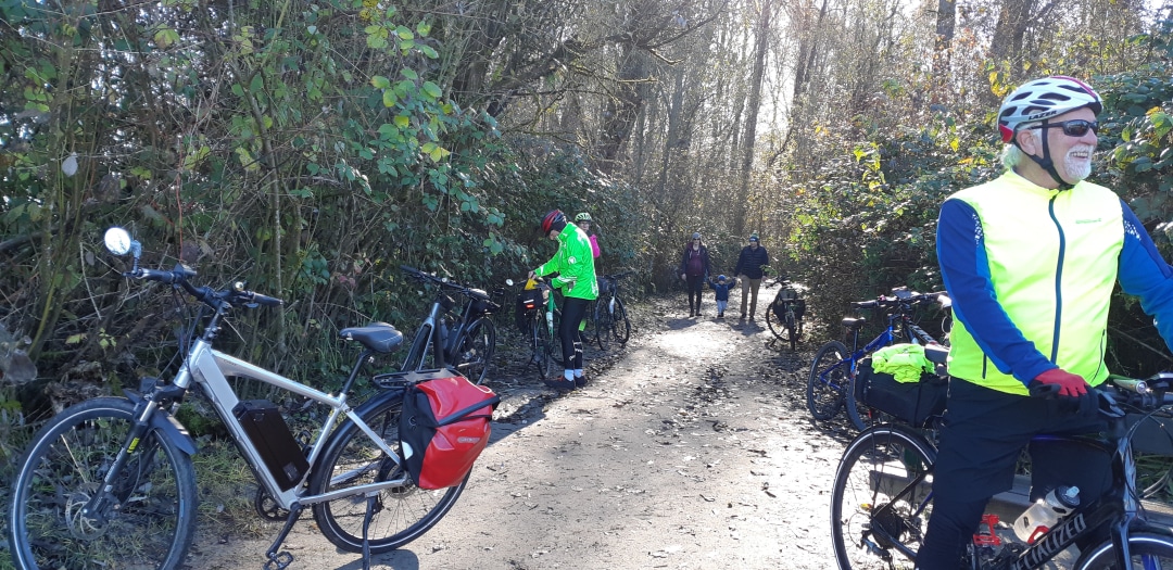
The Columbia River Trail – and even some sections from Castlegar to Ootischenia – is moderately challenging for touring cyclists lugging trailers or carrying panniers. Consider an alternate route using roadways. That said, there are no major obstacles – but several narrow sections and steep climbs/descents.
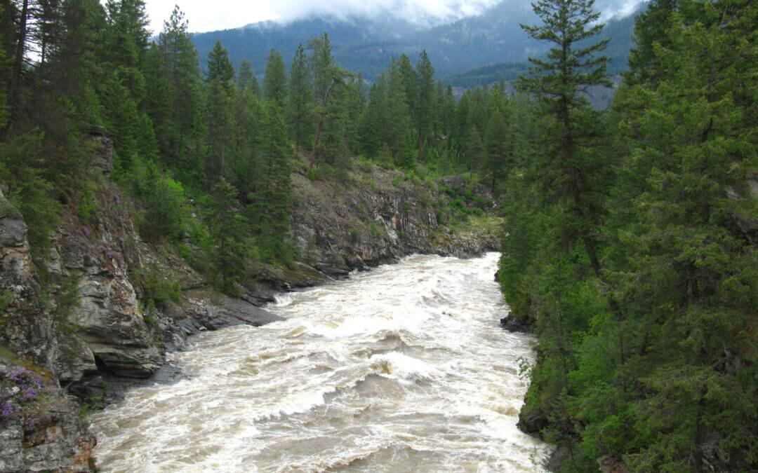
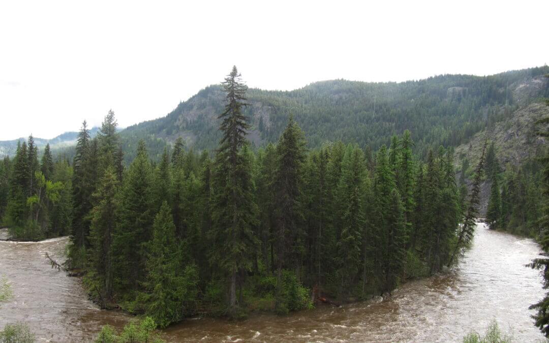
Spring flooding can be an issue along this entire route in early summer.
Closer to the city of Trail, the route run through Sunningdale and East Trail. A Trans Canada Trail pavilion is located in Gyro Park.
The Columbia & Western trail follows the Kettle River between Grand Forks to Christina Lake before climbing the shoulder of Castle Mountain and taking in the views of Christina Lake at the old railway station of Fife and continuing north uphill to Farron Station, nestled in the Monashee Mountains.
The Kettle Valley Railway continues from Beaverdell to Midway along a combination of paved roads, gravel roads, gravel trail and dirt tracks – plus multiple cattle guards and gates – that will keep you on your toes! Like the KVR between McCulloch and Beaverdell, the use of motorized vehicles along the trail – and conversion of trail into actual road – in this area means that some sections of the trail have become challenging – with some serious washboard conditions. The ride can be tiring, but the quiet pastureland provides beautiful views and possible close encounters with farm animals.
Be sure not to miss one of the highlights on the KVR; in the small community of Rhone is Cyclist’s Rest (and WWII epitaph). Local – and lifelong – resident Paul Letard has built a replica caboose which for years served as “the cyclist rest stop”. Now Paul lives in Midway and the new owners are keeping the cyclists rest stop open, but without the amenities. Please do not disturb them and it is only day-use. Water is no longer available here, the Big Dipper Campground a couple kms towards Beaverdell, has potable water available.
Rounding a bend in the river, the trail arrives to the warm grasslands of Midway. The museum is a popular place to explore. Midway is often the stopping point for many travelers since the KVR technically ends here – but beyond lies another rail trail – the Columbia & Western. The Columbia and Western Rail Trail extends from Castlegar to Midway for about 164kms and Midway was its terminus.
The trail is operational from Squamish to Whistler – and a portion is completed from Whistler Village up to Wedgemont Village north of Green Lake and another portion entering Pemberton between Nairn Falls and One Mile Lake. The trail is in great condition for walking and cycling. As a touring route, it doesn’t get any finer. Wayfinding signage is easy to find – familiarize yourself with the logo and watch for it as you ride!
While, at this time there is road and highway riding for some stretches between Squamish and Brandywine Falls, the features of the trail such as the Cheakamus Canyon, Brandywine Falls, a number of lakes, coastal forest and the shear fun navigating the substantial sections of winding trail makes the whole experience worthwhile.
The trail can be navigated at this time from Wedgemont Village at the north end of Green Lake to the trailhead in Squamish for a distance of 78 km, the most popular section being from Whistler Village to Brandywine Falls for a distance of 22 km one-way. Navigating the trail from Whistler to Squamish entails quite a bit more downhill than going north. The Squamish trailhead is at sea level and the highest point on the trail north of Whistler Village is 730 metres/2400 ft (680 metres/2200 ft at Whistler Village)

Recent Comments