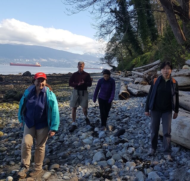
This walking loop takes in Pacific Spirit Regional Park including Wreck Beach with its towering cliffs. It also takes in a few campus features such as the new Reconciliation regarding Resicential Schools Haida Totem Pole and other Totems. The whole loop is an amazing natural setting that takes advantage of the majestic coastal forest and seashore of the UBC Endownment Lands. Along the seashore there a couple of WWII bunkers to distract. Be prepared for lenghty stairways up and down the cliffs. Expect nudists between trail 3 and 6 which can be mainly avoided by following the magenta routing through UBC Campus. Completing this whole loop will likely take about 3.5 to 4.5 hours.

Richmond is becoming a greenway mecca. This extraordinary loop is a complete greenway featuring the Salish Sea foreshore banks, a whole fisheries heritage area along the south arm of the Fraser, great eateries, and a whole abandoned railway corridor to close the loop to the north arm of the Fraser River. The rail corridor is best seen during the summer when the vegetation has really taken root. And, there is absolutely no climbing involved. Allow 4 to 5 hours and more allowing some time visiting in the heritage sites.
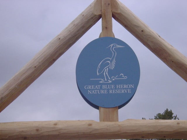
This fascinating loop takes in a Heron Centre that is a must-visit along with its bogs, the Vedder River, and forested trails. The Vedder River is a fishers mecca and in the spring people flock to see the 40-plus pairs of nesting herons, a sight to be seen before the trees sprout their leaves. Before being developed as a greenway and park the Department of National Defence used the area extensively to practice their drills, especially in the bog areas. Allow a good three hours for this visit – over an hour on a bicycle.
–
This portion of the Matsqui Trail, a superb greenway, places the walker right next to vast farmlands and borders on the Fraser River. By doing this as a loop allows one to experience the dike and forested trail next to the Fraser River. Do keep in mind that this trail extends to Douglas Taylor Park 4.5 km further to the west and to Page Road right against the Sumas Mountain 4.5 km further to the the east. The forested trail can be flooded during Spring thaw. Allow about two hours for this walk.

This is a walking loop that takes in Brae Island Regional Park and a heritage walk through Fort Langley. Brae Island along with MacMillan Island sits in the Fraser River and the trail allows for short walks to the river’s edge. This relatively short walk allows time to visit the Fort itself along with the Centennial and Auto Museum. Also the walk passes by a new neighbourhood along the Fraser, a former major mill site and the mouth of the Salmon River, a past inland route for the fur trade. The transformed train station museum adds interest and there is a superb view of a picturesque small heritage white church on the Kwantlen Reserve across the Bedford Channel of the Fraser River viewed from the Langley Marine Park. Allow about 2.5 hours for the walk itself knowing that you will want to spend additional time visiting in Fort Langley along with taking advantage of the shops in this artisan community.

Recent Comments