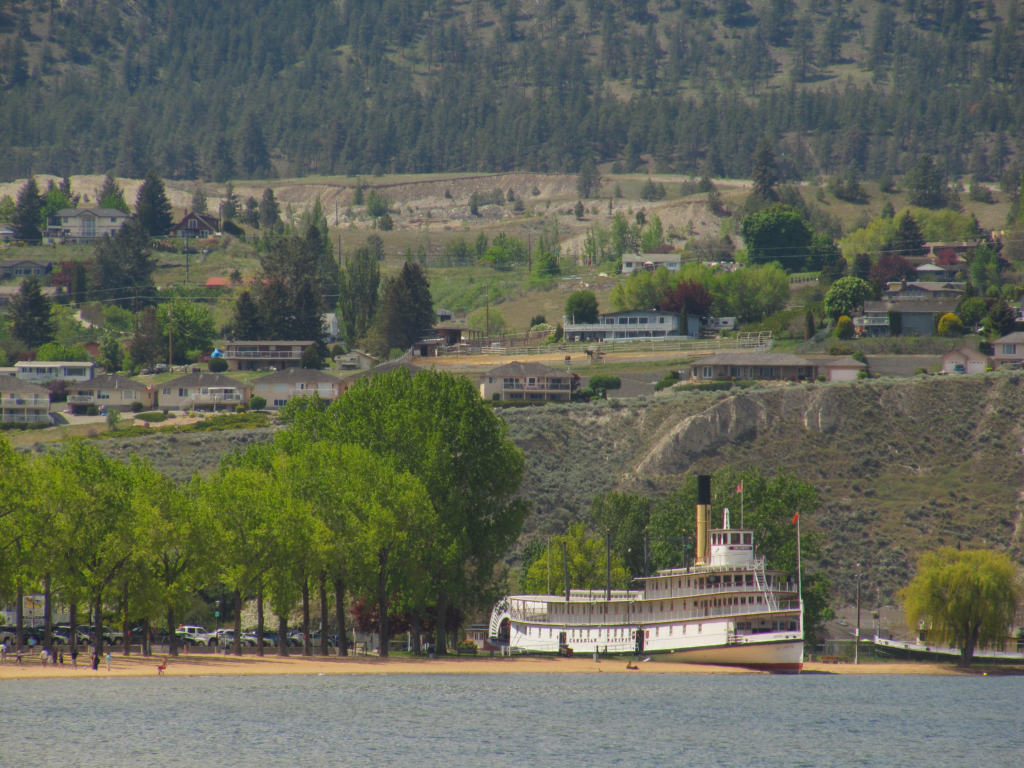
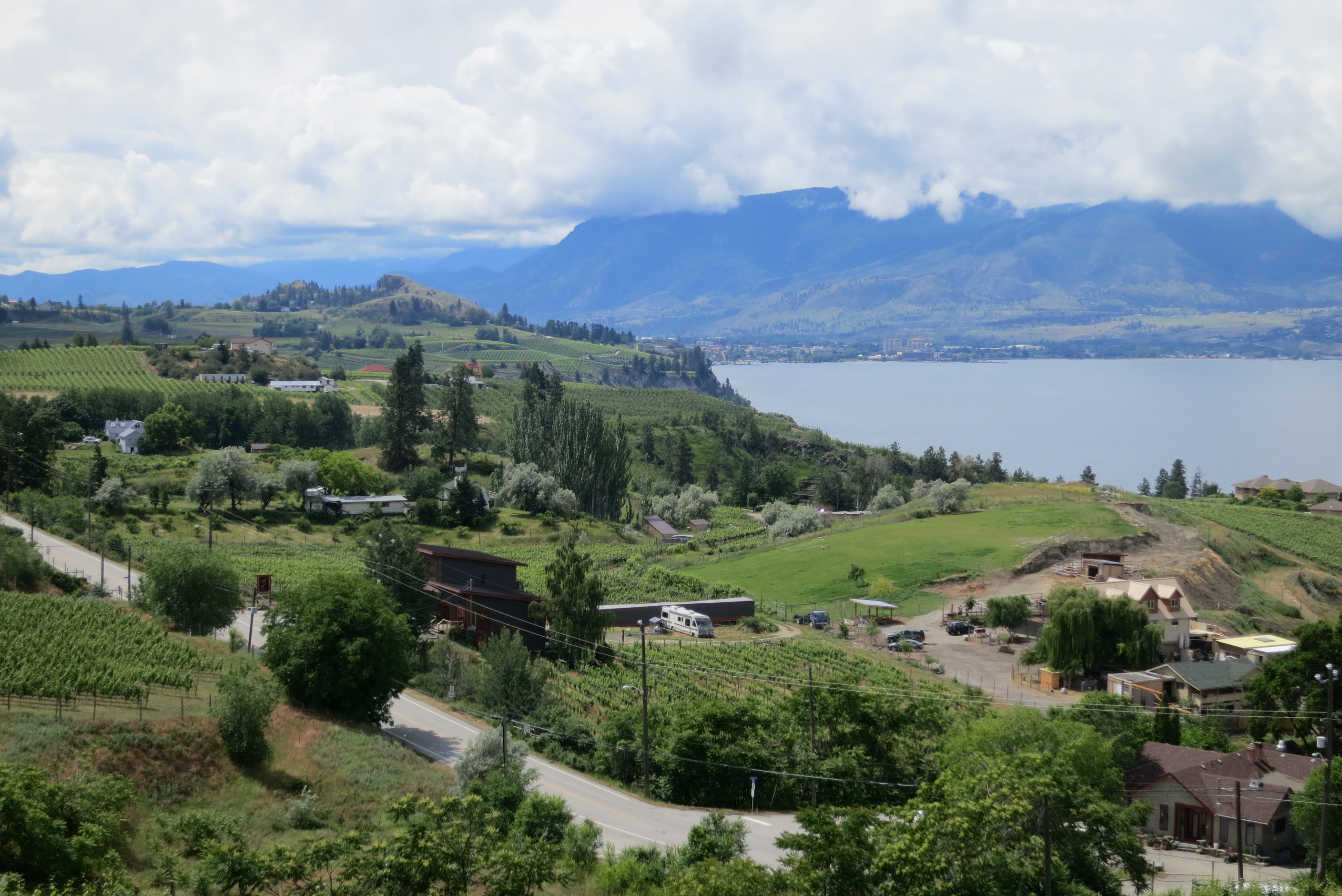
The Trans Canada Trail within the Penticton area arrives downhill from Summerland and makes it way along the shore of Okanagan Lake before continuing north along the Kettle Valley Railway through Naramata and Rock Ovens park. This stretch of trail is probably the most popular portion of the KVR – everyone from joggers, hikers, bicycling wine tasters and hardcore mountain bikers can be found along the trail.
The climb from Naramata to Rock Ovens can often be hard, thirsty work so be sure to carry along refreshments. The Naramata Woodwackers often stock up a supply of drinking water bottles at the Ovens – bless their hearts!
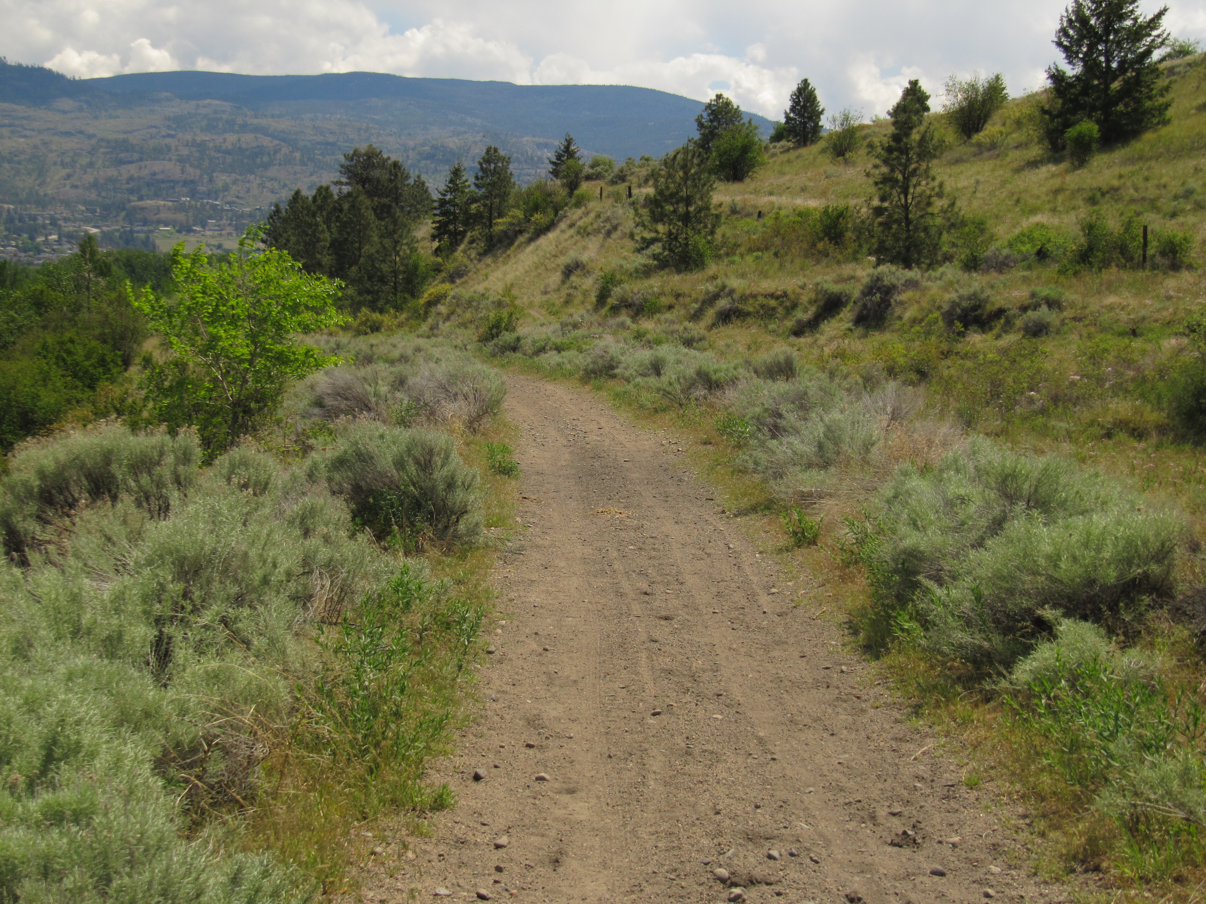
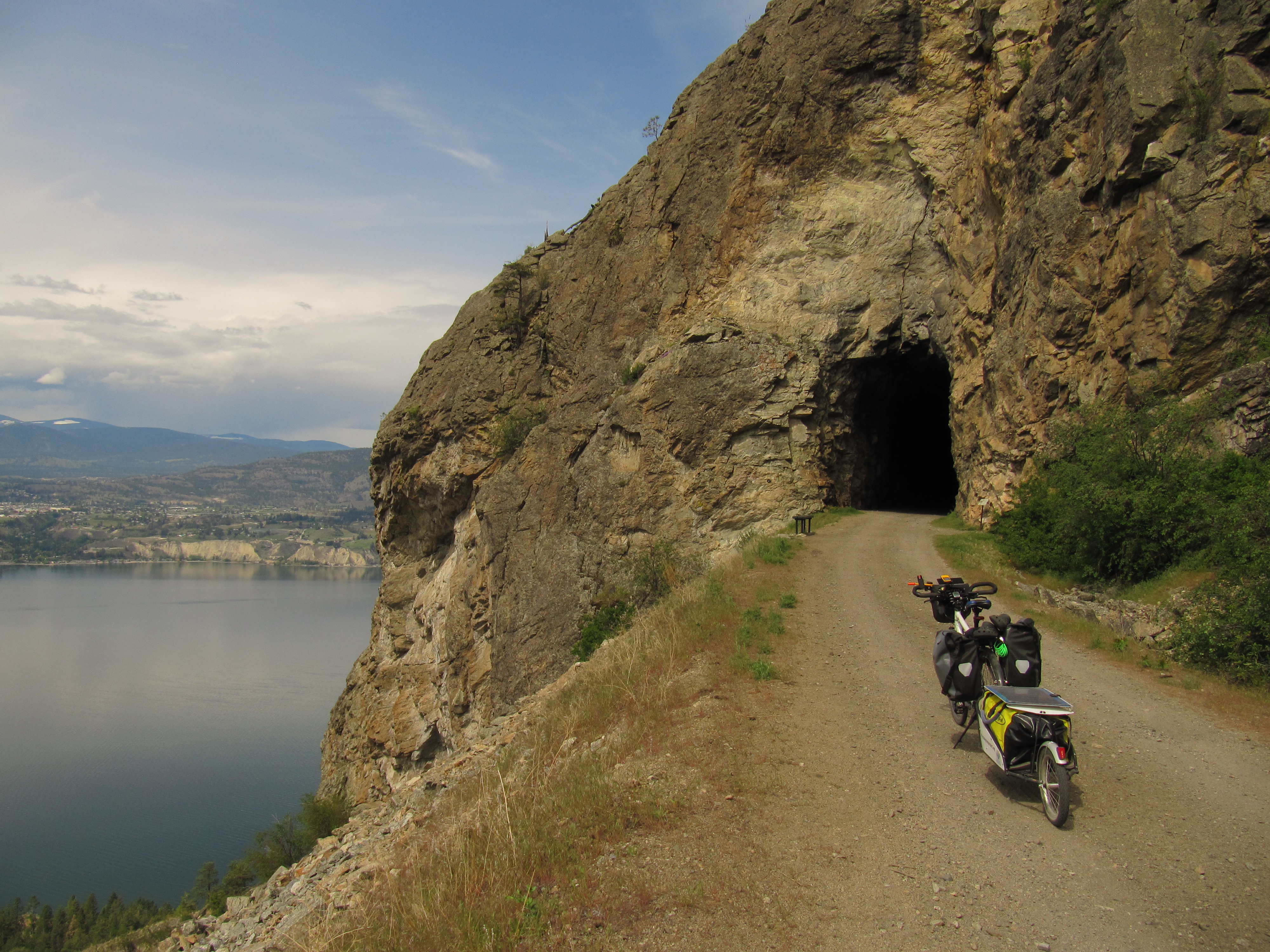
Views along the trail continue to get better and better as one heads uphill, but Little Tunnel is exceptional; it’s a great spot for photos and possibly even a picnic!
Important: You will almost certainly encounter motorized vehicles along the route, particularly ATVs and dirt bikes, which could be travelling at high speeds. Over the years, unregulated motorized use has degraded the trail surface along the Kettle Valley Railway, making many areas quite challenging for hikers and cyclists. Users should come prepared for sandy conditions. Please see our equipment recommendations on the Okanagan main page or even more detail on our “Equipment Tips” page of our Travel Tips.
Staging Areas:
GPS INFORMATION:
KML/KMZ files can be opened in Google Earth, and many smartphone apps.
GPX files can be opened by most GPS software apps when KMZ cannot. Note, GPX files do not contain custom colours and icons that we use on our maps; all tracks and icons will appear the same colour and styles. We recommend using KMZ instead of GPX if possible.
The files below include data for only this specific area. For all of our Trans Canada Trail data for the entire province (including features, campsites and alternate routes), download our BC.kmz master file (1.2 MB) Visit our GPS & Navigation page for instructions of how to use your smartphone as a GPS device (even when outside of data coverage) or how to import data to your Garmin unit.
Your journey along the KVR in the Penticton area is a spectacular part of the Trans Canada Trail. Some highlights include:
Great trail conditions from Penticton to Naramata
Little Tunnel and views of Okanagan Lake
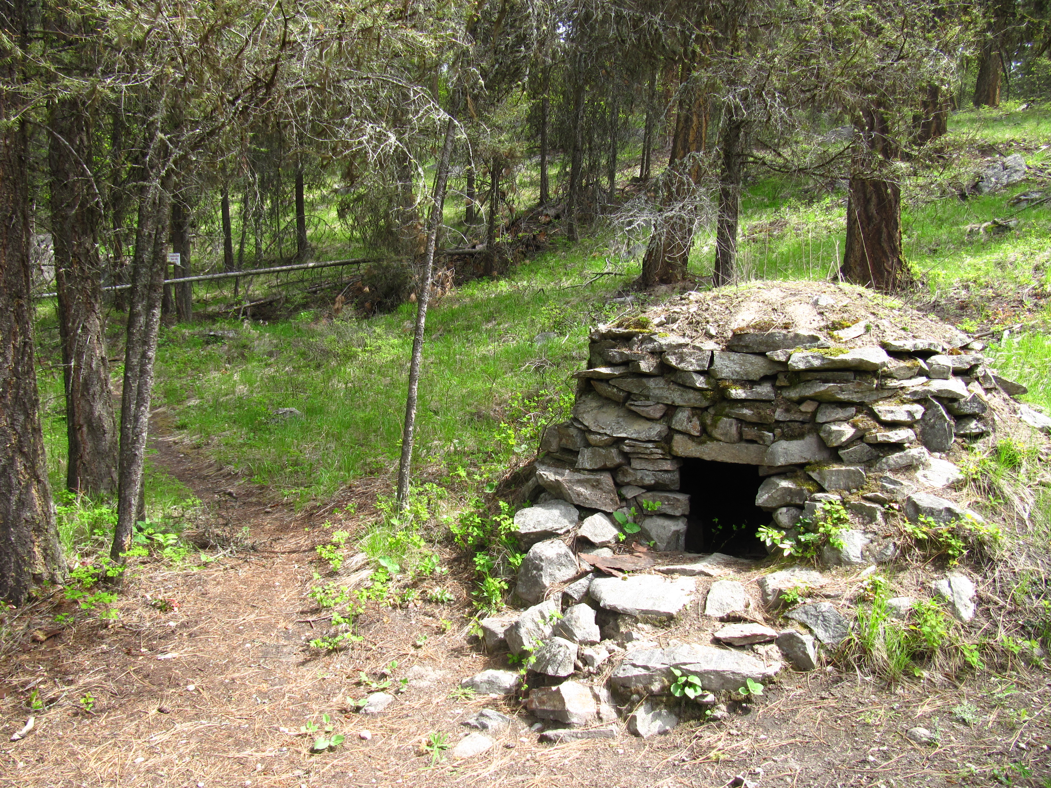
Rock Ovens Regional Park
Adra Tunnel (closed but under restoration)
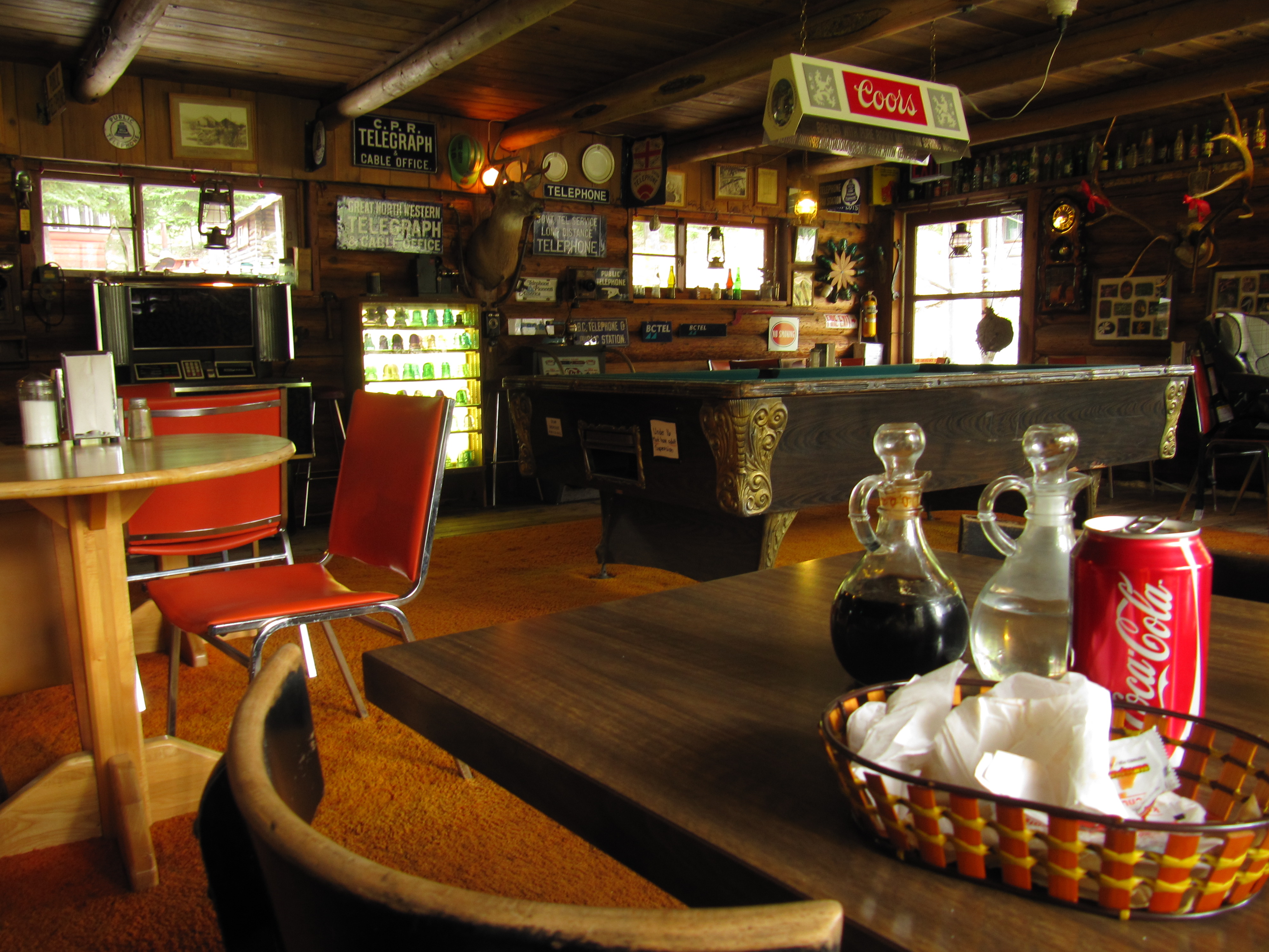
Chute Lake Resort
Although considered completely operational, three developments along the KVR will hopefully further enhance your trail experience:
The land between Summerland to Penticton has been transferred to the Penticton Indian Band from the provincial government. The result may affect the trail, but we are hopeful that the effect will be beneficial for both the PIB and trail users. In the meantime, Trans Canada Trail users are directed not to use this section of the KVR .
The Adra Tunnel restoration is still underway, though a recent act of arson at the tunnel’s mouth caused significant damage to the tunnel and destroyed virtually all of the original timber, raising the cost of the restoration. The Naramata Woodwackers continue to look for funding assistance. If restored, the tunnel would certainly be a major feature along the KVR.
A new trail management plan for the Naramata-Chute Lake section of the KVR is in development which would separate motorized and non-motorized users along portions of the trail while providing parking and staging facilities for motorized users. Trails BC believes that a management plan like this will create the first steps to creating a trail experience that is pleasurable for all users, fosters respect, and takes the first steps in providing a world-class rail trail system across the province
Also, local interest is growing for a paved, multi-use pathway along the shore of Okanagan Lake (beside Highway 97) which could be a fantastic recreational asset – and link with the Trans Canada Trail in the area.
In order to travel east along the Trans Canada Trail on the Kettle Valley Railway in the Penticton area, trail users will begin in Summerland and travel to Chute Lake, passing through the city of Penticton. Please note that since the KVR between Summerland and Penticton is not yet part of the TCT, you are required to not travel along it. South on Canyon View, the road crosses the active railway – but a trail follows the railway heading east and turning south. The train stops at the deep canyon at Trout Creek, and the KVR, privately owned and not open to the public, continues (unpaved) downhill, 11 km south to Penticton. Penticton is a full-service city, and campsites are located 4 km to the south, past the airport, on the north shore of Skaha Lake. Expect to pay $20 or more for a site. Heading north out of town, the KVR surface is paved for a short length, before reverting back to packed gravel as it climbs to Naramata, a journey of about 12 km. The views continue to get better and better, particularly at Little Tunnel. The KVR makes a long, lazy 180-degree turn, heading south through Rock Ovens Regional Park. The climb continues uphill for 8 km to Adra Tunnel. A route cuts through the forest on the left to bypass the tunnel. The trail continues its long, slow, northbound climb for another 12 km to the Chute Lake Resort. It might be time to reward yourself with pub grub and a slice of pie! Camping is possible at the lake.