
The trail between Hydaulic Lake and the community of Beaverdell is fairly quiet, though the use of motorized vehicles along the trail – and conversion of trail into actual road – means that some sections of the trail have become challenging – with some serious washboard conditions. Bicycle riders without front suspension will get their bones rattled! However, the rail trail is better than riding the busy hwy 33 corridor and has sections that are far removed from the speeding traffic. Also cycling this section gives views of the West Boundary and the West Kettle River which are outstanding.
Our map includes a short detour into the village of Beaverdell, which features a small general store, b&b’s and restaurants. To find more detailed info and updates on the rail trail, please contact the local stewardship society called Trails to the Boundary Society.
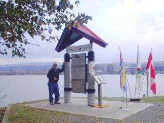
From the Abbotsford-Langley Boundary situated in Glen Valley in the middle of cranberry producing fields the trail will get away from the Fraser rising onto the Mount Lehman plateau following country roads passing farmlands and country estates to the Mount Lehman settlement with its heritage buildings dating as far back as 1864. Soon after, at Douglas Taylor Park, begins the 10 kilometre Matsqui Trail by descending back down to dikes along Fraser River protecting the Matsqui Prairie. At the Mission Bridge is the Matsqui Trail Regional Park where there is the location of a red-roof TCT Trail Marker overlooking the Fraser River. Note – there is no longer a campsite at this Regional Park. Supplies can be found a few blocks south on Riverside Street in historic Matsqui Village.
Over the Mission Bridge, is a large shopping centre and historic Mission City. A little further along is the Hatzic Rock Site where there is a Longhouse Interpretive Centre run by the Xá:ytem First Nations, Stó:lö member — 35087 Lougheed Highway. Mission is also the end of the line for the West Coast Express Commuter Train that can take one all the way back to Vancouver in the morning and back again in the evening.
The end of the Matsqui Trail abuts against the Sumas Mountain a challenging bump bounded by the Fraser River and the Sumas Prairie stretching all the way to the U.S. border.
For the Trans Canada Trail, it was decided to follow the base of the mountain on country roads to Clayburn Village, the site of a former clay factory of which remnant of its large kilns can be found in a park across a quaint coffee shop. Then, its over the toe of the mountain on the superb paved east section of the Abbotsford Discovery Trail. However, for the more adventurous hiker, there is a rugged trail (the Centennial Trail) that traverses the mountain past Chadsey Lake in the Sumas Mountain Regional Park and later rejoins the main Trans Canada Trail at a major pumphouse on the Sumas River on the edge of the Barrowtown. The pumphouse controls the water levels of the diked Sumas River protecting lands that was reclaimed from a huge shallow lake.
Off the toe off Sumas Mountain the trail finds itself on yet another series of dikes controlling the Sumas River and the Vedder Canal. The Vedder takes the outflow of the Chilliwack River and is a real magnet for fishermen. At a bridge over the Vedder (Keith-Wilson Bridge) is the Chilliwack boundary and the start of the Rotary Vedder Dike Trail.
Here trekkers are treated to vistas of farmland and mountains, a blue heron rookery known as The Great Blue Heron Reserve, the Rotary Interpretive Center, and many interpretive markers along the way. The trail is generally hard-packed gravel and flat, allowing many user groups, including wheelchairs, to take advantage of this section. This was the location of the former Canadian Forces Base Chilliwack. Washroom facilities are located at several locations along the trail.
The trail ends at Vedder crossing where a decision needs to be made either
- Head on the more adventures route via Cultus Lake, Chilliwack Lake Provincial Park, and over Paleface Pass to Hope, a mountainous route.
- Take the alternate cycling route through the City of Chilliwack back along the Fraser to Rosedale and then over the Agassiz Bridge to take Highway 7 to Hope, a relatiely flat route with good bike shoulder lanes..
Cultus Lake Park and Cultus Lake Provincial Park are located in a beautiful mountain setting that attract thousands of people every summer. It offers all the amenities associated with a summer destination. The Soowahlie First Nation, a member of the Stö:ló, also make this area their home. This is the last chance to buy supplies before heading up the valley.
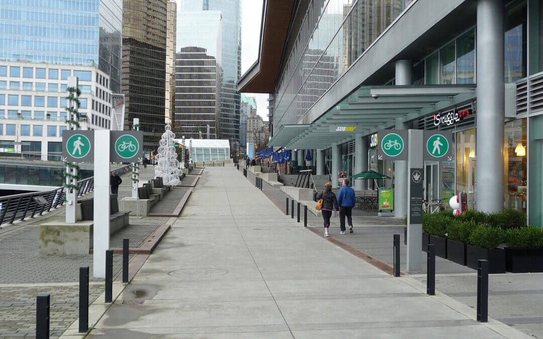
The Trans Canada Trail takes in the northern fringes of these two very large urban centers and manages to follow pathways most of the time but in some sections, it finds itself on bikeways that are controlled quiet streets with sidewalks.
In the City of Vancouver, the trail up to the Second Narrows Memorial Bridge is paved. From here there are both paved and gravel paths through Burnaby. Through Vancouver, the pathway is mostly flat up to Clark Drive on the border of the Italian Quarter. From this point heading east, there are a number of moderate short hills up to Burnaby Mountain. Burnaby Mountain offers spectacular views and ecology, the reward for a very stiff climb of about 2 km and an equally steep 4 km downhill back to sea level. Our map shows an alternate route that is much easier with a few short steep climbs along Burrard Inlet that takes in Barnet Marine Park for those not up to heavy climbing and downhill.
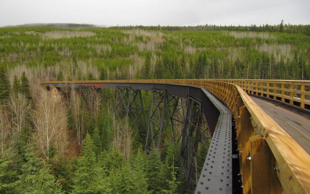
The Myra Canyon section of the Kettle Valley Railway was built between 1912 and 1914. It was part of a “Coast to Kootenay” railway line that linked Midway, in British Columbia’s Boundary District, with the Canadian Pacific Railway main line at Hope. The railway carried freight and passengers through the Myra Canyon until passenger service ended in 1964 and the last scheduled train went through in 1973.
In June 1973 the Kettle Valley Railway section in the Myra Canyon, with its wood-frame trestles, tunnels, rock cuts, and awe-inspiring mountainous terrain, was used by the Canadian Broadcasting Corporation (CBC) as a location for filming a segment of Pierre Berton’s “National Dream” television film on the construction of the CPR through the mountains of British Columbia.
The province purchased the rail corridor from Canadian Pacific Railway in 1990. The Myra Canyon Trestle Restoration Society, established in 1992, has been instrumental in leading the restoration and maintenance of the corridor and trestles. Hundreds of volunteers have worked to cover the open trestle ties and timbers with boardwalks and to install railings to make the route safe and accessible for all ages and abilities. As a result, the trestles became a cornerstone of the Provincial Rails to Trails network, a vital link along the Trans Canada Trail, as well as a significant tourism asset attracting as many as 50,000 visitors a year.
In January 2003, the Myra Canyon section (from Mile 84.5 to Mile 90.5) of the Kettle Valley Railway was designated a National Historic Site.
The Kettle Valley Railway concludes its journey through the Okanagan as it winds its way from the Myra Canyon towards Hydraulic Lake at McCulloch Station. This portion of the trail is quite flat, dropping only about 20 metres in elevation at the halfway point, then regaining it at the lake.
Important: Much of this portion of the KVR runs through Myra-Bellevue Provincial Park, which has rules against motorized use on the trail. However, elsewhere on the KVR you will almost certainly encounter motorized vehicles along the route, particularly ATVs and dirt bikes, which could be travelling at high speeds. Over the years, unregulated motorized use has degraded the trail surface along the Kettle Valley Railway, making many areas quite challenging for hikers and cyclists. Users should come prepared for sandy conditions. Please see our equipment recommendations on the Okanagan main page or even more detail on our “Equipment Tips” page of our Travel Tips.

The Trans Canada Trail within the Penticton area arrives downhill from Summerland and makes it way along the shore of Okanagan Lake before continuing north along the Kettle Valley Railway through Naramata and Rock Ovens park. This stretch of trail is probably the most popular portion of the KVR – everyone from joggers, hikers, bicycling wine tasters and hardcore mountain bikers can be found along the trail.
The climb from Naramata to Rock Ovens can often be hard, thirsty work so be sure to carry along refreshments. The Naramata Woodwackers often stock up a supply of drinking water bottles at the Ovens – bless their hearts!
Views along the trail continue to get better and better as one heads uphill, but Little Tunnel is exceptional; it’s a great spot for photos and possibly even a picnic!
Important: You will almost certainly encounter motorized vehicles along the route, particularly ATVs and dirt bikes, which could be travelling at high speeds. Over the years, unregulated motorized use has degraded the trail surface along the Kettle Valley Railway, making many areas quite challenging for hikers and cyclists. Users should come prepared for sandy conditions. Please see our equipment recommendations on the Okanagan main page or even more detail on our “Equipment Tips” page of our Travel Tips.

Recent Comments