Burrard Inlet is more often called Moody Inlet starting at the Port Moody Boundary. The Trail through the TriCities covers a 26 km stretch from this boundary to the Pitt River Bridge. Expect a varied, fun, and interesting trail experience with a few sidewalks for walkers and roads for cyclists in Port Moody Centre and Guildford Way in Coquitlam.
The Inlet Trail is a greenway with an undulating gravel trail. The first part of the Trail to Reed Point Marina was once the location of Aliceville. The ivy seen along the Trail was the backyard of residents. The country store was on the road down to Petro-Canada Port and the last house was sold to Gulf Oil Company in 1958. The views take in the BC Hydro Thermal Plant and Mountain Views over Moody Inlet, an arm of Burrard Inlet. The second part of Inlet Trail from Reed Point Marina to Port Moody Centre additionally features industrial activity such as the yellow sulphur piles of the SimcprTerminal and the Reichhold Chemical Plant. There are interpretive signs all along this route. Of note, this was the location of the first western most CPR rail station established in 1886. A visit to the Port Moody Museum at the entrance of Rocky Point Park will divulge many of these historical moments in the area.
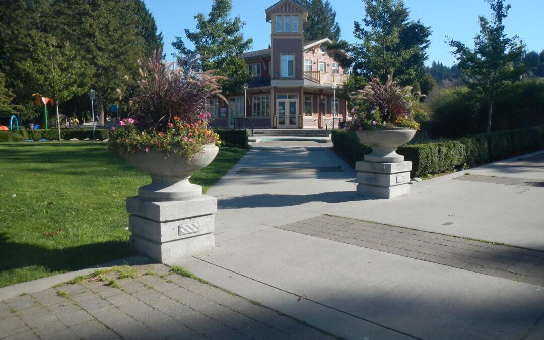
The Trail takes in the Old town of Port Moody with interesting heritage buildings, shops, and restaurants. Past this, the Shoreline Trail starting at Rocky Point Park features extraordinary tidal activity in the mud flats and is a greenway past a large recreation centre complex and a modern City Hall. Given extra time, it is worth taking a look at the architecture foyer of the City Hall. Past this complex through Pioneer Park the Trail heads through Newport Village a prime example of a dense livable residential village that reduces the need for a car.
Guildford Way, a boulevard with sidewalk and bike lanes, accesses a number of schools, the Coquitlam Grind and a park before reaching the entrance of the Hoy Creek Trail, a connector greenway between Douglas College Campus and Coquitlam Center Park. Hoy Creek is one of four major salmon producing creeks in the TriCities.
Entering Coquitlam Town Centre Park and following LaFarge Lake to the TCT Pavilion, the Trail continues on a series of greenways, that includes the Coquitlam River Park, Hyde Creek Trail and the Pitt River dikes and features magnificent coastal trees, a major fish hatchery on Hyde Creek and tidal Pitt River. It is also part of the Port Coquitlam Traboulay PoCo Trail that encircles Port Coquitlam.
Of note, the Hyde Creek Recreation Center is the site of the Terry Fox Hometown Run. It is difficult to imagine that LaFarge Lake was the site of a former quarry. Also, treat yourself to an extraordinary sight on Hyde Creek when the salmon are spawning in November. The dry creek reverts back to a flowing creek teeming with spawning salmon.
Along the Pitt dikes herons are plentiful along with other wild birds such as ospreys and ducks. Be treated with extraordinary views of the Golden Ears Mountain and farmlands all along these dikes. The river is also very active with boats and log booms. It is a tidal river in conjunction with Pitt Lake, one of the world’s largest tidal lakes.
The Trans Canada Trail takes in the northern fringes of these two very large urban centers and manages to follow pathways most of the time but in some sections, it finds itself on bikeways that are controlled quiet streets with sidewalks.
In the City of Vancouver, the trail up to the Second Narrows Memorial Bridge is paved. From here there are both paved and gravel paths through Burnaby. Through Vancouver, the pathway is mostly flat up to Clark Drive on the border of the Italian Quarter. From this point heading east, there are a number of moderate short hills up to Burnaby Mountain. Burnaby Mountain offers spectacular views and ecology, the reward for a very stiff climb of about 2 km and an equally steep 4 km downhill back to sea level. Our map shows an alternate route that is much easier with a few short steep climbs along Burrard Inlet that takes in Barnet Marine Park for those not up to heavy climbing and downhill.
On the North Shore there is a separate hiking and a cycling route from Horseshoe Bay to the exit of Capilano Regional Park on Capilano Road in North Vancouver.
HIKERS
Those hiking the upper main route should realize that there are no amenities along the Trail for about 26 km from Gleneagles Golf Course/Community Centre in Horseshoe Bay to the Capilano Regional Park. Anyone undertaking this trek must be in good physical condition and must carry water and food along with other hiking provisions. Be prepared for changes in weather and possible encounters with bears at all times.
From Horseshoe Bay/Nelson Creek to Eagle Lake access road, the route heads to the Skyline Trail via the Cypress Creek Trail within easy access to the the ski areas on Cypress and Hollyburn Mountains in Cypress Provincial Park. Note that at the top of the Cypress Creek Trail, it is a short hike to the Cypress Mountain Ski facilities that can also be used as a staging area and where many other trails can be explored such as the Baden Powell Trail and the start of the Howe Sound Crest Trail.
From here, it can get quite overgrown in places. The Skyline Trail features vestiges of early century logging, picturesque ravines, waterfalls, and west coast forest. Access trails to Cypress Bowl, Hollyburn Mountain and several other heritage trails can be used as alternates or side trips. For a short side trip, cross the Cleveland dam to get good views of the Capilano Canyon, outflows from the dam, and access to water and restrooms.
CYCLISTS
The cycling route from the Horseshoe Bay Ferry Terminal to the Cleveland Dam mainly follows existing pleasant cycling routes through West Vancouver using quiet residential streets before heading over to the Cleveland Dam. It is recommended to use the Dundarave alternative routing (see map) to get closer to Burrard Inlet shores and parks.
CYCLISTS AND HIKERS
The cyclists and the walkers will be on the same trail as they leave Capilano Regional Park for North Vancouver.
In Capilano Regional Park the trail generally follows the Capilano River Canyon in a typical coastal forest. Then the trail is on sidewalks and passes near the Capilano Suspension Bridge, a major tourist attraction.
Edgemont Village offers a charming village atmosphere. The Mosquito Creek Trail is a natural trail with adjacent spawning channels enhancing the fisheries potential of the creek. The Mission Reserve off Forbes Road includes St. Paul’s Church, a heritage site. The Elders Garden next to the church is also a unique attraction. There are informative interpretive signs in Waterfront Park, providing insights into the Harbour activities and its history.
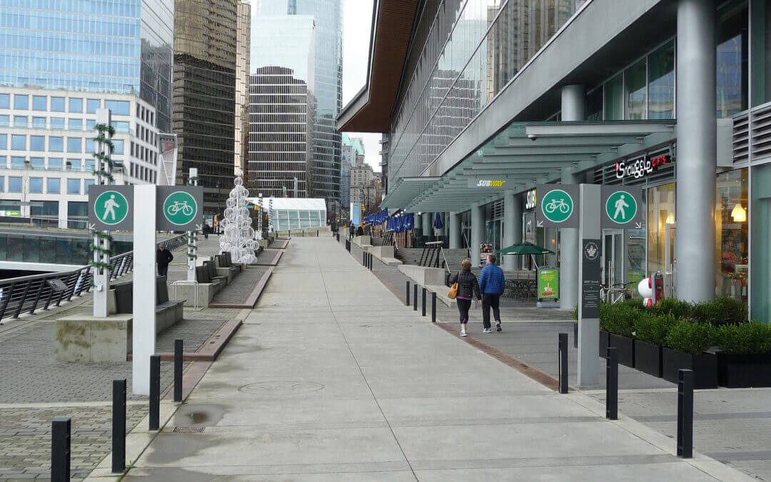
The trail arrives at the Sea Bus terminal to link with downtown Vancouver.
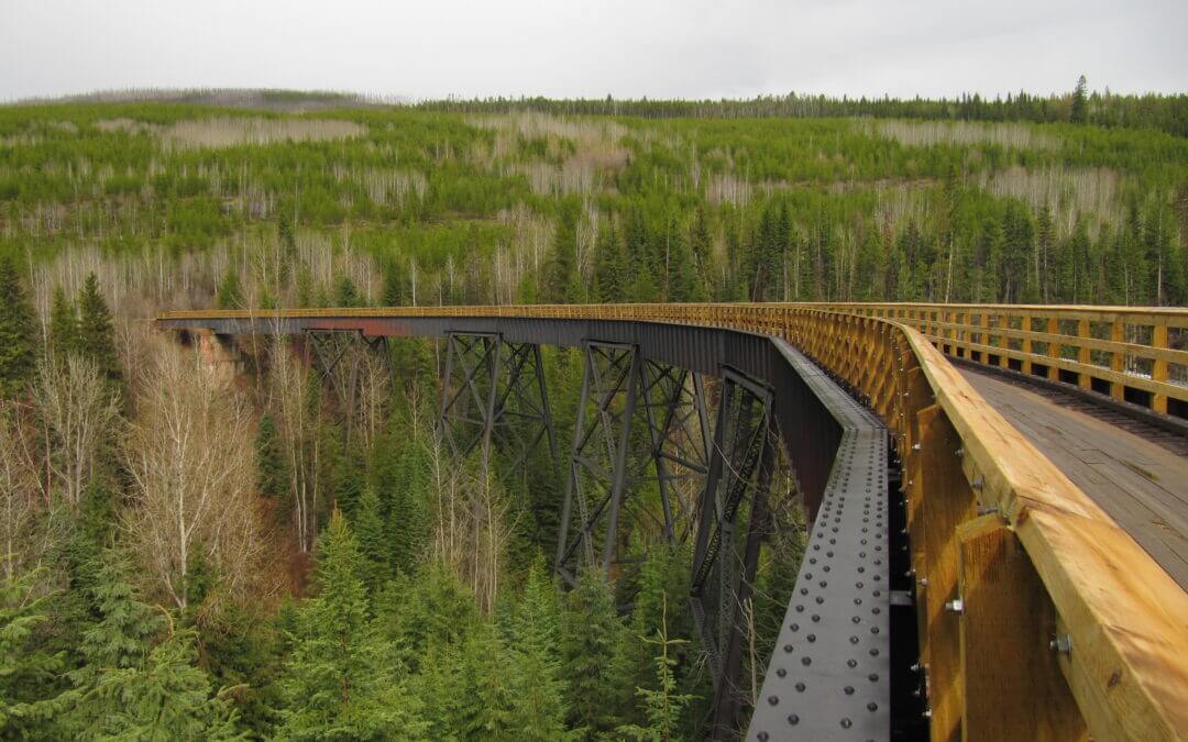
The Myra Canyon section of the Kettle Valley Railway was built between 1912 and 1914. It was part of a “Coast to Kootenay” railway line that linked Midway, in British Columbia’s Boundary District, with the Canadian Pacific Railway main line at Hope. The railway carried freight and passengers through the Myra Canyon until passenger service ended in 1964 and the last scheduled train went through in 1973.
In June 1973 the Kettle Valley Railway section in the Myra Canyon, with its wood-frame trestles, tunnels, rock cuts, and awe-inspiring mountainous terrain, was used by the Canadian Broadcasting Corporation (CBC) as a location for filming a segment of Pierre Berton’s “National Dream” television film on the construction of the CPR through the mountains of British Columbia.
The province purchased the rail corridor from Canadian Pacific Railway in 1990. The Myra Canyon Trestle Restoration Society, established in 1992, has been instrumental in leading the restoration and maintenance of the corridor and trestles. Hundreds of volunteers have worked to cover the open trestle ties and timbers with boardwalks and to install railings to make the route safe and accessible for all ages and abilities. As a result, the trestles became a cornerstone of the Provincial Rails to Trails network, a vital link along the Trans Canada Trail, as well as a significant tourism asset attracting as many as 50,000 visitors a year.
In January 2003, the Myra Canyon section (from Mile 84.5 to Mile 90.5) of the Kettle Valley Railway was designated a National Historic Site.
The Kettle Valley Railway concludes its journey through the Okanagan as it winds its way from the Myra Canyon towards Hydraulic Lake at McCulloch Station. This portion of the trail is quite flat, dropping only about 20 metres in elevation at the halfway point, then regaining it at the lake.
Important: Much of this portion of the KVR runs through Myra-Bellevue Provincial Park, which has rules against motorized use on the trail. However, elsewhere on the KVR you will almost certainly encounter motorized vehicles along the route, particularly ATVs and dirt bikes, which could be travelling at high speeds. Over the years, unregulated motorized use has degraded the trail surface along the Kettle Valley Railway, making many areas quite challenging for hikers and cyclists. Users should come prepared for sandy conditions. Please see our equipment recommendations on the Okanagan main page or even more detail on our “Equipment Tips” page of our Travel Tips.

The Trans Canada Trail within the Penticton area arrives downhill from Summerland and makes it way along the shore of Okanagan Lake before continuing north along the Kettle Valley Railway through Naramata and Rock Ovens park. This stretch of trail is probably the most popular portion of the KVR – everyone from joggers, hikers, bicycling wine tasters and hardcore mountain bikers can be found along the trail.
The climb from Naramata to Rock Ovens can often be hard, thirsty work so be sure to carry along refreshments. The Naramata Woodwackers often stock up a supply of drinking water bottles at the Ovens – bless their hearts!
Views along the trail continue to get better and better as one heads uphill, but Little Tunnel is exceptional; it’s a great spot for photos and possibly even a picnic!
Important: You will almost certainly encounter motorized vehicles along the route, particularly ATVs and dirt bikes, which could be travelling at high speeds. Over the years, unregulated motorized use has degraded the trail surface along the Kettle Valley Railway, making many areas quite challenging for hikers and cyclists. Users should come prepared for sandy conditions. Please see our equipment recommendations on the Okanagan main page or even more detail on our “Equipment Tips” page of our Travel Tips.

Recent Comments